Randonnée Autre activité Crécy-en-Ponthieu - crecy - Photo
 paul.damay@free.fr
paul.damay@free.fr

Utilisateur

© OpenStreetMap contributors
Longueur
Longueur
17,4 km
Altitude max
Altitude max
90 m
Dénivelé positif
Dénivelé positif
196 m
Km-Effort
Km-Effort  
20 km
Altitude min
Altitude min
40 m
Dénivelé négatif
Dénivelé négatif
183 m
Boucle
Boucle
Non
Date de création :
2014-12-10 00:00:00.0
Dernière modification :
2014-12-10 00:00:00.0

(0 Avis)

Autre activité
Autre activité
1h40
Difficulté : Inconnu

Scannez ce code QR pour ouvrir la randonnée dans l'application SityTrail

Application GPS de randonnée GRATUITE

Logo SityTrail SityTrail

IGN / Instituts géographiques

Télécharger SityTrail sur l'App Store Télécharger SityTrail sur Google Play

Logo SityTrail SityTrail World

Le monde est à vous

Télécharger SityTrail sur l'App Store Télécharger SityTrail sur Google Play Télécharger SityTrail sur Huawei AppGallery

À propos

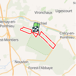
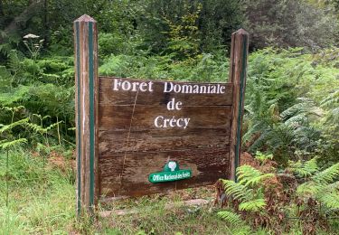
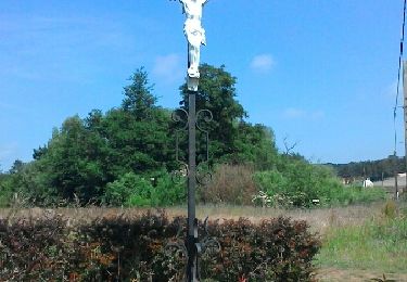
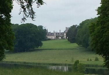
Randonnée Autre activité de 17,4 km à découvrir à Hauts-de-France, Somme, Crécy-en-Ponthieu. Cette randonnée est proposée par paul.damay@free.fr.

Profil altimétrique

Localisation

Pays :
France
Région :
Hauts-de-France
Département/Province :
Somme
Commune :
Crécy-en-Ponthieu
Localité :
Crécy-en-Ponthieu
Départ:(Dec)
Départ:(UTM)
414722 ; 5567820 (31U) N.

Randonnées à proximité

Randonnée V.T.T. Bernay-en-Ponthieu - Fort Mahon - Photo
V.T.T.
callia1

V.T.T.

Très facile
(1)
Bernay-en-Ponthieu, Hauts-de-France, Somme, France
27 km | 30 km-effort
2h 3min
Non
Randonnée Marche Crécy-en-Ponthieu - Forêt de Crécy-en-Ponthieu - Photo
Marche
GUIDE
lucclaes

Marche

Moyen
Crécy-en-Ponthieu, Hauts-de-France, Somme, France
18,8 km | 22 km-effort
4h 38min
Oui
Randonnée Marche Crécy-en-Ponthieu - Forêt de Crécy  - Photo
Marche
uyl1

Marche

Moyen
Crécy-en-Ponthieu, Hauts-de-France, Somme, France
6,3 km | 7 km-effort
2h 21min
Oui
Randonnée Marche Crécy-en-Ponthieu - LP80_Crecy Ponthieu_Scultures bois - Photo
Marche
GR77LP

Marche

Très facile
Crécy-en-Ponthieu, Hauts-de-France, Somme, France
4,2 km | 4,7 km-effort
1h 41min
Non
Randonnée Marche Crécy-en-Ponthieu - forêt de Crecy  - Photo
Marche
Papy Diouf

Marche

Très facile
Crécy-en-Ponthieu, Hauts-de-France, Somme, France
7,1 km | 8,3 km-effort
1h 44min
Oui
Randonnée V.T.T. Crécy-en-Ponthieu - Petit balade - Forêt Domaniale de Crécy en Ponthieu - Photo
V.T.T.

V.T.T.

Très facile
Crécy-en-Ponthieu, Hauts-de-France, Somme, France
12,6 km | 14,1 km-effort
40min
Oui
Randonnée Autre activité Machy - Machy - Photo
Autre activité
pbruneel

Autre activité

Très facile
Machy, Hauts-de-France, Somme, France
5,9 km | 7 km-effort
1h 19min
Oui
Randonnée Marche Crécy-en-Ponthieu - Forêt de Crecy 2 - Photo
Marche
sulcata80

Marche

Difficile
(1)
Crécy-en-Ponthieu, Hauts-de-France, Somme, France
18,8 km | 21 km-effort
4h 41min
Oui
Randonnée Vélo Nouvion - Au nord de la Baie de Somme - Circuit du Geai - Nouvion en Ponthieu - Photo
Vélo
tracegps

Vélo

Moyen
Nouvion, Hauts-de-France, Somme, France
21 km | 23 km-effort
2h 0min
Oui


Fermer
Mes abonnements