![](/images/other/stat-length.png)
![Randonnée Marche Brasparts - Circuit des landes et des tourbières par Botmeur - Photo](https://media.geolcdn.com/t/1900/400/ext.pjpeg?maxdim=2&url=https%3A%2F%2Fstatic1.geolcdn.com%2Fsiteimages%2Fupload%2Ffiles%2F1553511878bg_sport_marche.png)
Circuit des landes et des tourbières par Botmeur
ElisGino
Utilisateur
![Longueur](/images/other/stat-length.png)
![Altitude max](https://static1.geolcdn.com/siteimages/upload/files/1508320355ic_sort_altitude_max_24dp.png)
![Dénivelé positif](https://static1.geolcdn.com/siteimages/upload/files/1508320355ic_sort_den_pos_24dp.png)
![Km-Effort](/images/other/stat-length.png)
![Altitude min](https://static1.geolcdn.com/siteimages/upload/files/1508320355ic_sort_altitude_min_24dp.png)
![Dénivelé négatif](https://static1.geolcdn.com/siteimages/upload/files/1508320355ic_sort_den_neg_24dp.png)
![Boucle](https://static1.geolcdn.com/siteimages/upload/files/16400158638029165_repeat_loop_refresh_sync_direction_icon.png)
![Marche](https://static1.geolcdn.com/sitytour/trail-icons/101.png)
4h41
Difficulté : Facile
![Scannez ce code QR pour ouvrir la randonnée dans l'application SityTrail](https://capi.geolives.com/qq0zvz2zws4bq2lad0pu/sitytour/trails/2120232/qr.png?size=200)
Application GPS de randonnée GRATUITE
À propos
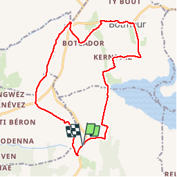
Randonnée Marche de 17,3 km à découvrir à Bretagne, Finistère, Brasparts. Cette randonnée est proposée par ElisGino.
Description
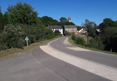
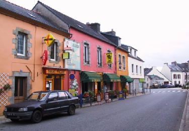
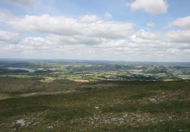
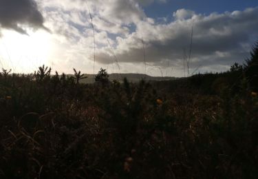
Très belle rando diversifiée, le village de Botmeur est magnifique avec ses maisons de pierre typiques de Bretagne, voir les anciennes toitures d'ardoise taillée à la main. On peut le prendre au départ du parking de la ferme des Artisans (près de Brasparts) comme nous ou au départ du village de Botmeur, ailleurs, pas trop de possibilités de parquer la voiture.
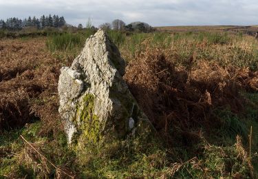
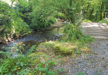
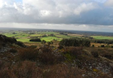
Attention, le passage par les landes et les tourbières peut s'avérer très humide (évidemment...) et il vaut mieux avoir de bonnes chaussures sinon c'est le bain de pieds assuré :o)
Par temps de pluie prévoir aussi les guêtres.
Bonne rando !
Localisation
Commentaires
Randonnées à proximité
![Randonnée A pied Saint-Rivoal - Landes et Tourbières - Photo](https://media.geolcdn.com/t/375/260/c5b98d78-e599-4d6a-ae17-467d21882015.jpeg&format=jpg&maxdim=2)
![A pied A pied](https://static1.geolcdn.com/sitytour/trail-icons/100.png)
A pied
![](/images/other/stat-length.png)
![](https://static1.geolcdn.com/siteimages/upload/files/16400158638029165_repeat_loop_refresh_sync_direction_icon.png)
![Randonnée A pied Botmeur - Brasparts Circuit des landes et tourbières - Photo](https://media.geolcdn.com/t/375/260/98159458-f3c1-4612-bed6-39d858fe0671.jpeg&format=jpg&maxdim=2)
![A pied A pied](https://static1.geolcdn.com/sitytour/trail-icons/100.png)
A pied
![](/images/other/stat-length.png)
![](https://static1.geolcdn.com/siteimages/upload/files/16400158638029165_repeat_loop_refresh_sync_direction_icon.png)
![Randonnée Marche Saint-Rivoal - GR_37_FA_12_St-Rivoal_Loperec_20200811 - Photo](https://media.geolcdn.com/t/375/260/f5ace299-8c7f-44c6-82e9-6da866129eef.jpg&format=jpg&maxdim=2)
![Marche Marche](https://static1.geolcdn.com/sitytour/trail-icons/101.png)
Marche
![](/images/other/stat-length.png)
![](https://static1.geolcdn.com/siteimages/upload/files/16400158638029165_repeat_loop_refresh_sync_direction_icon.png)
![Randonnée V.T.T. Brasparts - VTT depuis Brasparts - Photo](https://media.geolcdn.com/t/375/260/ext.jpg?maxdim=2&url=https%3A%2F%2Fservices.sitytrail.com%2FGeolivesWS%2FDownloadMedia.ashx%3FTrailID%3D686306%26Media%3De04271ce-293b-40e3-9d64-c84977ba0a9d.PNG)
![V.T.T. V.T.T.](https://static1.geolcdn.com/sitytour/trail-icons/202.png)
V.T.T.
![](/images/other/stat-length.png)
![](https://static1.geolcdn.com/siteimages/upload/files/16400158638029165_repeat_loop_refresh_sync_direction_icon.png)
![Randonnée Cheval Saint-Rivoal - Autour de St Rivoal par le lac du Drennec - Photo](https://media.geolcdn.com/t/375/260/ext.jpg?maxdim=2&url=https%3A%2F%2Fservices.sitytrail.com%2FGeolivesWS%2FDownloadMedia.ashx%3FTrailID%3D317263%26Media%3D16448_6.jpg)
![Cheval Cheval](https://static1.geolcdn.com/sitytour/trail-icons/300.png)
Cheval
![](/images/other/stat-length.png)
![](https://static1.geolcdn.com/siteimages/upload/files/16400158638029165_repeat_loop_refresh_sync_direction_icon.png)
![Randonnée Marche Botmeur - Roc'h Bichourel - Botmeur - Photo](https://media.geolcdn.com/t/375/260/ext.jpg?maxdim=2&url=https%3A%2F%2Fservices.sitytrail.com%2FGeolivesWS%2FDownloadMedia.ashx%3FTrailID%3D191436%26Media%3D15024_3.jpg)
![Marche Marche](https://static1.geolcdn.com/sitytour/trail-icons/101.png)
Marche
![](/images/other/stat-length.png)
![](https://static1.geolcdn.com/siteimages/upload/files/16400158638029165_repeat_loop_refresh_sync_direction_icon.png)
![Randonnée Marche Brasparts - circuit du gorre - Photo](https://media.geolcdn.com/t/375/260/770e7b8e-a1cf-4e69-8d22-3bbf5c1cdeca.jpg&format=jpg&maxdim=2)
![Marche Marche](https://static1.geolcdn.com/sitytour/trail-icons/101.png)
Marche
![](/images/other/stat-length.png)
![](https://static1.geolcdn.com/siteimages/upload/files/16400158638029165_repeat_loop_refresh_sync_direction_icon.png)
![Randonnée Marche Saint-Rivoal - st rivoal - Photo](https://media.geolcdn.com/t/375/260/e615d1db-b2ce-4a52-8cff-fd057e0ebecc.jpg&format=jpg&maxdim=2)
![Marche Marche](https://static1.geolcdn.com/sitytour/trail-icons/101.png)
Marche
![](/images/other/stat-length.png)
![](https://static1.geolcdn.com/siteimages/upload/files/16400158638029165_repeat_loop_refresh_sync_direction_icon.png)
![Randonnée Marche Saint-Rivoal - st rivoual - Photo](https://media.geolcdn.com/t/375/260/c156942c-1f61-4e4f-bc3a-2d9786911435.jpg&format=jpg&maxdim=2)
![Marche Marche](https://static1.geolcdn.com/sitytour/trail-icons/101.png)
Marche
![](/images/other/stat-length.png)
![](https://static1.geolcdn.com/siteimages/upload/files/16400158638029165_repeat_loop_refresh_sync_direction_icon.png)