Randonnée Marche Paulhenc - The landscape fontaine - Photo
 catherineslater
catherineslater

Utilisateur

© OpenStreetMap contributors
Longueur
Longueur
5,4 km
Altitude max
Altitude max
921 m
Dénivelé positif
Dénivelé positif
255 m
Km-Effort
Km-Effort  
8,7 km
Altitude min
Altitude min
726 m
Dénivelé négatif
Dénivelé négatif
233 m
Boucle
Boucle
Oui
Date de création :
2019-06-06 07:24:46.831
Dernière modification :
2019-06-09 16:28:02.004

(0 Avis)

Marche
Marche
2h18
Difficulté : Très facile

Scannez ce code QR pour ouvrir la randonnée dans l'application SityTrail

Application GPS de randonnée GRATUITE

Logo SityTrail SityTrail

IGN / Instituts géographiques

Télécharger SityTrail sur l'App Store Télécharger SityTrail sur Google Play

Logo SityTrail SityTrail World

Le monde est à vous

Télécharger SityTrail sur l'App Store Télécharger SityTrail sur Google Play Télécharger SityTrail sur Huawei AppGallery

À propos

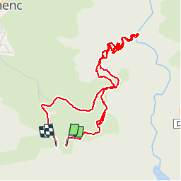
Randonnée Marche de 5,4 km à découvrir à Auvergne-Rhône-Alpes, Cantal, Paulhenc. Cette randonnée est proposée par catherineslater.

Description

x

Profil altimétrique

Localisation

Pays :
France
Région :
Auvergne-Rhône-Alpes
Département/Province :
Cantal
Commune :
Paulhenc
Localité :
Unknown
Départ:(UTM)
486259 ; 4969333 (31T) N.

Randonnées à proximité

Randonnée Marche Pierrefort - Vezou (Faverolles-Boussac) - Photo
Marche
catherineslater

Marche

Très facile
Pierrefort, Auvergne-Rhône-Alpes, Cantal, France
13,2 km | 18,5 km-effort
3h 51min
Non
Randonnée Marche Pierrefort - le colombier le théron - Photo
Marche
catherineslater

Marche

Très facile
Pierrefort, Auvergne-Rhône-Alpes, Cantal, France
4,4 km | 5,8 km-effort
1h 30min
Oui
Randonnée Marche Pierrefort - Le Monteil-Turlande - Photo
Marche
catherineslater

Marche

Très facile
Pierrefort, Auvergne-Rhône-Alpes, Cantal, France
5,7 km | 6,6 km-effort
1h 24min
Non
Randonnée Marche Paulhenc - tersons 13b - Photo
Marche
catherineslater

Marche

Très facile
Paulhenc, Auvergne-Rhône-Alpes, Cantal, France
11,4 km | 13,7 km-effort
3h 9min
Non
Randonnée Moto-cross Lieutadès - Lieutades laguiole  - Photo
Moto-cross
jaboin

Moto-cross

Lieutadès, Auvergne-Rhône-Alpes, Cantal, France
52 km | 67 km-effort
1h 38min
Non
Randonnée Marche Cantoin - Vines les berges du lac de Sarrans - Photo
Marche
les joyeux randonneurs

Marche

Difficile
(1)
Cantoin, Occitanie, Aveyron, France
11,2 km | 16,4 km-effort
3h 43min
Oui
Randonnée Vélo électrique Saint-Martin-sous-Vigouroux - 6_280423 - Photo
Vélo électrique
ricou1964

Vélo électrique

Difficile
Saint-Martin-sous-Vigouroux, Auvergne-Rhône-Alpes, Cantal, France
71 km | 90 km-effort
10h 6min
Non
Randonnée Marche Thérondels - 14072020 Laussac - Photo
Marche
benquad45

Marche

(1)
Thérondels, Occitanie, Aveyron, France
6,4 km | 10,3 km-effort
2h 2min
Oui
Randonnée A pied Thérondels - Presqu'ile de Laussac Thérondels - Photo
A pied
rigol05

A pied

Très facile
Thérondels, Occitanie, Aveyron, France
16,4 km | 23 km-effort
Inconnu
Oui


Fermer
Mes abonnements