![](/images/other/stat-length.png)
![Randonnée Marche Münchweiler an der Rodalb - Pirmasens - Felsenwald - Photo](https://media.geolcdn.com/t/1900/400/5baf6c00-a6a3-46f6-9a28-4727ebd10360.jpg&format=pjpeg&maxdim=2)
Pirmasens - Felsenwald
VacheKiri67
Utilisateur
![Longueur](/images/other/stat-length.png)
![Altitude max](https://static1.geolcdn.com/siteimages/upload/files/1508320355ic_sort_altitude_max_24dp.png)
![Dénivelé positif](https://static1.geolcdn.com/siteimages/upload/files/1508320355ic_sort_den_pos_24dp.png)
![Km-Effort](/images/other/stat-length.png)
![Altitude min](https://static1.geolcdn.com/siteimages/upload/files/1508320355ic_sort_altitude_min_24dp.png)
![Dénivelé négatif](https://static1.geolcdn.com/siteimages/upload/files/1508320355ic_sort_den_neg_24dp.png)
![Boucle](https://static1.geolcdn.com/siteimages/upload/files/16400158638029165_repeat_loop_refresh_sync_direction_icon.png)
![Marche](https://static1.geolcdn.com/sitytour/trail-icons/101.png)
4h48
Difficulté : Moyen
![Scannez ce code QR pour ouvrir la randonnée dans l'application SityTrail](https://capi.geolives.com/qq0zvz2zws4bq2lad0pu/sitytour/trails/2109018/qr.png?size=200)
Application GPS de randonnée GRATUITE
À propos
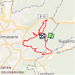
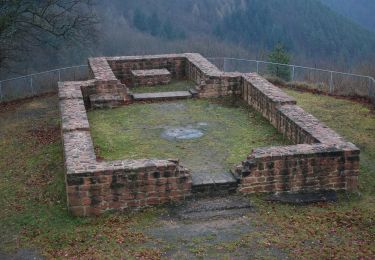
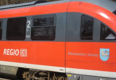
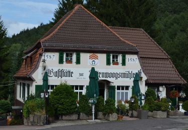
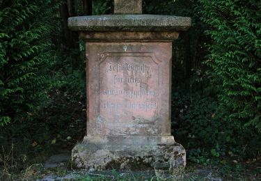
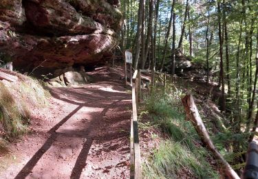
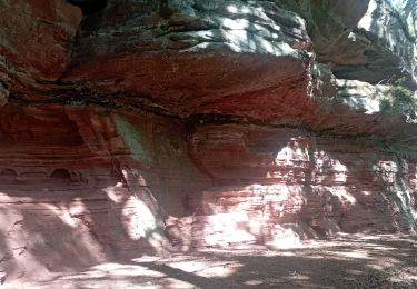
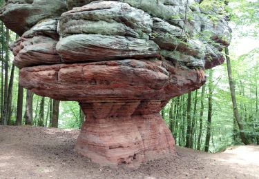
Randonnée Marche de 14,2 km à découvrir à Rhénanie-Palatinat, Südwestpfalz, Münchweiler an der Rodalb. Cette randonnée est proposée par VacheKiri67.
Description
Faite le 09/06/2019 avec nos amis Eléonore et Bernard et notre fils Théo de 14 ans. D'après https://www.wanderinstitut.de/premiumwege/rheinland-pfalz/felsenwald/
Flyer http://www.pirmasens.de/dante-cms/app_data/adam/repo/tempmedia/1560178286.ZIOWZUNMWOQSEGFOMTFLKAVWMRDWXMWG/86090_wanderflyer-felsenwald-x-web_neu.pdf
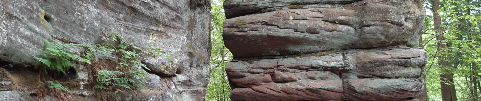
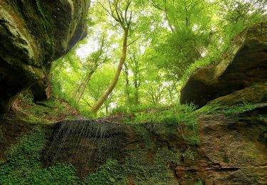
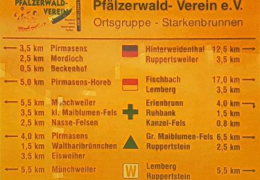
Localisation
Commentaires
Randonnées à proximité
![Randonnée A pied - Teufelspfad - Photo](https://media.geolcdn.com/t/375/260/72c485d3-1a1c-4db9-8c42-8274cd2b76d3.jpeg&format=jpg&maxdim=2)
![A pied A pied](https://static1.geolcdn.com/sitytour/trail-icons/100.png)
A pied
![](/images/other/stat-length.png)
![](https://static1.geolcdn.com/siteimages/upload/files/16400158638029165_repeat_loop_refresh_sync_direction_icon.png)
![Randonnée A pied Münchweiler an der Rodalb - Felsenwaldtour - Photo](https://media.geolcdn.com/t/375/260/27ea1187-bd8b-4476-ae26-5025c4273908.jpeg&format=jpg&maxdim=2)
![A pied A pied](https://static1.geolcdn.com/sitytour/trail-icons/100.png)
A pied
![](/images/other/stat-length.png)
![](https://static1.geolcdn.com/siteimages/upload/files/16400158638029165_repeat_loop_refresh_sync_direction_icon.png)
![Randonnée A pied Lemberg - Lemberger Rothenberg-Weg - Photo](https://media.geolcdn.com/t/375/260/707b9fb7-6276-4f2e-9888-5b78e2108006.jpeg&format=jpg&maxdim=2)
![A pied A pied](https://static1.geolcdn.com/sitytour/trail-icons/100.png)
A pied
![](/images/other/stat-length.png)
![](https://static1.geolcdn.com/siteimages/upload/files/16400158638029165_repeat_loop_refresh_sync_direction_icon.png)
![Randonnée A pied Münchweiler an der Rodalb - Münchweiler Höhenwanderweg - Photo](https://media.geolcdn.com/t/375/260/bbd39193-5a66-4d9f-be64-d7d175ff56e8.jpeg&format=jpg&maxdim=2)
![A pied A pied](https://static1.geolcdn.com/sitytour/trail-icons/100.png)
A pied
![](/images/other/stat-length.png)
![](https://static1.geolcdn.com/siteimages/upload/files/16400158638029165_repeat_loop_refresh_sync_direction_icon.png)
![Randonnée A pied Lemberg - Lemberger Graf-Heinrich-Weg - Photo](https://media.geolcdn.com/t/375/260/1a275d3c-a618-441f-91f7-5b44c8024737.jpeg&format=jpg&maxdim=2)
![A pied A pied](https://static1.geolcdn.com/sitytour/trail-icons/100.png)
A pied
![](/images/other/stat-length.png)
![](https://static1.geolcdn.com/siteimages/upload/files/16400158638029165_repeat_loop_refresh_sync_direction_icon.png)
![Randonnée A pied Münchweiler an der Rodalb - DE-7 - Photo](https://media.geolcdn.com/t/375/260/070582bd-8e05-4f19-a255-4308f2490e36.jpeg&format=jpg&maxdim=2)
![A pied A pied](https://static1.geolcdn.com/sitytour/trail-icons/100.png)
A pied
![](/images/other/stat-length.png)
![](https://static1.geolcdn.com/siteimages/upload/files/16400158638029165_repeat_loop_refresh_sync_direction_icon.png)
![Randonnée Marche Münchweiler an der Rodalb - Felsenwald - Photo](https://media.geolcdn.com/t/375/260/405030d7-97d3-4f5f-ba79-d025ac7a07cb.jpg&format=jpg&maxdim=2)
![Marche Marche](https://static1.geolcdn.com/sitytour/trail-icons/101.png)
Marche
![](/images/other/stat-length.png)
![](https://static1.geolcdn.com/siteimages/upload/files/16400158638029165_repeat_loop_refresh_sync_direction_icon.png)
![Randonnée Marche Lemberg - lemberger rothenbergerweg - Photo](https://media.geolcdn.com/t/375/260/cddecaaf-a040-463d-9719-ab6f1d8c2ec4.jpg&format=jpg&maxdim=2)
![Marche Marche](https://static1.geolcdn.com/sitytour/trail-icons/101.png)
Marche
![](/images/other/stat-length.png)
![](https://static1.geolcdn.com/siteimages/upload/files/16400158638029165_repeat_loop_refresh_sync_direction_icon.png)
![Randonnée Marche - Pirmasens - Felsenwald - Photo](https://media.geolcdn.com/t/375/260/3ba6f11f-1f49-416d-9c9b-6b8c23ffe125.jpg&format=jpg&maxdim=2)
![Marche Marche](https://static1.geolcdn.com/sitytour/trail-icons/101.png)
Marche
![](/images/other/stat-length.png)
![](https://static1.geolcdn.com/siteimages/upload/files/16400158638029165_repeat_loop_refresh_sync_direction_icon.png)