![](/images/other/stat-length.png)
![Randonnée Marche Fontanès - Fontanes (tours de Salles) - Photo](https://media.geolcdn.com/t/1900/400/ext.pjpeg?maxdim=2&url=https%3A%2F%2Fstatic1.geolcdn.com%2Fsiteimages%2Fupload%2Ffiles%2F1553511878bg_sport_marche.png)
Fontanes (tours de Salles)
coulombf
Utilisateur
![Longueur](/images/other/stat-length.png)
Longueur
9,1 km
![Altitude max](https://static1.geolcdn.com/siteimages/upload/files/1508320355ic_sort_altitude_max_24dp.png)
Altitude max
238 m
![Dénivelé positif](https://static1.geolcdn.com/siteimages/upload/files/1508320355ic_sort_den_pos_24dp.png)
Dénivelé positif
182 m
![Km-Effort](/images/other/stat-length.png)
Km-Effort
11,6 km
![Altitude min](https://static1.geolcdn.com/siteimages/upload/files/1508320355ic_sort_altitude_min_24dp.png)
Altitude min
98 m
![Dénivelé négatif](https://static1.geolcdn.com/siteimages/upload/files/1508320355ic_sort_den_neg_24dp.png)
Dénivelé négatif
182 m
![Boucle](https://static1.geolcdn.com/siteimages/upload/files/16400158638029165_repeat_loop_refresh_sync_direction_icon.png)
Boucle
Oui
Date de création :
2019-06-05 12:13:52.0
Dernière modification :
2019-06-18 07:38:54.342
![Marche](https://static1.geolcdn.com/sitytour/trail-icons/101.png)
3h07
Difficulté : Facile
![Scannez ce code QR pour ouvrir la randonnée dans l'application SityTrail](https://capi.geolives.com/qq0zvz2zws4bq2lad0pu/sitytour/trails/2105572/qr.png?size=200)
Application GPS de randonnée GRATUITE
À propos
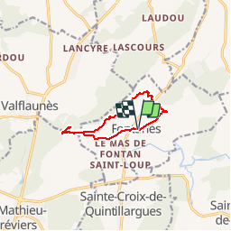
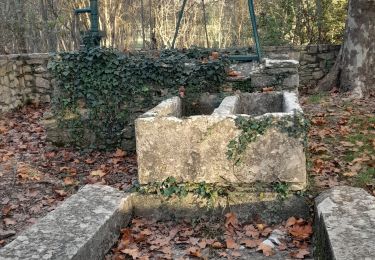
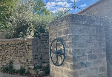
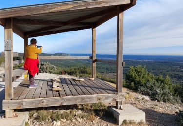
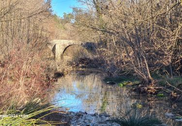
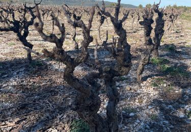
Randonnée Marche de 9,1 km à découvrir à Occitanie, Hérault, Fontanès. Cette randonnée est proposée par coulombf.
Description
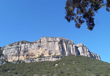
05/06/2019 AVF MBDM 2* ( , montée finale aux tours dans lapiaz)
1/05/2019 reconnaissance avec Catherine BRUGUIER, Annie et Patrick MASUREL
Localisation
Pays :
France
Région :
Occitanie
Département/Province :
Hérault
Commune :
Fontanès
Localité :
Unknown
Départ:(Dec)
Départ:(UTM)
573602 ; 4849346 (31T) N.
Commentaires
Randonnées à proximité
![Randonnée Marche Sainte-Croix-de-Quintillargues - Ste Croix de Quintillargues - Photo](https://media.geolcdn.com/t/375/260/ext.jpg?maxdim=2&url=https%3A%2F%2Fstatic1.geolcdn.com%2Fsiteimages%2Fupload%2Ffiles%2F1553511878bg_sport_marche.png)
![Marche Marche](https://static1.geolcdn.com/sitytour/trail-icons/101.png)
Ste Croix de Quintillargues
Marche
Moyen
(2)
Sainte-Croix-de-Quintillargues,
Occitanie,
Hérault,
France
![](/images/other/stat-length.png)
6,8 km | 8,3 km-effort
1h 48min
![](https://static1.geolcdn.com/siteimages/upload/files/16400158638029165_repeat_loop_refresh_sync_direction_icon.png)
Oui
![Randonnée Marche Valflaunès - l'Hortus crêtes - Photo](https://media.geolcdn.com/t/375/260/8ba1a285-4e0d-4a16-95c0-7302eff43924.jpg&format=jpg&maxdim=2)
![Marche Marche](https://static1.geolcdn.com/sitytour/trail-icons/101.png)
l'Hortus crêtes
Marche
Difficile
(1)
Valflaunès,
Occitanie,
Hérault,
France
![](/images/other/stat-length.png)
19 km | 27 km-effort
6h 5min
![](https://static1.geolcdn.com/siteimages/upload/files/16400158638029165_repeat_loop_refresh_sync_direction_icon.png)
Oui
![Randonnée Marche Lauret - lac de Matane / moulin de la Fous - Photo](https://media.geolcdn.com/t/375/260/7a42b83d-a238-4ec2-9bf1-47f0c2f04255.jpg&format=jpg&maxdim=2)
![Marche Marche](https://static1.geolcdn.com/sitytour/trail-icons/101.png)
lac de Matane / moulin de la Fous
Marche
Moyen
Lauret,
Occitanie,
Hérault,
France
![](/images/other/stat-length.png)
12,3 km | 17,7 km-effort
5h 5min
![](https://static1.geolcdn.com/siteimages/upload/files/16400158638029165_repeat_loop_refresh_sync_direction_icon.png)
Oui
![Randonnée Marche Lauret - lauret-rocher-du-Causse - Photo](https://media.geolcdn.com/t/375/260/1cc3cdf4-f391-4c4a-b2a4-819aef973558.jpg&format=jpg&maxdim=2)
![Marche Marche](https://static1.geolcdn.com/sitytour/trail-icons/101.png)
lauret-rocher-du-Causse
Marche
Difficile
Lauret,
Occitanie,
Hérault,
France
![](/images/other/stat-length.png)
12,1 km | 16,2 km-effort
3h 40min
![](https://static1.geolcdn.com/siteimages/upload/files/16400158638029165_repeat_loop_refresh_sync_direction_icon.png)
Oui
![Randonnée Marche Valflaunès - L'hortus et château de Vivourès - Photo](https://media.geolcdn.com/t/375/260/d44f13ad-be4c-4470-90dd-904594bb1650.jpg&format=jpg&maxdim=2)
![Marche Marche](https://static1.geolcdn.com/sitytour/trail-icons/101.png)
L'hortus et château de Vivourès
Marche
Moyen
Valflaunès,
Occitanie,
Hérault,
France
![](/images/other/stat-length.png)
15,6 km | 22 km-effort
8h 5min
![](https://static1.geolcdn.com/siteimages/upload/files/16400158638029165_repeat_loop_refresh_sync_direction_icon.png)
Oui
![Randonnée sport Fontanès - Fontanes - Photo](https://media.geolcdn.com/t/375/260/1d9c4f50-de68-4de6-a46d-3eba75c7d0ac.jpg&format=jpg&maxdim=2)
![Randonnée Marche Saint-Bauzille-de-Montmel - Puech des Mourgues - Photo](https://media.geolcdn.com/t/375/260/778d0258-477b-444e-94ad-029be09d1018.jpg&format=jpg&maxdim=2)
![Marche Marche](https://static1.geolcdn.com/sitytour/trail-icons/101.png)
Puech des Mourgues
Marche
Moyen
Saint-Bauzille-de-Montmel,
Occitanie,
Hérault,
France
![](/images/other/stat-length.png)
4,1 km | 6,1 km-effort
1h 54min
![](https://static1.geolcdn.com/siteimages/upload/files/16400158638029165_repeat_loop_refresh_sync_direction_icon.png)
Oui
![Randonnée Marche Vacquières - chapelle D'Aleyrac vers vacquieres parc du duc - Photo](https://media.geolcdn.com/t/375/260/1016cbc1-84d7-4082-b269-d91c1919b57d.jpg&format=jpg&maxdim=2)
![Marche Marche](https://static1.geolcdn.com/sitytour/trail-icons/101.png)
chapelle D'Aleyrac vers vacquieres parc du duc
Marche
Difficile
Vacquières,
Occitanie,
Hérault,
France
![](/images/other/stat-length.png)
12,9 km | 15,3 km-effort
3h 28min
![](https://static1.geolcdn.com/siteimages/upload/files/16400158638029165_repeat_loop_refresh_sync_direction_icon.png)
Oui
![Randonnée Marche Sainte-Croix-de-Quintillargues - St croix de quintillargues Mas du Greffier M’ont la Suque - Photo](https://media.geolcdn.com/t/375/260/2f227888-4e40-44ad-b59b-0e71e99ca2dc.jpg&format=jpg&maxdim=2)
![Marche Marche](https://static1.geolcdn.com/sitytour/trail-icons/101.png)
St croix de quintillargues Mas du Greffier M’ont la Suque
Marche
Difficile
Sainte-Croix-de-Quintillargues,
Occitanie,
Hérault,
France
![](/images/other/stat-length.png)
10,1 km | 14 km-effort
5h 44min
![](https://static1.geolcdn.com/siteimages/upload/files/16400158638029165_repeat_loop_refresh_sync_direction_icon.png)
Oui