


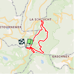

23 km | 36 km-effort

Utilisateur

Application GPS de randonnée GRATUITE
 SityTrail
IGN / Instituts géographiques
SityTrail World
Le monde est à vous
Randonnée Marche de 12 km à découvrir à Grand Est, Vosges, La Bresse. Cette randonnée est proposée par margotte.
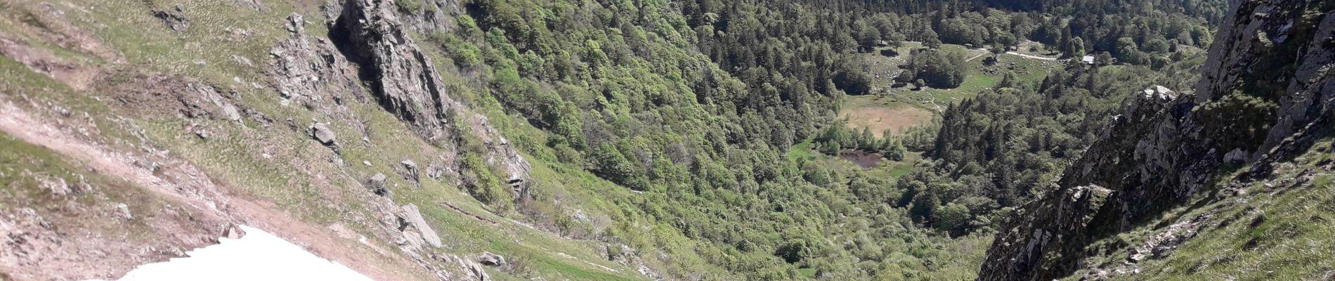
belle journée estivale pour cette randonnée. Nombreux points de vue et paysages ouverts via les Hautes Chaumes. Attention toutefois à être bien chaussé et de ne pas avoir le vertige...


Marche

Marche

Marche

Marche

Marche

Marche

Marche

Marche

Marche