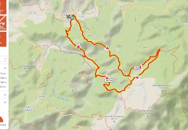
14 km | 22 km-effort
vtt 310519
wkm
Utilisateur
Longueur
32 km
Altitude max
390 m
Dénivelé positif
221 m
Km-Effort
36 km
Altitude min
-2 m
Dénivelé négatif
578 m
Boucle
Non
Date de création :
2019-05-31 07:35:38.179
Dernière modification :
2019-05-31 09:10:19.201
1h33
Difficulté : Très facile
Application GPS de randonnée GRATUITE
À propos
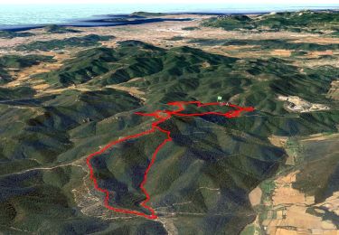
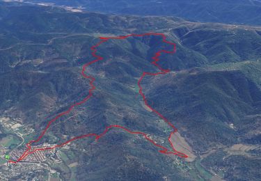
Randonnée V.T.T. de 32 km à découvrir à Provence-Alpes-Côte d'Azur, Var, Collobrières. Cette randonnée est proposée par wkm.
Description
ffd
jjh
Localisation
Pays :
France
Région :
Provence-Alpes-Côte d'Azur
Département/Province :
Var
Commune :
Collobrières
Localité :
Unknown
Départ:(Dec)
Départ:(UTM)
279162 ; 4787515 (32T) N.
Commentaires
Randonnées à proximité
Les vallons de Valcros
Marche
Difficile
(2)
Bormes-les-Mimosas,
Provence-Alpes-Côte d'Azur,
Var,
France
6h 0min
Oui
Pierrefeu - Pt Gageai - Temple - Citadelle - Gd Gageai - Bourgas
Marche
Moyen
(1)
Pierrefeu-du-Var,
Provence-Alpes-Côte d'Azur,
Var,
France
15,3 km | 22 km-effort
6h 0min
Oui
Collobriéres - Plateau Lambert
Marche
Moyen
(1)
Collobrières,
Provence-Alpes-Côte d'Azur,
Var,
France
12,8 km | 20 km-effort
6h 0min
Oui
Col du Gratteloup - Piste domaniale Sud - Cols de Labade et Landon - Pierre d...
Marche
Facile
(1)
Bormes-les-Mimosas,
Provence-Alpes-Côte d'Azur,
Var,
France
15,1 km | 21 km-effort
6h 0min
Oui
Collobrières par pistes
V.T.T.
Moyen
(1)
Collobrières,
Provence-Alpes-Côte d'Azur,
Var,
France
28 km | 35 km-effort
2h 20min
Oui
Plateau Lambert 2
Marche
Facile
(1)
Collobrières,
Provence-Alpes-Côte d'Azur,
Var,
France
14,2 km | 21 km-effort
4h 40min
Oui
piste du feu Collobrieres
Marche
Très facile
(1)
Pierrefeu-du-Var,
Provence-Alpes-Côte d'Azur,
Var,
France
15,2 km | 20 km-effort
Inconnu
Oui
Circuit dans les maures
Marche
Très difficile
Pierrefeu-du-Var,
Provence-Alpes-Côte d'Azur,
Var,
France
15,5 km | 21 km-effort
5h 21min
Oui
plateau Lambert en partant de Collobrieres
Marche
Très difficile
Collobrières,
Provence-Alpes-Côte d'Azur,
Var,
France
15,2 km | 22 km-effort
6h 58min
Oui