Randonnée Marche Jouy - jouy - Photo
 marcopascal
marcopascal

Utilisateur

© OpenStreetMap contributors
Longueur
Longueur
4,9 km
Altitude max
Altitude max
153 m
Dénivelé positif
Dénivelé positif
76 m
Km-Effort
Km-Effort  
5,9 km
Altitude min
Altitude min
110 m
Dénivelé négatif
Dénivelé négatif
77 m
Boucle
Boucle
Oui
Date de création :
2019-05-30 13:07:56.06
Dernière modification :
2019-05-30 14:07:57.957

(1 Avis)

Marche
Marche
59m
Difficulté : Très facile

Scannez ce code QR pour ouvrir la randonnée dans l'application SityTrail

Application GPS de randonnée GRATUITE

Logo SityTrail SityTrail

IGN / Instituts géographiques

Télécharger SityTrail sur l'App Store Télécharger SityTrail sur Google Play

Logo SityTrail SityTrail World

Le monde est à vous

Télécharger SityTrail sur l'App Store Télécharger SityTrail sur Google Play Télécharger SityTrail sur Huawei AppGallery

À propos

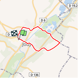
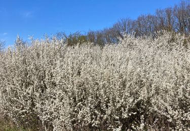
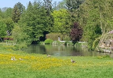
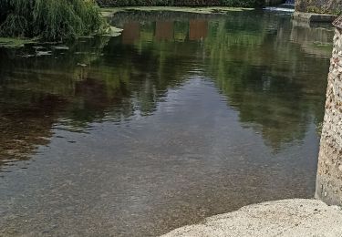
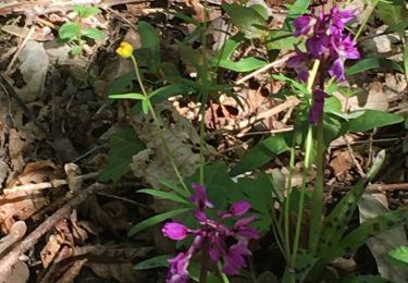
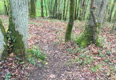
Randonnée Marche de 4,9 km à découvrir à Centre-Val de Loire, Eure-et-Loir, Jouy. Cette randonnée est proposée par marcopascal.

Profil altimétrique

Localisation

Pays :
France
Région :
Centre-Val de Loire
Département/Province :
Eure-et-Loir
Commune :
Jouy
Localité :
Unknown
Départ:(UTM)
392606 ; 5374417 (31U) N.

Commentaires

Veuillez vous connecter pour laisser un commentaire ou une note


Randonnées à proximité

Randonnée Marche Saint-Prest - St prèst>> Soulaires>>jouy >> St prest  - Photo
Marche
ezola

Marche

Très difficile
Saint-Prest, Centre-Val de Loire, Eure-et-Loir, France
21 km | 24 km-effort
4h 46min
Oui
Randonnée Marche Saint-Piat - 20200611St Piat - Photo
Marche
Jeanclaudebic

Marche

Très facile
(1)
Saint-Piat, Centre-Val de Loire, Eure-et-Loir, France
10,6 km | 12,5 km-effort
2h 8min
Oui
Randonnée Marche Soulaires - Soulaires, Saint Piat  - Photo
Marche
galou29

Marche

Très facile
Soulaires, Centre-Val de Loire, Eure-et-Loir, France
13,8 km | 16,5 km-effort
3h 17min
Non
Randonnée Marche Jouy - GB Jouy - Photo
Marche
jctbis

Marche

Facile
Jouy, Centre-Val de Loire, Eure-et-Loir, France
10,2 km | 12,4 km-effort
2h 36min
Oui
Randonnée Marche Lèves - Étang lèves, champhol, oiseme, st prest, jouy  - Photo
Marche
ezola

Marche

Difficile
Lèves, Centre-Val de Loire, Eure-et-Loir, France
30 km | 34 km-effort
6h 23min
Non
Randonnée Marche Lèves - Haut de Leves al/ret. Par seresville  - Photo
Marche
ezola

Marche

Facile
Lèves, Centre-Val de Loire, Eure-et-Loir, France
11,5 km | 13,6 km-effort
2h 54min
Oui
Randonnée sport Saint-Piat - Parcours Thierry, Geille Saint-Piat - Photo
sport
ezola

sport

Très facile
Saint-Piat, Centre-Val de Loire, Eure-et-Loir, France
23 km | 27 km-effort
Inconnu
Oui
Randonnée Marche Saint-Prest - Rando Oisème  - Photo
Marche
LEGUE

Marche

Facile
Saint-Prest, Centre-Val de Loire, Eure-et-Loir, France
26 km | 29 km-effort
2h 0min
Non
Randonnée sport Saint-Prest - Randonnée de Jean-Pierre samedi jeudi matin - Photo
sport
ezola

sport

Très facile
Saint-Prest, Centre-Val de Loire, Eure-et-Loir, France
11,5 km | 13,5 km-effort
Inconnu
Oui


Fermer
Mes abonnements