![](/images/other/stat-length.png)
![Randonnée Marche Binche - Binche 20 km - Photo](https://media.geolcdn.com/t/1900/400/1841b57f-6493-467c-87bb-7bd139775c50.jpg&format=pjpeg&maxdim=2)
Binche 20 km
rvapeldo
Utilisateur GUIDE
![Longueur](/images/other/stat-length.png)
Longueur
20 km
![Boucle](https://static1.geolcdn.com/siteimages/upload/files/16400158638029165_repeat_loop_refresh_sync_direction_icon.png)
Boucle
Oui
Date de création :
2019-05-30 09:14:40.0
Dernière modification :
2019-05-30 17:21:09.212
![Marche](https://static1.geolcdn.com/sitytour/trail-icons/101.png)
4h49
Difficulté : Moyen
![Scannez ce code QR pour ouvrir la randonnée dans l'application SityTrail](https://capi.geolives.com/qq0zvz2zws4bq2lad0pu/sitytour/trails/2098789/qr.png?size=200)
Application GPS de randonnée GRATUITE
À propos
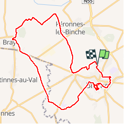
Randonnée Marche de 20 km à découvrir à Wallonie, Hainaut, Binche. Cette randonnée est proposée par rvapeldo.
Description
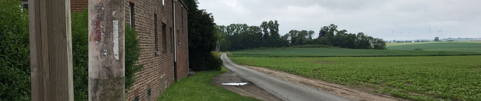
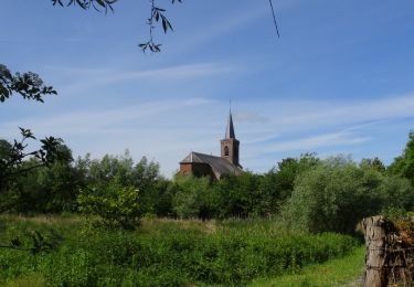
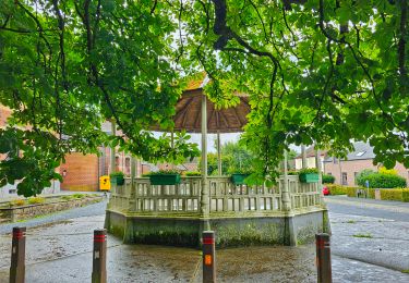
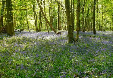
Balade sur les chemins de campagne entre Binche et Bray. Avec un tour du parc des remparts. Départ au cimetière. Avec quelques options comme le musée gallo romain et le musée international du carnaval et du masque (près du parc des remparts).
Localisation
Pays :
Belgique
Région :
Wallonie
Département/Province :
Hainaut
Commune :
Binche
Localité :
Binche
Départ:(Dec)
Départ:(UTM)
582781 ; 5585937 (31U) N.
Commentaires
Randonnées à proximité
![Randonnée Marche Lobbes - Balade à Mont-Sainte-Geneviève - Photo](https://media.geolcdn.com/t/375/260/ext.jpg?maxdim=2&url=https%3A%2F%2Fservices.sitytrail.com%2FGeolivesWS%2FDownloadMedia.ashx%3FTrailID%3D378767%26Media%3D9ad7b20e-c031-407f-875d-742351009cf4.jpg)
![Marche Marche](https://static1.geolcdn.com/sitytour/trail-icons/101.png)
Balade à Mont-Sainte-Geneviève
Marche
Très facile
(3)
Lobbes,
Wallonie,
Hainaut,
Belgique
![](/images/other/stat-length.png)
9,1 km | 10,4 km-effort
2h 18min
![](https://static1.geolcdn.com/siteimages/upload/files/16400158638029165_repeat_loop_refresh_sync_direction_icon.png)
Oui
![Randonnée Marche Binche - Les marais de Buvrinnes - Photo](https://media.geolcdn.com/t/375/260/ext.jpg?maxdim=2&url=https%3A%2F%2Fservices.sitytrail.com%2FGeolivesWS%2FDownloadMedia.ashx%3FTrailID%3D308684%26Media%3Dc96914c7-aa42-4b0f-8d11-534a0221fc18.JPG)
![Marche Marche](https://static1.geolcdn.com/sitytour/trail-icons/101.png)
Les marais de Buvrinnes
Marche
Très facile
(2)
Binche,
Wallonie,
Hainaut,
Belgique
![](/images/other/stat-length.png)
4,2 km | 5 km-effort
1h 5min
![](https://static1.geolcdn.com/siteimages/upload/files/16400158638029165_repeat_loop_refresh_sync_direction_icon.png)
Oui
![Randonnée Marche Binche - De Leval-Trahegnies à Mont-Sainte-Aldegonde - Photo](https://media.geolcdn.com/t/375/260/ext.jpg?maxdim=2&url=https%3A%2F%2Fservices.sitytrail.com%2FGeolivesWS%2FDownloadMedia.ashx%3FTrailID%3D96104%26Media%3D21dc5c72-4ff2-4334-88b1-a5c37d1d86a8.JPG)
![Marche Marche](https://static1.geolcdn.com/sitytour/trail-icons/101.png)
De Leval-Trahegnies à Mont-Sainte-Aldegonde
Marche
Facile
(1)
Binche,
Wallonie,
Hainaut,
Belgique
![](/images/other/stat-length.png)
8,8 km | 10,8 km-effort
2h 20min
![](https://static1.geolcdn.com/siteimages/upload/files/16400158638029165_repeat_loop_refresh_sync_direction_icon.png)
Oui
![Randonnée Marche Binche - Balade à Binche - Photo](https://media.geolcdn.com/t/375/260/ext.jpg?maxdim=2&url=https%3A%2F%2Fstatic1.geolcdn.com%2Fsiteimages%2Fupload%2Ffiles%2F1553511878bg_sport_marche.png)
![Marche Marche](https://static1.geolcdn.com/sitytour/trail-icons/101.png)
Balade à Binche
Marche
Moyen
(4)
Binche,
Wallonie,
Hainaut,
Belgique
![](/images/other/stat-length.png)
17,9 km | 21 km-effort
4h 30min
![](https://static1.geolcdn.com/siteimages/upload/files/16400158638029165_repeat_loop_refresh_sync_direction_icon.png)
Oui
![Randonnée Marche nordique Morlanwelz - Mont Sainte Aldegonde 7km - Photo](https://media.geolcdn.com/t/375/260/ext.jpg?maxdim=2&url=https%3A%2F%2Fstatic1.geolcdn.com%2Fsiteimages%2Fupload%2Ffiles%2F1545311037marcheuse_200dpi.jpg)
![Marche nordique Marche nordique](https://static1.geolcdn.com/sitytour/trail-icons/102.png)
Mont Sainte Aldegonde 7km
Marche nordique
Facile
(1)
Morlanwelz,
Wallonie,
Hainaut,
Belgique
![](/images/other/stat-length.png)
7,1 km | 8,2 km-effort
1h 30min
![](https://static1.geolcdn.com/siteimages/upload/files/16400158638029165_repeat_loop_refresh_sync_direction_icon.png)
Oui
![Randonnée Marche Lobbes - Balade à Mont-Sainte-Geneviève - Photo](https://media.geolcdn.com/t/375/260/3e6cb871-d675-45b6-b039-eefee51e193b.jpeg&format=jpg&maxdim=2)
![Marche Marche](https://static1.geolcdn.com/sitytour/trail-icons/101.png)
Balade à Mont-Sainte-Geneviève
Marche
Moyen
(1)
Lobbes,
Wallonie,
Hainaut,
Belgique
![](/images/other/stat-length.png)
10,5 km | 11,8 km-effort
3h 11min
![](https://static1.geolcdn.com/siteimages/upload/files/16400158638029165_repeat_loop_refresh_sync_direction_icon.png)
Oui
![Randonnée Marche Lobbes - Balade à Mont-Sainte-Geneviève - Photo](https://media.geolcdn.com/t/375/260/bca4789a-9723-4611-bdb6-0d9835beb766.jpg&format=jpg&maxdim=2)
![Marche Marche](https://static1.geolcdn.com/sitytour/trail-icons/101.png)
Balade à Mont-Sainte-Geneviève
Marche
Moyen
Lobbes,
Wallonie,
Hainaut,
Belgique
![](/images/other/stat-length.png)
9,9 km | 11,8 km-effort
2h 40min
![](https://static1.geolcdn.com/siteimages/upload/files/16400158638029165_repeat_loop_refresh_sync_direction_icon.png)
Oui
![Randonnée Marche Binche - Autour du marais de Buvrinnes - Photo](https://media.geolcdn.com/t/375/260/ext.jpg?maxdim=2&url=https%3A%2F%2Fstatic1.geolcdn.com%2Fsiteimages%2Fupload%2Ffiles%2F1553511878bg_sport_marche.png)
![Marche Marche](https://static1.geolcdn.com/sitytour/trail-icons/101.png)
Autour du marais de Buvrinnes
Marche
Facile
(1)
Binche,
Wallonie,
Hainaut,
Belgique
![](/images/other/stat-length.png)
4,2 km | 5 km-effort
1h 8min
![](https://static1.geolcdn.com/siteimages/upload/files/16400158638029165_repeat_loop_refresh_sync_direction_icon.png)
Oui
![Randonnée Marche La Louvière - Etincelle - Photo](https://media.geolcdn.com/t/375/260/ext.jpg?maxdim=2&url=https%3A%2F%2Fstatic1.geolcdn.com%2Fsiteimages%2Fupload%2Ffiles%2F1553511878bg_sport_marche.png)
![Marche Marche](https://static1.geolcdn.com/sitytour/trail-icons/101.png)
Etincelle
Marche
Très facile
(1)
La Louvière,
Wallonie,
Hainaut,
Belgique
![](/images/other/stat-length.png)
9,9 km | 11,3 km-effort
2h 29min
![](https://static1.geolcdn.com/siteimages/upload/files/16400158638029165_repeat_loop_refresh_sync_direction_icon.png)
Oui