


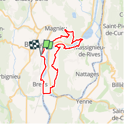

39 km | 54 km-effort


Utilisateur


Application GPS de randonnée GRATUITE
 SityTrail
IGN / Instituts géographiques
SityTrail World
Le monde est à vous
Randonnée V.T.T. de 28 km à découvrir à Auvergne-Rhône-Alpes, Ain, Belley. Cette randonnée est proposée par jeannot01.
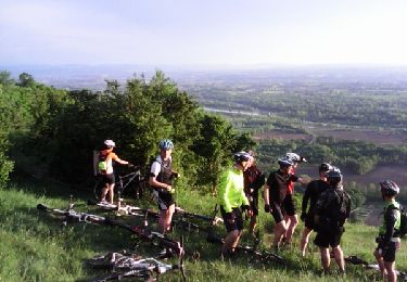
Si vous aimez les cotes un peu saignantes, cette rando est faites pour vous.
Parcours original et très varié.
De bonnes portions roulantes pour récupérer mais aussi de sacrées grimpettes.
Les descentes sont beaucoup moins technique que les montés sur cette rando
A faire!!!

V.T.T.
V.T.T.

V.T.T.
V.T.T.
V.T.T.
V.T.T.
V.T.T.
V.T.T.