![](/images/other/stat-length.png)
![Randonnée Marche Barnave - Barnave - Photo](https://media.geolcdn.com/t/1900/400/ext.pjpeg?maxdim=2&url=https%3A%2F%2Fstatic1.geolcdn.com%2Fsiteimages%2Fupload%2Ffiles%2F1553511878bg_sport_marche.png)
Barnave
ajd26
Utilisateur
![Longueur](/images/other/stat-length.png)
Longueur
12,5 km
![Boucle](https://static1.geolcdn.com/siteimages/upload/files/16400158638029165_repeat_loop_refresh_sync_direction_icon.png)
Boucle
Oui
Date de création :
2019-05-16 07:17:20.0
Dernière modification :
2019-05-16 17:08:10.108
![Marche](https://static1.geolcdn.com/sitytour/trail-icons/101.png)
6h46
Difficulté : Difficile
![Scannez ce code QR pour ouvrir la randonnée dans l'application SityTrail](https://capi.geolives.com/qq0zvz2zws4bq2lad0pu/sitytour/trails/2085535/qr.png?size=200)
Application GPS de randonnée GRATUITE
À propos
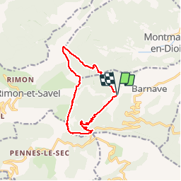
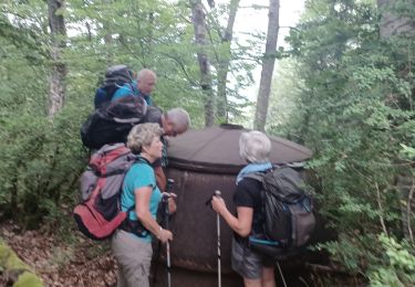
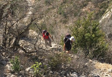
Randonnée Marche de 12,5 km à découvrir à Auvergne-Rhône-Alpes, Drôme, Barnave. Cette randonnée est proposée par ajd26.
Description
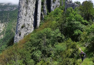
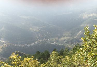
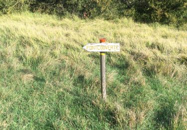
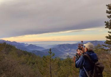
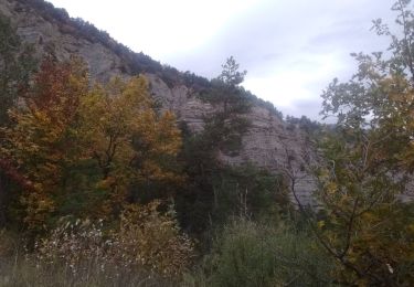
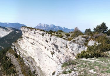
Barnave, col de Pennes, la Pâle 1340m puis les crêtes en direction du pas de la lune et ensuite le pas du soleil très joli panorama
Localisation
Pays :
France
Région :
Auvergne-Rhône-Alpes
Département/Province :
Drôme
Commune :
Barnave
Localité :
Unknown
Départ:(Dec)
Départ:(UTM)
686726 ; 4947605 (31T) N.
Commentaires
Randonnées à proximité
![Randonnée Marche Rimon-et-Savel - 26 lames de pennes savel jp - Photo](https://media.geolcdn.com/t/375/260/f2bea45a-9c65-4d39-b93d-6507c3374444.jpg&format=jpg&maxdim=2)
![Marche Marche](https://static1.geolcdn.com/sitytour/trail-icons/101.png)
26 lames de pennes savel jp
Marche
Moyen
Rimon-et-Savel,
Auvergne-Rhône-Alpes,
Drôme,
France
![](/images/other/stat-length.png)
10,8 km | 0 m-effort
7h 56min
![](https://static1.geolcdn.com/siteimages/upload/files/16400158638029165_repeat_loop_refresh_sync_direction_icon.png)
Oui
![Randonnée Marche Rimon-et-Savel - balcons de la Roanne - Photo](https://media.geolcdn.com/t/375/260/6f529a2b-52ed-4864-b6b1-e2b0e3236399.jpg&format=jpg&maxdim=2)
![Marche Marche](https://static1.geolcdn.com/sitytour/trail-icons/101.png)
balcons de la Roanne
Marche
Moyen
Rimon-et-Savel,
Auvergne-Rhône-Alpes,
Drôme,
France
![](/images/other/stat-length.png)
18,8 km | 29 km-effort
5h 17min
![](https://static1.geolcdn.com/siteimages/upload/files/16400158638029165_repeat_loop_refresh_sync_direction_icon.png)
Oui
![Randonnée Marche Aurel - Butte de l'Aigle - Photo](https://media.geolcdn.com/t/375/260/93f8cc31-cdb7-4c51-ac3c-2c9d3f413282.jpg&format=jpg&maxdim=2)
![Marche Marche](https://static1.geolcdn.com/sitytour/trail-icons/101.png)
Butte de l'Aigle
Marche
Moyen
(1)
Aurel,
Auvergne-Rhône-Alpes,
Drôme,
France
![](/images/other/stat-length.png)
13,5 km | 24 km-effort
4h 37min
![](https://static1.geolcdn.com/siteimages/upload/files/16400158638029165_repeat_loop_refresh_sync_direction_icon.png)
Oui
![Randonnée Marche Rimon-et-Savel - rimon 2/1/2022 - Photo](https://media.geolcdn.com/t/375/260/d71302a3-bf5b-468d-ad27-fcad37c90032.jpg&format=jpg&maxdim=2)
![Marche Marche](https://static1.geolcdn.com/sitytour/trail-icons/101.png)
rimon 2/1/2022
Marche
Moyen
Rimon-et-Savel,
Auvergne-Rhône-Alpes,
Drôme,
France
![](/images/other/stat-length.png)
5,4 km | 6,9 km-effort
1h 48min
![](https://static1.geolcdn.com/siteimages/upload/files/16400158638029165_repeat_loop_refresh_sync_direction_icon.png)
Non
![Randonnée Vélo de route Recoubeau-Jansac - col de Penne - Photo](https://media.geolcdn.com/t/375/260/47037570-c0aa-4718-9214-10ee3d6f6cd7.jpg&format=jpg&maxdim=2)
![Vélo de route Vélo de route](https://static1.geolcdn.com/sitytour/trail-icons/201.png)
col de Penne
Vélo de route
Facile
Recoubeau-Jansac,
Auvergne-Rhône-Alpes,
Drôme,
France
![](/images/other/stat-length.png)
24 km | 33 km-effort
1h 31min
![](https://static1.geolcdn.com/siteimages/upload/files/16400158638029165_repeat_loop_refresh_sync_direction_icon.png)
Oui
![Randonnée Marche Aucelon - la montagne d Aucelon - Photo](https://media.geolcdn.com/t/375/260/418d345f-bb1e-4446-b000-4d78372a3cd9.jpg&format=jpg&maxdim=2)
![Marche Marche](https://static1.geolcdn.com/sitytour/trail-icons/101.png)
la montagne d Aucelon
Marche
Difficile
Aucelon,
Auvergne-Rhône-Alpes,
Drôme,
France
![](/images/other/stat-length.png)
97 km | 119 km-effort
6h 0min
![](https://static1.geolcdn.com/siteimages/upload/files/16400158638029165_repeat_loop_refresh_sync_direction_icon.png)
Non
![Randonnée Marche Rimon-et-Savel - Savel - La Pale - Photo](https://media.geolcdn.com/t/375/260/6ba554c1-703a-4efa-8a00-2064218d8db8.jpg&format=jpg&maxdim=2)
![Marche Marche](https://static1.geolcdn.com/sitytour/trail-icons/101.png)
Savel - La Pale
Marche
Difficile
Rimon-et-Savel,
Auvergne-Rhône-Alpes,
Drôme,
France
![](/images/other/stat-length.png)
17,4 km | 30 km-effort
6h 0min
![](https://static1.geolcdn.com/siteimages/upload/files/16400158638029165_repeat_loop_refresh_sync_direction_icon.png)
Oui
![Randonnée Marche Aurel - Aurel 15/10/2020 - Photo](https://media.geolcdn.com/t/375/260/4042d0a3-24f1-40dc-9aa7-4bee70a8d897.jpg&format=jpg&maxdim=2)
![Marche Marche](https://static1.geolcdn.com/sitytour/trail-icons/101.png)
Aurel 15/10/2020
Marche
Moyen
Aurel,
Auvergne-Rhône-Alpes,
Drôme,
France
![](/images/other/stat-length.png)
18,5 km | 31 km-effort
5h 21min
![](https://static1.geolcdn.com/siteimages/upload/files/16400158638029165_repeat_loop_refresh_sync_direction_icon.png)
Oui
![Randonnée Marche Aurel - Le Plateau de Solaure par Aurel - Photo](https://media.geolcdn.com/t/375/260/f9469c55-e221-43bf-9e27-eaf4200de7b7.jpg&format=jpg&maxdim=2)
![Marche Marche](https://static1.geolcdn.com/sitytour/trail-icons/101.png)
Le Plateau de Solaure par Aurel
Marche
Difficile
Aurel,
Auvergne-Rhône-Alpes,
Drôme,
France
![](/images/other/stat-length.png)
17,6 km | 29 km-effort
5h 0min
![](https://static1.geolcdn.com/siteimages/upload/files/16400158638029165_repeat_loop_refresh_sync_direction_icon.png)
Oui