22 km | 26 km-effort
essai
Gaucho
Utilisateur
Longueur
8,7 km
Altitude max
239 m
Dénivelé positif
84 m
Km-Effort
10 km
Altitude min
169 m
Dénivelé négatif
149 m
Boucle
Non
Date de création :
2019-05-15 14:55:16.485
Dernière modification :
2019-05-15 15:00:32.604
4m
Difficulté : Très facile
Application GPS de randonnée GRATUITE
À propos
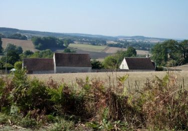
Randonnée Voiture de 8,7 km à découvrir à Centre-Val de Loire, Eure-et-Loir, Authon-du-Perche. Cette randonnée est proposée par Gaucho .
Localisation
Pays :
France
Région :
Centre-Val de Loire
Département/Province :
Eure-et-Loir
Commune :
Authon-du-Perche
Localité :
Authon-du-Perche
Départ:(Dec)
Départ:(UTM)
341320 ; 5340244 (31U) N.
Commentaires
Randonnées à proximité
Les terres douces - Authon-du-Perche
Cheval
Difficile
(1)
Authon-du-Perche,
Centre-Val de Loire,
Eure-et-Loir,
France
3h 30min
Oui
Saint Ulphace - Au fil des moulins...
Marche
Moyen
Saint-Ulphace,
Pays de la Loire,
Sarthe,
France
17,4 km | 21 km-effort
4h 0min
Oui
Les terres douces 23 km
V.T.T.
Moyen
Authon-du-Perche,
Centre-Val de Loire,
Eure-et-Loir,
France
23 km | 26 km-effort
1h 49min
Oui
Authon du Perche - Saint-Lubin-des-Cinq-Fonts 16 km
Marche
Très difficile
Authon-du-Perche,
Centre-Val de Loire,
Eure-et-Loir,
France
15,8 km | 19,3 km-effort
4h 23min
Oui
Les Etilleux 5.7 Km
Marche
Très facile
Les Étilleux,
Centre-Val de Loire,
Eure-et-Loir,
France
5,7 km | 7,3 km-effort
1h 33min
Oui
20240601 ""xxxxx"
Marche
Difficile
Authon-du-Perche,
Centre-Val de Loire,
Eure-et-Loir,
France
15,6 km | 18,4 km-effort
4h 4min
Oui
Bethonvilliers 8,5 km
Marche
Moyen
Béthonvilliers,
Centre-Val de Loire,
Eure-et-Loir,
France
8,5 km | 10,2 km-effort
2h 19min
Oui
Authon-du-Perche et alentours 12 km
Marche
Difficile
Authon-du-Perche,
Centre-Val de Loire,
Eure-et-Loir,
France
11,6 km | 14,6 km-effort
3h 18min
Oui
Dernier entraînement Corse 2022 Hotton du perche
Marche
Très difficile
Authon-du-Perche,
Centre-Val de Loire,
Eure-et-Loir,
France
26 km | 32 km-effort
6h 5min
Oui