![](/images/other/stat-length.png)
![Randonnée Marche Belsentes - Nonières. Par les chemins de l'école Buisson-nière - Photo](https://media.geolcdn.com/t/1900/400/976f364e-d9bc-40c0-917c-10e734dac3f0.jpg&format=pjpeg&maxdim=2)
Nonières. Par les chemins de l'école Buisson-nière
bernadette revoux
Utilisateur
![Longueur](/images/other/stat-length.png)
Longueur
8,6 km
![Altitude max](https://static1.geolcdn.com/siteimages/upload/files/1508320355ic_sort_altitude_max_24dp.png)
Altitude max
910 m
![Dénivelé positif](https://static1.geolcdn.com/siteimages/upload/files/1508320355ic_sort_den_pos_24dp.png)
Dénivelé positif
419 m
![Km-Effort](/images/other/stat-length.png)
Km-Effort
14,2 km
![Altitude min](https://static1.geolcdn.com/siteimages/upload/files/1508320355ic_sort_altitude_min_24dp.png)
Altitude min
590 m
![Dénivelé négatif](https://static1.geolcdn.com/siteimages/upload/files/1508320355ic_sort_den_neg_24dp.png)
Dénivelé négatif
420 m
![Boucle](https://static1.geolcdn.com/siteimages/upload/files/16400158638029165_repeat_loop_refresh_sync_direction_icon.png)
Boucle
Oui
Date de création :
2019-04-06 06:48:49.614
Dernière modification :
2019-04-16 13:16:30.15
![Marche](https://static1.geolcdn.com/sitytour/trail-icons/101.png)
3h20
Difficulté : Moyen
![Scannez ce code QR pour ouvrir la randonnée dans l'application SityTrail](https://capi.geolives.com/qq0zvz2zws4bq2lad0pu/sitytour/trails/2057576/qr.png?size=200)
Application GPS de randonnée GRATUITE
À propos
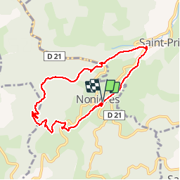
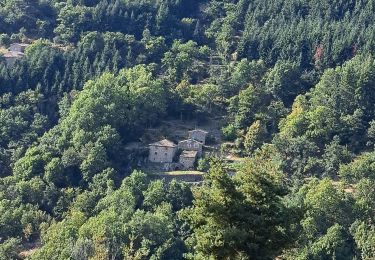
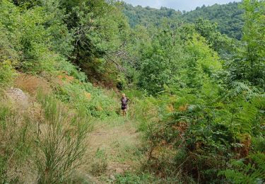
Randonnée Marche de 8,6 km à découvrir à Auvergne-Rhône-Alpes, Ardèche, Belsentes. Cette randonnée est proposée par bernadette revoux.
Description
9km 420 m de dénivelé
il pleuvait !
La marche n'a duré que 2h environ. Le tracé a continué à être enregistré pendant le casse-croute et le retour sur Lamastre en voiture ce qui explique les 3h20
Localisation
Pays :
France
Région :
Auvergne-Rhône-Alpes
Département/Province :
Ardèche
Commune :
Belsentes
Localité :
Nonières
Départ:(Dec)
Départ:(UTM)
617325 ; 4976522 (31T) N.
Commentaires
Randonnées à proximité
![Randonnée Vélo de route Saint-Prix - 07 vélo st agreve Cheylard desaigne - Photo](https://media.geolcdn.com/t/375/260/cb07a453-941e-4d73-bdf9-21d53d331c4e.jpg&format=jpg&maxdim=2)
![Vélo de route Vélo de route](https://static1.geolcdn.com/sitytour/trail-icons/201.png)
07 vélo st agreve Cheylard desaigne
Vélo de route
Moyen
Saint-Prix,
Auvergne-Rhône-Alpes,
Ardèche,
France
![](/images/other/stat-length.png)
66 km | 87 km-effort
6h 53min
![](https://static1.geolcdn.com/siteimages/upload/files/16400158638029165_repeat_loop_refresh_sync_direction_icon.png)
Oui
![Randonnée Marche Belsentes - Autour de la Chazalet - Photo](https://media.geolcdn.com/t/375/260/0529213e-4140-4cfe-bfda-fffdadbdd07d.jpg&format=jpg&maxdim=2)
![Marche Marche](https://static1.geolcdn.com/sitytour/trail-icons/101.png)
Autour de la Chazalet
Marche
Facile
(1)
Belsentes,
Auvergne-Rhône-Alpes,
Ardèche,
France
![](/images/other/stat-length.png)
8,1 km | 11,5 km-effort
2h 18min
![](https://static1.geolcdn.com/siteimages/upload/files/16400158638029165_repeat_loop_refresh_sync_direction_icon.png)
Oui
![Randonnée Marche Saint-Jean-Chambre - Boucle Chalencon Pont de Chervil - Photo](https://media.geolcdn.com/t/375/260/25b89ba2-0bca-4c8c-a18d-9e8f4c8cd813.jpg&format=jpg&maxdim=2)
![Marche Marche](https://static1.geolcdn.com/sitytour/trail-icons/101.png)
Boucle Chalencon Pont de Chervil
Marche
Difficile
Saint-Jean-Chambre,
Auvergne-Rhône-Alpes,
Ardèche,
France
![](/images/other/stat-length.png)
15,9 km | 24 km-effort
5h 42min
![](https://static1.geolcdn.com/siteimages/upload/files/16400158638029165_repeat_loop_refresh_sync_direction_icon.png)
Oui
![Randonnée Marche Belsentes - Saint-julien-labrousse 1er mai la rando des chanteurs de mai - Photo](https://media.geolcdn.com/t/375/260/dbd45dbc-9529-4e5d-9148-ee37437ae5f2.jpg&format=jpg&maxdim=2)
![Marche Marche](https://static1.geolcdn.com/sitytour/trail-icons/101.png)
Saint-julien-labrousse 1er mai la rando des chanteurs de mai
Marche
Moyen
Belsentes,
Auvergne-Rhône-Alpes,
Ardèche,
France
![](/images/other/stat-length.png)
20 km | 30 km-effort
4h 35min
![](https://static1.geolcdn.com/siteimages/upload/files/16400158638029165_repeat_loop_refresh_sync_direction_icon.png)
Non
![Randonnée Marche Le Cheylard - Randonnée Le cheylard - Saint-Agrève - Lac Devesset - Photo](https://media.geolcdn.com/t/375/260/ext.jpg?maxdim=2&url=https%3A%2F%2Fstatic1.geolcdn.com%2Fsiteimages%2Fupload%2Ffiles%2F1553511878bg_sport_marche.png)
![Marche Marche](https://static1.geolcdn.com/sitytour/trail-icons/101.png)
Randonnée Le cheylard - Saint-Agrève - Lac Devesset
Marche
Moyen
(2)
Le Cheylard,
Auvergne-Rhône-Alpes,
Ardèche,
France
![](/images/other/stat-length.png)
34 km | 45 km-effort
9h 55min
![](https://static1.geolcdn.com/siteimages/upload/files/16400158638029165_repeat_loop_refresh_sync_direction_icon.png)
Non
![Randonnée Marche Le Cheylard - Le Cheylard -> Saint Martin de Valamas - Photo](https://media.geolcdn.com/t/375/260/ext.jpg?maxdim=2&url=https%3A%2F%2Fservices.sitytrail.com%2FGeolivesWS%2FDownloadMedia.ashx%3FTrailID%3D911165%26Media%3Dfix__20180123114120.jpg)
![Marche Marche](https://static1.geolcdn.com/sitytour/trail-icons/101.png)
Le Cheylard -> Saint Martin de Valamas
Marche
Très facile
Le Cheylard,
Auvergne-Rhône-Alpes,
Ardèche,
France
![](/images/other/stat-length.png)
17,4 km | 22 km-effort
5h 9min
![](https://static1.geolcdn.com/siteimages/upload/files/16400158638029165_repeat_loop_refresh_sync_direction_icon.png)
Oui
![Randonnée V.T.T. Belsentes - St Julien Boutières - La Gare- Le Cheylard - Photo](https://media.geolcdn.com/t/375/260/ext.jpg?maxdim=2&url=https%3A%2F%2Fservices.sitytrail.com%2FGeolivesWS%2FDownloadMedia.ashx%3FTrailID%3D129915%26Media%3D13467_4.jpg)
![V.T.T. V.T.T.](https://static1.geolcdn.com/sitytour/trail-icons/202.png)
St Julien Boutières - La Gare- Le Cheylard
V.T.T.
Moyen
Belsentes,
Auvergne-Rhône-Alpes,
Ardèche,
France
![](/images/other/stat-length.png)
35 km | 43 km-effort
2h 30min
![](https://static1.geolcdn.com/siteimages/upload/files/16400158638029165_repeat_loop_refresh_sync_direction_icon.png)
Oui
![Randonnée Marche Belsentes - 20240815 - Photo](https://media.geolcdn.com/t/375/260/0492b2db-0b68-4fe0-931d-8cc0ef7d2bc2.jpg&format=jpg&maxdim=2)
![Marche Marche](https://static1.geolcdn.com/sitytour/trail-icons/101.png)
20240815
Marche
Difficile
Belsentes,
Auvergne-Rhône-Alpes,
Ardèche,
France
![](/images/other/stat-length.png)
10,9 km | 15,5 km-effort
3h 55min
![](https://static1.geolcdn.com/siteimages/upload/files/16400158638029165_repeat_loop_refresh_sync_direction_icon.png)
Oui
![Randonnée Randonnée équestre Saint-Prix - 2023-06-08 Rando CVA Ardeche Verte Reel - Photo](https://media.geolcdn.com/t/375/260/ext.jpg?maxdim=2&url=https%3A%2F%2Fstatic1.geolcdn.com%2Fsiteimages%2Fupload%2Ffiles%2F1524743154cheval.jpg)
![Randonnée équestre Randonnée équestre](https://static1.geolcdn.com/sitytour/trail-icons/301.png)
2023-06-08 Rando CVA Ardeche Verte Reel
Randonnée équestre
Moyen
Saint-Prix,
Auvergne-Rhône-Alpes,
Ardèche,
France
![](/images/other/stat-length.png)
27 km | 38 km-effort
5h 2min
![](https://static1.geolcdn.com/siteimages/upload/files/16400158638029165_repeat_loop_refresh_sync_direction_icon.png)
Non