![](/images/other/stat-length.png)
![Randonnée Marche Montjoie - GR15-20130816-Monschau_Eupen - Photo](https://media.geolcdn.com/t/1900/400/ext.pjpeg?maxdim=2&url=https%3A%2F%2Fstatic1.geolcdn.com%2Fsiteimages%2Fupload%2Ffiles%2F1553511878bg_sport_marche.png)
GR15-20130816-Monschau_Eupen
yamadix
Utilisateur
![Longueur](/images/other/stat-length.png)
Longueur
23 km
![Altitude max](https://static1.geolcdn.com/siteimages/upload/files/1508320355ic_sort_altitude_max_24dp.png)
Altitude max
669 m
![Dénivelé positif](https://static1.geolcdn.com/siteimages/upload/files/1508320355ic_sort_den_pos_24dp.png)
Dénivelé positif
424 m
![Km-Effort](/images/other/stat-length.png)
Km-Effort
29 km
![Altitude min](https://static1.geolcdn.com/siteimages/upload/files/1508320355ic_sort_altitude_min_24dp.png)
Altitude min
268 m
![Dénivelé négatif](https://static1.geolcdn.com/siteimages/upload/files/1508320355ic_sort_den_neg_24dp.png)
Dénivelé négatif
565 m
![Boucle](https://static1.geolcdn.com/siteimages/upload/files/16400158638029165_repeat_loop_refresh_sync_direction_icon.png)
Boucle
Non
Date de création :
2014-12-10 00:00:00.0
Dernière modification :
2014-12-10 00:00:00.0
![Marche](https://static1.geolcdn.com/sitytour/trail-icons/101.png)
5h50
Difficulté : Facile
![Scannez ce code QR pour ouvrir la randonnée dans l'application SityTrail](https://capi.geolives.com/qq0zvz2zws4bq2lad0pu/sitytour/trails/205547/qr.png?size=200)
Application GPS de randonnée GRATUITE
À propos
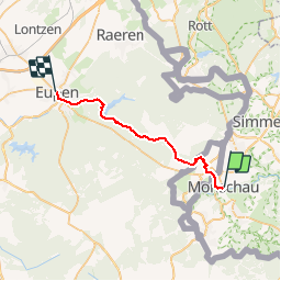
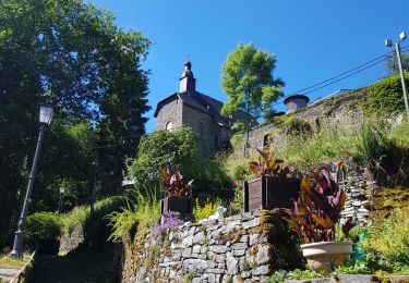
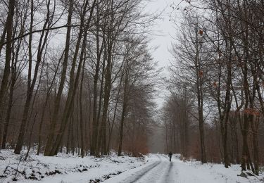
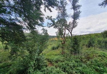
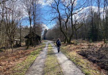
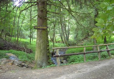
Randonnée Marche de 23 km à découvrir à Rhénanie-du-Nord-Westphalie, Région urbaine d'Aix-la-Chapelle, Montjoie. Cette randonnée est proposée par yamadix.
Description
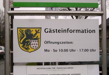
Départ : Hôtel Royal - Stadtstrasse 4-6 - 52156 Monschau
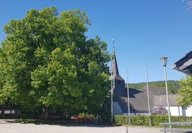
Arrivée : Café-Pension Zum Goldenen Anker - Marktplatz 13 - 4700 Eupen
Localisation
Pays :
Allemagne
Région :
Rhénanie-du-Nord-Westphalie
Département/Province :
Région urbaine d'Aix-la-Chapelle
Commune :
Montjoie
Localité :
Unknown
Départ:(Dec)
Départ:(UTM)
304581 ; 5603898 (32U) N.
Commentaires
Randonnées à proximité
![Randonnée Marche Montjoie - Route des jonquilles Monschau-Höfen - Photo](https://media.geolcdn.com/t/375/260/f78b6422-c27b-477b-b695-82eecbd61b40.jpg&format=jpg&maxdim=2)
![Marche Marche](https://static1.geolcdn.com/sitytour/trail-icons/101.png)
Route des jonquilles Monschau-Höfen
Marche
Moyen
(1)
Montjoie,
Rhénanie-du-Nord-Westphalie,
Région urbaine d'Aix-la-Chapelle,
Allemagne
![](/images/other/stat-length.png)
14,8 km | 18,2 km-effort
4h 8min
![](https://static1.geolcdn.com/siteimages/upload/files/16400158638029165_repeat_loop_refresh_sync_direction_icon.png)
Oui
![Randonnée Marche Montjoie - Montjoie - Ternell en ligne - Photo](https://media.geolcdn.com/t/375/260/d0229e76-e80b-4ee0-af20-8e96d215cea3.jpg&format=jpg&maxdim=2)
![Marche Marche](https://static1.geolcdn.com/sitytour/trail-icons/101.png)
Montjoie - Ternell en ligne
Marche
Moyen
(1)
Montjoie,
Rhénanie-du-Nord-Westphalie,
Région urbaine d'Aix-la-Chapelle,
Allemagne
![](/images/other/stat-length.png)
13,2 km | 17,1 km-effort
3h 52min
![](https://static1.geolcdn.com/siteimages/upload/files/16400158638029165_repeat_loop_refresh_sync_direction_icon.png)
Non
![Randonnée Marche Butgenbach - Küchelscheid 🇧🇪/Kalterherberg 🇩🇪 - Photo](https://media.geolcdn.com/t/375/260/f30f3eaf-c1e4-41d4-bcfb-42e5cbece161.jpg&format=jpg&maxdim=2)
![Marche Marche](https://static1.geolcdn.com/sitytour/trail-icons/101.png)
Küchelscheid 🇧🇪/Kalterherberg 🇩🇪
Marche
Facile
(3)
Butgenbach,
Wallonie,
Liège,
Belgique
![](/images/other/stat-length.png)
13,8 km | 17,3 km-effort
3h 56min
![](https://static1.geolcdn.com/siteimages/upload/files/16400158638029165_repeat_loop_refresh_sync_direction_icon.png)
Oui
![Randonnée Marche Montjoie - rando kalterherberg-rocher bieley 11/08/2021 - Photo](https://media.geolcdn.com/t/375/260/b8400c0e-5378-474d-9c63-b53205ca548b.jpg&format=jpg&maxdim=2)
![Marche Marche](https://static1.geolcdn.com/sitytour/trail-icons/101.png)
rando kalterherberg-rocher bieley 11/08/2021
Marche
Moyen
(1)
Montjoie,
Rhénanie-du-Nord-Westphalie,
Région urbaine d'Aix-la-Chapelle,
Allemagne
![](/images/other/stat-length.png)
18,3 km | 23 km-effort
4h 11min
![](https://static1.geolcdn.com/siteimages/upload/files/16400158638029165_repeat_loop_refresh_sync_direction_icon.png)
Non
![Randonnée Marche Eupen - Hautes Fagnes hohes Venn 20 km - Photo](https://media.geolcdn.com/t/375/260/6f1cadd0-76cd-4012-82b6-befbf33ff4a3.jpg&format=jpg&maxdim=2)
![Marche Marche](https://static1.geolcdn.com/sitytour/trail-icons/101.png)
Hautes Fagnes hohes Venn 20 km
Marche
Moyen
(1)
Eupen,
Wallonie,
Liège,
Belgique
![](/images/other/stat-length.png)
20 km | 23 km-effort
6h 1min
![](https://static1.geolcdn.com/siteimages/upload/files/16400158638029165_repeat_loop_refresh_sync_direction_icon.png)
Oui
![Randonnée A pied Montjoie - Eifelverein Rohren - Weg 57 - Photo](https://media.geolcdn.com/t/375/260/a620ba14-736e-46ad-b0d4-965dfc1d4df3.jpeg&format=jpg&maxdim=2)
![A pied A pied](https://static1.geolcdn.com/sitytour/trail-icons/100.png)
Eifelverein Rohren - Weg 57
A pied
Moyen
(1)
Montjoie,
Rhénanie-du-Nord-Westphalie,
Région urbaine d'Aix-la-Chapelle,
Allemagne
![](/images/other/stat-length.png)
15,1 km | 20 km-effort
4h 34min
![](https://static1.geolcdn.com/siteimages/upload/files/16400158638029165_repeat_loop_refresh_sync_direction_icon.png)
Oui
![Randonnée A pied Simmerath - Zur Ölmühle - Photo](https://media.geolcdn.com/t/375/260/acc51ee5-0286-4f84-ba55-5791dee5e476.jpeg&format=jpg&maxdim=2)
![A pied A pied](https://static1.geolcdn.com/sitytour/trail-icons/100.png)
Zur Ölmühle
A pied
Facile
Simmerath,
Rhénanie-du-Nord-Westphalie,
Région urbaine d'Aix-la-Chapelle,
Allemagne
![](/images/other/stat-length.png)
10,9 km | 14,3 km-effort
3h 15min
![](https://static1.geolcdn.com/siteimages/upload/files/16400158638029165_repeat_loop_refresh_sync_direction_icon.png)
Oui
![Randonnée A pied Simmerath - Flurheckenweg Eicherscheid - Photo](https://media.geolcdn.com/t/375/260/4e1bbe09-5ed6-460b-be04-ce40a88226b7.jpeg&format=jpg&maxdim=2)
![A pied A pied](https://static1.geolcdn.com/sitytour/trail-icons/100.png)
Flurheckenweg Eicherscheid
A pied
Facile
Simmerath,
Rhénanie-du-Nord-Westphalie,
Région urbaine d'Aix-la-Chapelle,
Allemagne
![](/images/other/stat-length.png)
7,8 km | 9,1 km-effort
2h 3min
![](https://static1.geolcdn.com/siteimages/upload/files/16400158638029165_repeat_loop_refresh_sync_direction_icon.png)
Oui
![Randonnée A pied Montjoie - Monschauer Nationalpark-Wanderweg](https://media.geolcdn.com/t/375/260/6ecae744-a5e1-4d67-8c65-d4bc2433654d.jpeg&format=jpg&maxdim=2)
![A pied A pied](https://static1.geolcdn.com/sitytour/trail-icons/100.png)
Monschauer Nationalpark-Wanderweg "Wasser, Wolle, Schieferstein"
A pied
Facile
Montjoie,
Rhénanie-du-Nord-Westphalie,
Région urbaine d'Aix-la-Chapelle,
Allemagne
![](/images/other/stat-length.png)
5,9 km | 8,6 km-effort
1h 57min
![](https://static1.geolcdn.com/siteimages/upload/files/16400158638029165_repeat_loop_refresh_sync_direction_icon.png)
Non