![](/images/other/stat-length.png)
68 Oberlarg - Château de Morimont
E.BURCK
Utilisateur
![Longueur](/images/other/stat-length.png)
![Altitude max](https://static1.geolcdn.com/siteimages/upload/files/1508320355ic_sort_altitude_max_24dp.png)
![Dénivelé positif](https://static1.geolcdn.com/siteimages/upload/files/1508320355ic_sort_den_pos_24dp.png)
![Km-Effort](/images/other/stat-length.png)
![Altitude min](https://static1.geolcdn.com/siteimages/upload/files/1508320355ic_sort_altitude_min_24dp.png)
![Dénivelé négatif](https://static1.geolcdn.com/siteimages/upload/files/1508320355ic_sort_den_neg_24dp.png)
![Boucle](https://static1.geolcdn.com/siteimages/upload/files/16400158638029165_repeat_loop_refresh_sync_direction_icon.png)
![Marche](https://static1.geolcdn.com/sitytour/trail-icons/101.png)
2h46
Difficulté : Difficile
![Scannez ce code QR pour ouvrir la randonnée dans l'application SityTrail](https://capi.geolives.com/qq0zvz2zws4bq2lad0pu/sitytour/trails/2055309/qr.png?size=200)
Application GPS de randonnée GRATUITE
À propos
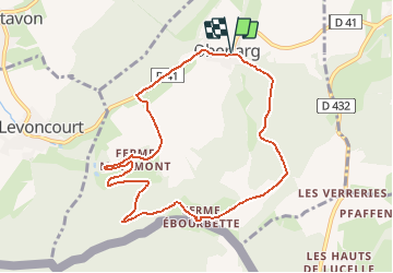
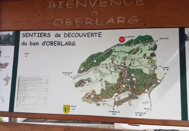
Randonnée Marche de 9 km à découvrir à Grand Est, Haut-Rhin, Oberlarg. Cette randonnée est proposée par E.BURCK.
Description
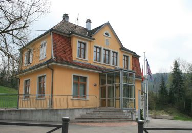
La ballade prendra son départ au pied de la Mairie d’Oberlarg
N 47,457847 - E 7,234409 ou N 47° 27' 28" - E 7° 14' 3,9"
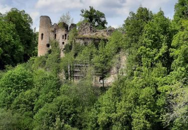
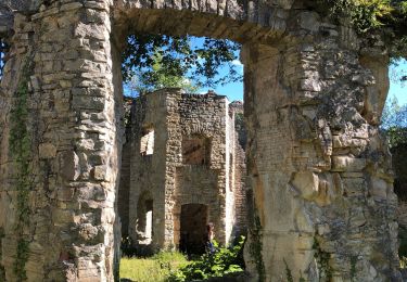
et se terminera au Château de Morimont.
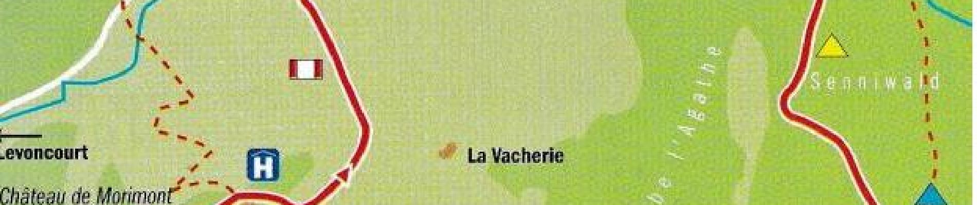
« Les paysages traversés ici comptent parmi les plus beaux du Jura alsacien ».* Nous traverserons un des derniers gués subsistant en Alsace, avant de passer par le site archéologique de la Grotte du Mannlefelsen et par la source de la Largue (549 m).
Une montée douce mais continue nous amènera au bout de moins d’une heure à la Ferme des Ebourbettes (730m), devenue célèbre par l’évasion du Général Giraud en avril 1942. De là on continue en direction du Morimont que l’on atteint au bout d’un peu plus de 2 km.
En fin de parcours nous nous retrouverons pour le déjeuner à l’Auberge du Morimont à proximité de la magnifique ruine du château que nous visiterons après le déjeuner.
10h00 : Rendez-vous au parking près de l’école d’Oberlarg
* Citation et plan du parcours de Marc Glotz
Localisation
Commentaires
Randonnées à proximité
![Randonnée Marche Levoncourt - Sortie les Copains d'abord.. 24/03/2022 - Photo](https://media.geolcdn.com/t/375/260/e59d3d7b-9ac7-43c7-934b-93ab50cd5556.jpg&format=jpg&maxdim=2)
![Marche Marche](https://static1.geolcdn.com/sitytour/trail-icons/101.png)
Marche
![](/images/other/stat-length.png)
![](https://static1.geolcdn.com/siteimages/upload/files/16400158638029165_repeat_loop_refresh_sync_direction_icon.png)
![Randonnée A pied Pleigne - Lucelle Douane - Pleigne - Photo](https://media.geolcdn.com/t/375/260/5e067c34-edcf-4a93-bd6c-7208fa7d1c3b.jpeg&format=jpg&maxdim=2)
![A pied A pied](https://static1.geolcdn.com/sitytour/trail-icons/100.png)
A pied
![](/images/other/stat-length.png)
![](https://static1.geolcdn.com/siteimages/upload/files/16400158638029165_repeat_loop_refresh_sync_direction_icon.png)
![Randonnée Marche Oberlarg - Oberlarg - sa grotte - la ferme des Ebourbettes - le château de Morimont - Photo](https://media.geolcdn.com/t/375/260/12ac5782-f6dd-4515-a936-425ac3e33bf2.jpg&format=jpg&maxdim=2)
![Marche Marche](https://static1.geolcdn.com/sitytour/trail-icons/101.png)
Marche
![](/images/other/stat-length.png)
![](https://static1.geolcdn.com/siteimages/upload/files/16400158638029165_repeat_loop_refresh_sync_direction_icon.png)
![Randonnée Marche Oberlarg - oberlag- château de morimont - Photo](https://media.geolcdn.com/t/375/260/7e84c322-06fc-4520-96d4-1ad54658d0ec.jpg&format=jpg&maxdim=2)
![Marche Marche](https://static1.geolcdn.com/sitytour/trail-icons/101.png)
Marche
![](/images/other/stat-length.png)
![](https://static1.geolcdn.com/siteimages/upload/files/16400158638029165_repeat_loop_refresh_sync_direction_icon.png)
![Randonnée Marche Oberlarg - Château de Morimont avec Patrice - Photo](https://media.geolcdn.com/t/375/260/23bc92de-96db-4f82-bda0-2218ea04717c.jpg&format=jpg&maxdim=2)
![Marche Marche](https://static1.geolcdn.com/sitytour/trail-icons/101.png)
Marche
![](/images/other/stat-length.png)
![](https://static1.geolcdn.com/siteimages/upload/files/16400158638029165_repeat_loop_refresh_sync_direction_icon.png)
![Randonnée A pied Bendorf - Rando CLAS du 20/06/2024 par PBo - Photo](https://media.geolcdn.com/t/375/260/ext.jpg?maxdim=2&url=https%3A%2F%2Fstatic1.geolcdn.com%2Fsiteimages%2Fupload%2Ffiles%2F1545311037marcheuse_200dpi.jpg)
![A pied A pied](https://static1.geolcdn.com/sitytour/trail-icons/100.png)
A pied
![](/images/other/stat-length.png)
![](https://static1.geolcdn.com/siteimages/upload/files/16400158638029165_repeat_loop_refresh_sync_direction_icon.png)
![Randonnée Marche Bendorf - Rando Bendorf 30/05/2024 - Photo](https://media.geolcdn.com/t/375/260/ext.jpg?maxdim=2&url=https%3A%2F%2Fstatic1.geolcdn.com%2Fsiteimages%2Fupload%2Ffiles%2F1553511878bg_sport_marche.png)
![Marche Marche](https://static1.geolcdn.com/sitytour/trail-icons/101.png)
Marche
![](/images/other/stat-length.png)
![](https://static1.geolcdn.com/siteimages/upload/files/16400158638029165_repeat_loop_refresh_sync_direction_icon.png)
![Randonnée Marche Winkel - Winkel-Petit Kohlberg-Verreries variante - Photo](https://media.geolcdn.com/t/375/260/ext.jpg?maxdim=2&url=https%3A%2F%2Fstatic1.geolcdn.com%2Fsiteimages%2Fupload%2Ffiles%2F1553511878bg_sport_marche.png)
![Marche Marche](https://static1.geolcdn.com/sitytour/trail-icons/101.png)
Marche
![](/images/other/stat-length.png)
![](https://static1.geolcdn.com/siteimages/upload/files/16400158638029165_repeat_loop_refresh_sync_direction_icon.png)
![Randonnée Marche Winkel - Winkel-Petit Kohlberg-Allée des Hêtres - Photo](https://media.geolcdn.com/t/375/260/ext.jpg?maxdim=2&url=https%3A%2F%2Fstatic1.geolcdn.com%2Fsiteimages%2Fupload%2Ffiles%2F1553511878bg_sport_marche.png)
![Marche Marche](https://static1.geolcdn.com/sitytour/trail-icons/101.png)
Marche
![](/images/other/stat-length.png)
![](https://static1.geolcdn.com/siteimages/upload/files/16400158638029165_repeat_loop_refresh_sync_direction_icon.png)