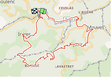
![](/images/other/stat-length.png)
![Randonnée V.T.T. Saint-Julien-du-Gua - VTT La pervenche (07) - Photo](https://media.geolcdn.com/t/1900/400/ext.pjpeg?maxdim=2&url=https%3A%2F%2Fservices.sitytrail.com%2FGeolivesWS%2FDownloadMedia.ashx%3FTrailID%3D205203%26Media%3Dfix__20130714085115.jpg)
VTT La pervenche (07)
sebout2
Utilisateur
![Longueur](/images/other/stat-length.png)
![Altitude max](https://static1.geolcdn.com/siteimages/upload/files/1508320355ic_sort_altitude_max_24dp.png)
![Dénivelé positif](https://static1.geolcdn.com/siteimages/upload/files/1508320355ic_sort_den_pos_24dp.png)
![Km-Effort](/images/other/stat-length.png)
![Altitude min](https://static1.geolcdn.com/siteimages/upload/files/1508320355ic_sort_altitude_min_24dp.png)
![Dénivelé négatif](https://static1.geolcdn.com/siteimages/upload/files/1508320355ic_sort_den_neg_24dp.png)
![Boucle](https://static1.geolcdn.com/siteimages/upload/files/16400158638029165_repeat_loop_refresh_sync_direction_icon.png)
![V.T.T.](https://static1.geolcdn.com/sitytour/trail-icons/202.png)
1h29
Difficulté : Moyen
![Scannez ce code QR pour ouvrir la randonnée dans l'application SityTrail](https://capi.geolives.com/qq0zvz2zws4bq2lad0pu/sitytour/trails/205203/qr.png?size=200)
Application GPS de randonnée GRATUITE
À propos
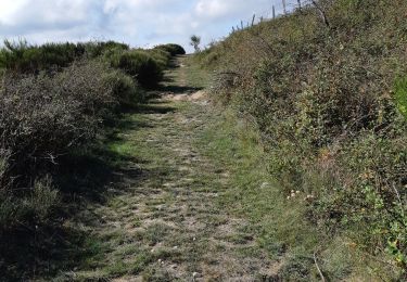
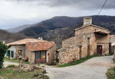
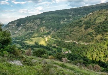
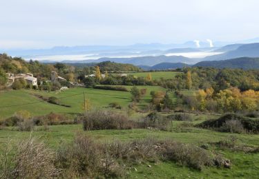
Randonnée V.T.T. de 14,8 km à découvrir à Auvergne-Rhône-Alpes, Ardèche, Saint-Julien-du-Gua. Cette randonnée est proposée par sebout2.
Description
Sortie relativement courte en kilomètres mais j'ai poussé pas mal dans l'ascension vers Ajoux. Montées un peu difficiles de part la pente et le sol recouvert de cailloux/ branches/ feuilles. Descentes agréables, ludiques et peu techniques. De très beaux points de vues par endroits.
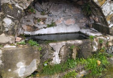
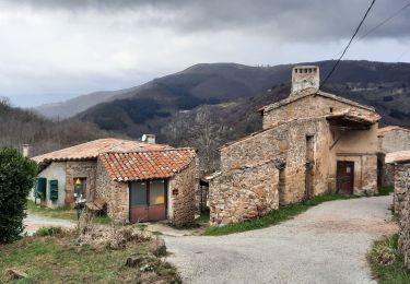
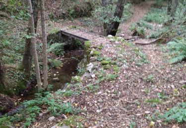
Localisation
Commentaires
Randonnées à proximité
![Randonnée Marche Creysseilles - 07 mageroan pierre de boeuf ajoux zel - Photo](https://media.geolcdn.com/t/375/260/7bb0b48c-bed8-4199-9213-2d5bb1436604.jpg&format=jpg&maxdim=2)
![Marche Marche](https://static1.geolcdn.com/sitytour/trail-icons/101.png)
Marche
![](/images/other/stat-length.png)
![](https://static1.geolcdn.com/siteimages/upload/files/16400158638029165_repeat_loop_refresh_sync_direction_icon.png)
![Randonnée Marche Creysseilles - Magerouan Le Chier 14KM - Photo](https://media.geolcdn.com/t/375/260/85649a27-9268-4d71-b7cd-d2621e352912.jpg&format=jpg&maxdim=2)
![Marche Marche](https://static1.geolcdn.com/sitytour/trail-icons/101.png)
Marche
![](/images/other/stat-length.png)
![](https://static1.geolcdn.com/siteimages/upload/files/16400158638029165_repeat_loop_refresh_sync_direction_icon.png)
![Randonnée Marche Ajoux - 07 sarrasset ajoux - Photo](https://media.geolcdn.com/t/375/260/face0531-7fe7-422a-a1ce-fc11533e4944.jpg&format=jpg&maxdim=2)
![Marche Marche](https://static1.geolcdn.com/sitytour/trail-icons/101.png)
Marche
![](/images/other/stat-length.png)
![](https://static1.geolcdn.com/siteimages/upload/files/16400158638029165_repeat_loop_refresh_sync_direction_icon.png)
![Randonnée Marche Saint-Joseph-des-Bancs - 07 st joseph les bancs - Photo](https://media.geolcdn.com/t/375/260/7e9021ed-61a8-43c1-8ba0-cf3b13c5f55b.jpg&format=jpg&maxdim=2)
![Marche Marche](https://static1.geolcdn.com/sitytour/trail-icons/101.png)
Marche
![](/images/other/stat-length.png)
![](https://static1.geolcdn.com/siteimages/upload/files/16400158638029165_repeat_loop_refresh_sync_direction_icon.png)
![Randonnée Marche Saint-Étienne-de-Serre - 07 chier magerouan - Photo](https://media.geolcdn.com/t/375/260/59fa1224-8f7b-47f4-adf5-40690e32d481.jpg&format=jpg&maxdim=2)
![Marche Marche](https://static1.geolcdn.com/sitytour/trail-icons/101.png)
Marche
![](/images/other/stat-length.png)
![](https://static1.geolcdn.com/siteimages/upload/files/16400158638029165_repeat_loop_refresh_sync_direction_icon.png)
![Randonnée Marche Gourdon - Col de la Fayolle - Rocher de Gourdon - Photo](https://media.geolcdn.com/t/375/260/ext.jpg?maxdim=2&url=https%3A%2F%2Fstatic1.geolcdn.com%2Fsiteimages%2Fupload%2Ffiles%2F1553511878bg_sport_marche.png)
![Marche Marche](https://static1.geolcdn.com/sitytour/trail-icons/101.png)
Marche
![](/images/other/stat-length.png)
![](https://static1.geolcdn.com/siteimages/upload/files/16400158638029165_repeat_loop_refresh_sync_direction_icon.png)
![Randonnée Marche Creysseilles - Magerouan Le Chier14km. - Photo](https://media.geolcdn.com/t/375/260/41dabbb9-612f-471d-b214-46bc7a218642.jpg&format=jpg&maxdim=2)
![Marche Marche](https://static1.geolcdn.com/sitytour/trail-icons/101.png)
Marche
![](/images/other/stat-length.png)
![](https://static1.geolcdn.com/siteimages/upload/files/16400158638029165_repeat_loop_refresh_sync_direction_icon.png)
![Randonnée Marche Pourchères - Pourchères : Col des Croix de Creyseilles.14km - Photo](https://media.geolcdn.com/t/375/260/c893c304-1184-4767-a285-6a863710fc4a.jpg&format=jpg&maxdim=2)
![Marche Marche](https://static1.geolcdn.com/sitytour/trail-icons/101.png)
Marche
![](/images/other/stat-length.png)
![](https://static1.geolcdn.com/siteimages/upload/files/16400158638029165_repeat_loop_refresh_sync_direction_icon.png)
![Randonnée Marche Pourchères - Pourcheres 14km - Photo](https://media.geolcdn.com/t/375/260/be9ee3b9-8804-4b4d-9cba-6ad775ec08a2.jpg&format=jpg&maxdim=2)
![Marche Marche](https://static1.geolcdn.com/sitytour/trail-icons/101.png)
Marche
![](/images/other/stat-length.png)
![](https://static1.geolcdn.com/siteimages/upload/files/16400158638029165_repeat_loop_refresh_sync_direction_icon.png)