![](/images/other/stat-length.png)
![Randonnée Marche Plévenon - Cap Frehel-La Latte(Boucle) - Photo](https://media.geolcdn.com/t/1900/400/ext.pjpeg?maxdim=2&url=https%3A%2F%2Fservices.sitytrail.com%2FGeolivesWS%2FDownloadMedia.ashx%3FTrailID%3D204455%26Media%3D48ff1889-a222-4091-9d63-ca5af1de4bd3.jpeg)
Cap Frehel-La Latte(Boucle)
douneto
Utilisateur
![Longueur](/images/other/stat-length.png)
Longueur
13,1 km
![Altitude max](https://static1.geolcdn.com/siteimages/upload/files/1508320355ic_sort_altitude_max_24dp.png)
Altitude max
79 m
![Dénivelé positif](https://static1.geolcdn.com/siteimages/upload/files/1508320355ic_sort_den_pos_24dp.png)
Dénivelé positif
195 m
![Km-Effort](/images/other/stat-length.png)
Km-Effort
15,7 km
![Altitude min](https://static1.geolcdn.com/siteimages/upload/files/1508320355ic_sort_altitude_min_24dp.png)
Altitude min
11 m
![Dénivelé négatif](https://static1.geolcdn.com/siteimages/upload/files/1508320355ic_sort_den_neg_24dp.png)
Dénivelé négatif
192 m
![Boucle](https://static1.geolcdn.com/siteimages/upload/files/16400158638029165_repeat_loop_refresh_sync_direction_icon.png)
Boucle
Oui
Date de création :
2019-04-30 14:33:20.192
Dernière modification :
2019-04-30 14:33:20.316
![Marche](https://static1.geolcdn.com/sitytour/trail-icons/101.png)
3h41
Difficulté : Moyen
![Scannez ce code QR pour ouvrir la randonnée dans l'application SityTrail](https://capi.geolives.com/qq0zvz2zws4bq2lad0pu/sitytour/trails/204455/qr.png?size=200)
Application GPS de randonnée GRATUITE
À propos
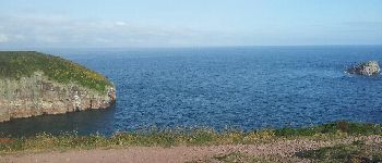
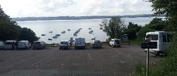
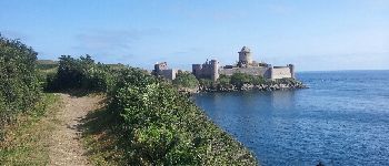
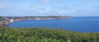
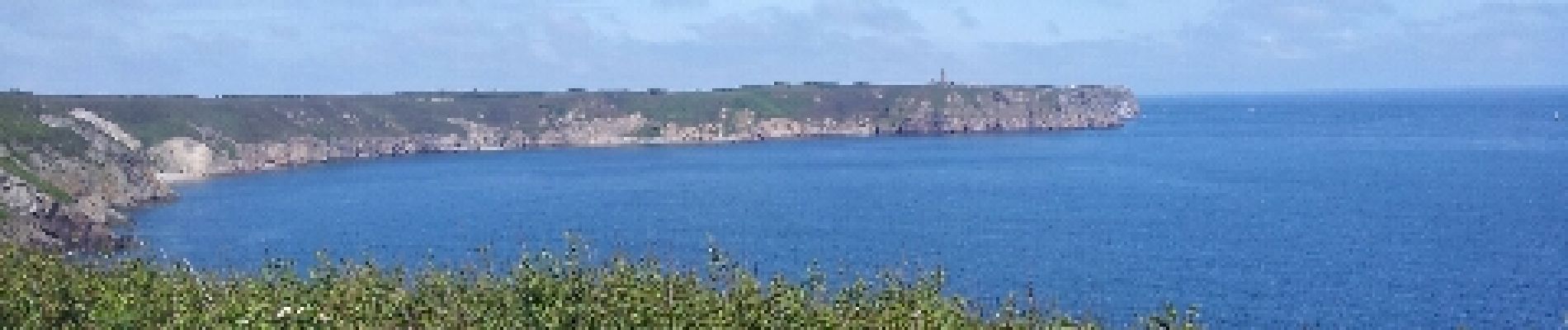
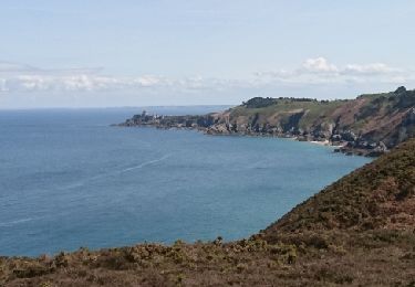
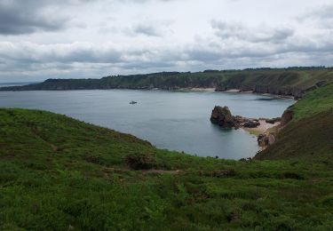
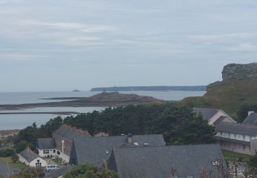
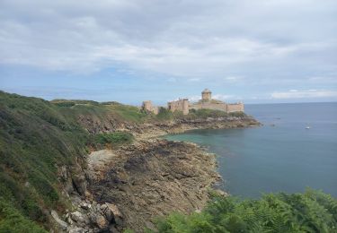
Randonnée Marche de 13,1 km à découvrir à Bretagne, Côtes-d'Armor, Plévenon. Cette randonnée est proposée par douneto.
Description
Rando Juin 2013
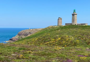
Parking payant à Cap Frehel selon période.
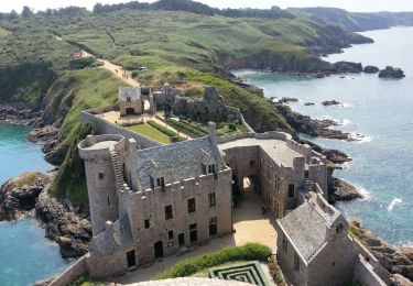
Départ possible au Parking à Port St GERAN ou du parking de Fort de la Latte
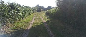
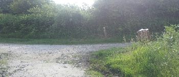
Localisation
Pays :
France
Région :
Bretagne
Département/Province :
Côtes-d'Armor
Commune :
Plévenon
Localité :
Unknown
Départ:(Dec)
Départ:(UTM)
550078 ; 5392506 (30U) N.
Commentaires
Randonnées à proximité
![Randonnée Marche Plévenon - cap Frehel - Photo](https://media.geolcdn.com/t/375/260/ext.jpg?maxdim=2&url=https%3A%2F%2Fservices.sitytrail.com%2FGeolivesWS%2FDownloadMedia.ashx%3FTrailID%3D733815%26Media%3Dfix__20170416142659.jpg)
![Marche Marche](https://static1.geolcdn.com/sitytour/trail-icons/101.png)
cap Frehel
Marche
Moyen
(1)
Plévenon,
Bretagne,
Côtes-d'Armor,
France
![](/images/other/stat-length.png)
17,2 km | 21 km-effort
4h 43min
![](https://static1.geolcdn.com/siteimages/upload/files/16400158638029165_repeat_loop_refresh_sync_direction_icon.png)
Oui
![Marche Marche](https://static1.geolcdn.com/sitytour/trail-icons/101.png)
N°10 GR34 Pléhérel Plage -- Pléneuf Val André
Marche
Très difficile
Fréhel,
Bretagne,
Côtes-d'Armor,
France
![](/images/other/stat-length.png)
20 km | 25 km-effort
5h 35min
![](https://static1.geolcdn.com/siteimages/upload/files/16400158638029165_repeat_loop_refresh_sync_direction_icon.png)
Non
![Marche Marche](https://static1.geolcdn.com/sitytour/trail-icons/101.png)
N°8 GR34 St Cast le Guildo -- Le Petit Trécelin
Marche
Très difficile
Saint-Cast-le-Guildo,
Bretagne,
Côtes-d'Armor,
France
![](/images/other/stat-length.png)
18,9 km | 24 km-effort
5h 23min
![](https://static1.geolcdn.com/siteimages/upload/files/16400158638029165_repeat_loop_refresh_sync_direction_icon.png)
Non
![Randonnée Marche Plévenon - Plévenon - Fort la Latte - 3.1km 65m 1h00 - 2017 06 22 - Photo](https://media.geolcdn.com/t/375/260/8294287f-801d-42c8-995a-de2105ee0c15.jpg&format=jpg&maxdim=2)
![Marche Marche](https://static1.geolcdn.com/sitytour/trail-icons/101.png)
Plévenon - Fort la Latte - 3.1km 65m 1h00 - 2017 06 22
Marche
Très facile
Plévenon,
Bretagne,
Côtes-d'Armor,
France
![](/images/other/stat-length.png)
3,1 km | 4 km-effort
1h 0min
![](https://static1.geolcdn.com/siteimages/upload/files/16400158638029165_repeat_loop_refresh_sync_direction_icon.png)
Oui
![Randonnée Autre activité Plévenon - Cap Frehel Fort la latte - Photo](https://media.geolcdn.com/t/375/260/ext.jpg?maxdim=2&url=https%3A%2F%2Fstatic1.geolcdn.com%2Fsiteimages%2Fupload%2Ffiles%2F1545311037marcheuse_200dpi.jpg)
![Autre activité Autre activité](https://static1.geolcdn.com/sitytour/trail-icons/900.png)
Cap Frehel Fort la latte
Autre activité
Moyen
(1)
Plévenon,
Bretagne,
Côtes-d'Armor,
France
![](/images/other/stat-length.png)
12,9 km | 15,6 km-effort
4h 41min
![](https://static1.geolcdn.com/siteimages/upload/files/16400158638029165_repeat_loop_refresh_sync_direction_icon.png)
Oui
![Randonnée Marche Plévenon - Cap Frehel - Photo](https://media.geolcdn.com/t/375/260/017eb03e-444e-4bbb-a7dd-b551f9a78235.jpg&format=jpg&maxdim=2)
![Marche Marche](https://static1.geolcdn.com/sitytour/trail-icons/101.png)
Cap Frehel
Marche
Facile
Plévenon,
Bretagne,
Côtes-d'Armor,
France
![](/images/other/stat-length.png)
12,1 km | 14,2 km-effort
4h 28min
![](https://static1.geolcdn.com/siteimages/upload/files/16400158638029165_repeat_loop_refresh_sync_direction_icon.png)
Oui
![Randonnée Marche Fréhel - J4G2 - Photo](https://media.geolcdn.com/t/375/260/9526b197-a435-4e56-a4d2-07969405d323.jpg&format=jpg&maxdim=2)
![Marche Marche](https://static1.geolcdn.com/sitytour/trail-icons/101.png)
![Randonnée Marche Plévenon - GR_34_BF_12_Plevenon_Erquy_20230818 - Photo](https://media.geolcdn.com/t/375/260/2759aa01-3305-4693-920a-9eec8c0be183.jpg&format=jpg&maxdim=2)
![Marche Marche](https://static1.geolcdn.com/sitytour/trail-icons/101.png)
GR_34_BF_12_Plevenon_Erquy_20230818
Marche
Facile
Plévenon,
Bretagne,
Côtes-d'Armor,
France
![](/images/other/stat-length.png)
15,5 km | 18,7 km-effort
3h 44min
![](https://static1.geolcdn.com/siteimages/upload/files/16400158638029165_repeat_loop_refresh_sync_direction_icon.png)
Non
![Randonnée Marche Plévenon - Cap Fréhel et Fort la Latte 5.7.23 - Photo](https://media.geolcdn.com/t/375/260/17bf9c44-d657-48b0-aeb2-b0316457cb2f.jpg&format=jpg&maxdim=2)
![Marche Marche](https://static1.geolcdn.com/sitytour/trail-icons/101.png)
Cap Fréhel et Fort la Latte 5.7.23
Marche
Facile
Plévenon,
Bretagne,
Côtes-d'Armor,
France
![](/images/other/stat-length.png)
13,4 km | 16 km-effort
3h 25min
![](https://static1.geolcdn.com/siteimages/upload/files/16400158638029165_repeat_loop_refresh_sync_direction_icon.png)
Oui