![](/images/other/stat-length.png)
![Randonnée Marche Villeneuve - Villeneuve - Bard - Photo](https://media.geolcdn.com/t/1900/400/c71988ad-0e7f-47fb-9915-f31c76706656.jpg&format=pjpeg&maxdim=2)
Villeneuve - Bard
GilGry
Utilisateur
![Longueur](/images/other/stat-length.png)
![Altitude max](https://static1.geolcdn.com/siteimages/upload/files/1508320355ic_sort_altitude_max_24dp.png)
![Dénivelé positif](https://static1.geolcdn.com/siteimages/upload/files/1508320355ic_sort_den_pos_24dp.png)
![Km-Effort](/images/other/stat-length.png)
![Altitude min](https://static1.geolcdn.com/siteimages/upload/files/1508320355ic_sort_altitude_min_24dp.png)
![Dénivelé négatif](https://static1.geolcdn.com/siteimages/upload/files/1508320355ic_sort_den_neg_24dp.png)
![Boucle](https://static1.geolcdn.com/siteimages/upload/files/16400158638029165_repeat_loop_refresh_sync_direction_icon.png)
![Marche](https://static1.geolcdn.com/sitytour/trail-icons/101.png)
3h38
Difficulté : Moyen
![Scannez ce code QR pour ouvrir la randonnée dans l'application SityTrail](https://capi.geolives.com/qq0zvz2zws4bq2lad0pu/sitytour/trails/2041768/qr.png?size=200)
Application GPS de randonnée GRATUITE
À propos
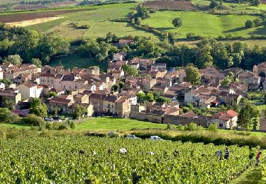
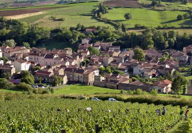
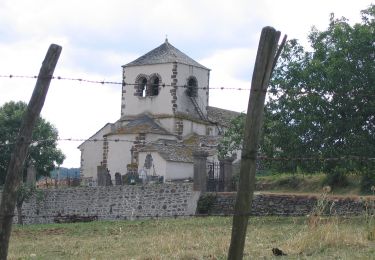
Randonnée Marche de 11,6 km à découvrir à Auvergne-Rhône-Alpes, Puy-de-Dôme, Villeneuve. Cette randonnée est proposée par GilGry.
Description
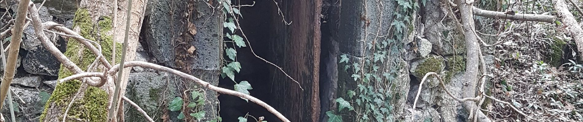
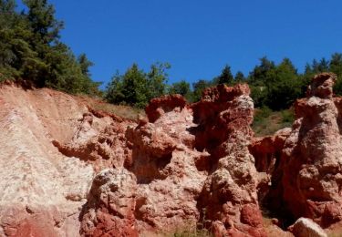
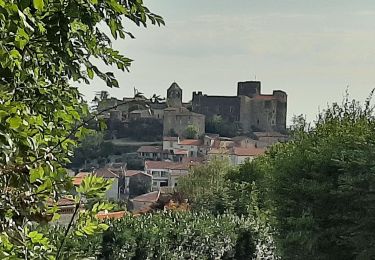
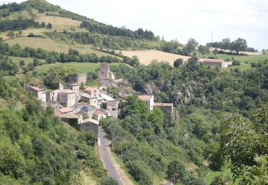
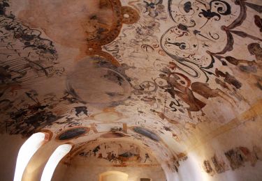
Départ du château de Villeneuve. Recherche en vain du Dolmen. J'ai trouvé d'autres vieilles constructions ou abris de sources. Ascension passage à travers les coteaux de vignes. La tour des fées le canyon des fées le classique parcours de Boudes jusqu'à la source de Bard. Pour corsé un peu passage hors sentier, retour à Boudes, ascension en ligne droite à travers les pâturages, raccourcis par un pierrier et retour au château par le dolmen que je n'ai toujours pas trouvé !!!! Encore trouvé un abri de pierre mais pas de dolmen.
Localisation
Commentaires
Randonnées à proximité
![Randonnée Marche Boudes - Boudes_Vallee_Saints_1 - Photo](https://media.geolcdn.com/t/375/260/2d6f9b52-9afa-4443-acb4-142ca3c3881a.jpg&format=jpg&maxdim=2)
![Marche Marche](https://static1.geolcdn.com/sitytour/trail-icons/101.png)
Marche
![](/images/other/stat-length.png)
![](https://static1.geolcdn.com/siteimages/upload/files/16400158638029165_repeat_loop_refresh_sync_direction_icon.png)
![Randonnée Marche Boudes - Boudes_Vallee_Saints_2 - Photo](https://media.geolcdn.com/t/375/260/75dcab49-0943-405f-9b02-ddf9cf506eea.jpg&format=jpg&maxdim=2)
![Marche Marche](https://static1.geolcdn.com/sitytour/trail-icons/101.png)
Marche
![](/images/other/stat-length.png)
![](https://static1.geolcdn.com/siteimages/upload/files/16400158638029165_repeat_loop_refresh_sync_direction_icon.png)
![Randonnée Marche Villeneuve - Villeneuve_Boudes_Chalus - Photo](https://media.geolcdn.com/t/375/260/fa4d9ad2-0c04-4754-942b-a8352fff5676.jpg&format=jpg&maxdim=2)
![Marche Marche](https://static1.geolcdn.com/sitytour/trail-icons/101.png)
Marche
![](/images/other/stat-length.png)
![](https://static1.geolcdn.com/siteimages/upload/files/16400158638029165_repeat_loop_refresh_sync_direction_icon.png)
![Randonnée Marche Boudes - Boudes_Coteaux - Photo](https://media.geolcdn.com/t/375/260/84417786-618e-40d7-80a8-c68612090218.jpg&format=jpg&maxdim=2)
![Marche Marche](https://static1.geolcdn.com/sitytour/trail-icons/101.png)
Marche
![](/images/other/stat-length.png)
![](https://static1.geolcdn.com/siteimages/upload/files/16400158638029165_repeat_loop_refresh_sync_direction_icon.png)
![Randonnée A pied Boudes - Villeneuve, Boudes, Chalus - Photo](https://media.geolcdn.com/t/375/260/9a83dcb2-377f-43a0-8436-358d4c634f72.jpeg&format=jpg&maxdim=2)
![A pied A pied](https://static1.geolcdn.com/sitytour/trail-icons/100.png)
A pied
![](/images/other/stat-length.png)
![](https://static1.geolcdn.com/siteimages/upload/files/16400158638029165_repeat_loop_refresh_sync_direction_icon.png)
![Randonnée A pied Madriat - Bard et Letz - Photo](https://media.geolcdn.com/t/375/260/e7b4e9aa-8c72-4cfb-b241-a0f535763702.jpeg&format=jpg&maxdim=2)
![A pied A pied](https://static1.geolcdn.com/sitytour/trail-icons/100.png)
A pied
![](/images/other/stat-length.png)
![](https://static1.geolcdn.com/siteimages/upload/files/16400158638029165_repeat_loop_refresh_sync_direction_icon.png)
![Randonnée A pied Boudes - La Vallee des Saints - Photo](https://media.geolcdn.com/t/375/260/8b5212f5-c0d3-403b-b77d-cbcbaaa74e95.jpeg&format=jpg&maxdim=2)
![A pied A pied](https://static1.geolcdn.com/sitytour/trail-icons/100.png)
A pied
![](/images/other/stat-length.png)
![](https://static1.geolcdn.com/siteimages/upload/files/16400158638029165_repeat_loop_refresh_sync_direction_icon.png)
![Randonnée A pied Mareugheol - La Chaux et le Bois de Jaby - Photo](https://media.geolcdn.com/t/375/260/d7ed3937-d9f3-475d-9b76-187d38d4bf46.jpeg&format=jpg&maxdim=2)
![A pied A pied](https://static1.geolcdn.com/sitytour/trail-icons/100.png)
A pied
![](/images/other/stat-length.png)
![](https://static1.geolcdn.com/siteimages/upload/files/16400158638029165_repeat_loop_refresh_sync_direction_icon.png)
![Randonnée A pied Villeneuve - Vodable et Colamine - Photo](https://media.geolcdn.com/t/375/260/fd9aa514-9038-4f51-9473-e7a8f5ea4688.jpeg&format=jpg&maxdim=2)
![A pied A pied](https://static1.geolcdn.com/sitytour/trail-icons/100.png)
A pied
![](/images/other/stat-length.png)
![](https://static1.geolcdn.com/siteimages/upload/files/16400158638029165_repeat_loop_refresh_sync_direction_icon.png)