![](/images/other/stat-length.png)
![Randonnée A pied Saint-Georges-de-Didonne - St Georges-Vallières 17 8km200 - Photo](https://media.geolcdn.com/t/1900/400/99ecf766-7a66-4d45-9b46-41ea3f51dcff.jpg&format=pjpeg&maxdim=2)
St Georges-Vallières 17 8km200
Jos17
Utilisateur
![Longueur](/images/other/stat-length.png)
![Altitude max](https://static1.geolcdn.com/siteimages/upload/files/1508320355ic_sort_altitude_max_24dp.png)
![Dénivelé positif](https://static1.geolcdn.com/siteimages/upload/files/1508320355ic_sort_den_pos_24dp.png)
![Km-Effort](/images/other/stat-length.png)
![Altitude min](https://static1.geolcdn.com/siteimages/upload/files/1508320355ic_sort_altitude_min_24dp.png)
![Dénivelé négatif](https://static1.geolcdn.com/siteimages/upload/files/1508320355ic_sort_den_neg_24dp.png)
![Boucle](https://static1.geolcdn.com/siteimages/upload/files/16400158638029165_repeat_loop_refresh_sync_direction_icon.png)
![A pied](https://static1.geolcdn.com/sitytour/trail-icons/100.png)
2h03
Difficulté : Facile
![Scannez ce code QR pour ouvrir la randonnée dans l'application SityTrail](https://capi.geolives.com/qq0zvz2zws4bq2lad0pu/sitytour/trails/2040675/qr.png?size=200)
Application GPS de randonnée GRATUITE
À propos
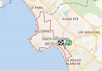
Randonnée A pied de 8,2 km à découvrir à Nouvelle-Aquitaine, Charente-Maritime, Saint-Georges-de-Didonne. Cette randonnée est proposée par Jos17.
Description
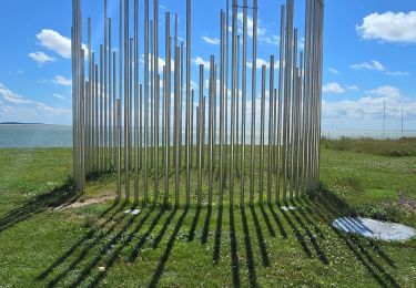
Le parcours traverse le centre de St.Georges, puis les avenues du Parc de Vallières avec leurs résidences secondaires ombragées par les pins ayant résistés à la tempête de 1999, pour arriver au Riveau de Boubes.
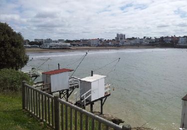
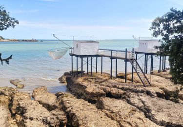
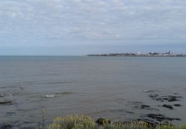
Le parcours suit le filet d'eau jusqu'à la plage et revient sur St Georges en longeant la plage et la corniche jusqu'au port.
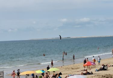
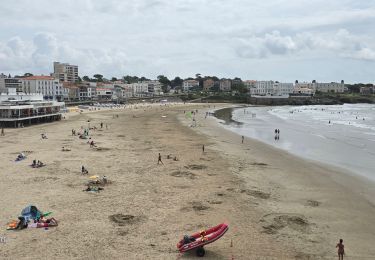
Le parcours peut se poursuivre jusqu'au bout de la plage et revenir par l'avenue intérieure.
Localisation
Commentaires
Randonnées à proximité
![A pied A pied](https://static1.geolcdn.com/sitytour/trail-icons/100.png)
A pied
![](/images/other/stat-length.png)
![](https://static1.geolcdn.com/siteimages/upload/files/16400158638029165_repeat_loop_refresh_sync_direction_icon.png)
![A pied A pied](https://static1.geolcdn.com/sitytour/trail-icons/100.png)
A pied
![](/images/other/stat-length.png)
![](https://static1.geolcdn.com/siteimages/upload/files/16400158638029165_repeat_loop_refresh_sync_direction_icon.png)
![Randonnée Marche Royan - Royan-La Palmyre - Photo](https://media.geolcdn.com/t/375/260/ext.jpg?maxdim=2&url=https%3A%2F%2Fservices.sitytrail.com%2FGeolivesWS%2FDownloadMedia.ashx%3FTrailID%3D278052%26Media%3Dfix__20140508114344.jpg)
![Marche Marche](https://static1.geolcdn.com/sitytour/trail-icons/101.png)
Marche
![](/images/other/stat-length.png)
![](https://static1.geolcdn.com/siteimages/upload/files/16400158638029165_repeat_loop_refresh_sync_direction_icon.png)
![Randonnée Marche Royan - Gr4 De Royan au phrare de Terre Nègre - Photo](https://media.geolcdn.com/t/375/260/e2e1be40-3353-49e2-9bdd-4bdd833373c6.jpg&format=jpg&maxdim=2)
![Marche Marche](https://static1.geolcdn.com/sitytour/trail-icons/101.png)
Marche
![](/images/other/stat-length.png)
![](https://static1.geolcdn.com/siteimages/upload/files/16400158638029165_repeat_loop_refresh_sync_direction_icon.png)
![Randonnée Vélo électrique Royan - sortie vtt 20072024 - Photo](https://media.geolcdn.com/t/375/260/76a60497-0453-4055-b50d-57ae6303986f.jpg&format=jpg&maxdim=2)
![Vélo électrique Vélo électrique](https://static1.geolcdn.com/sitytour/trail-icons/205.png)
Vélo électrique
![](/images/other/stat-length.png)
![](https://static1.geolcdn.com/siteimages/upload/files/16400158638029165_repeat_loop_refresh_sync_direction_icon.png)
![Randonnée Vélo électrique Royan - sortie vtt 16072024 la Palmyre - Photo](https://media.geolcdn.com/t/375/260/84127a57-102b-4e0a-8195-b081cde28e83.jpg&format=jpg&maxdim=2)
![Vélo électrique Vélo électrique](https://static1.geolcdn.com/sitytour/trail-icons/205.png)
Vélo électrique
![](/images/other/stat-length.png)
![](https://static1.geolcdn.com/siteimages/upload/files/16400158638029165_repeat_loop_refresh_sync_direction_icon.png)
![Randonnée Vélo électrique Royan - sortie vtt 12072024 Royan - Photo](https://media.geolcdn.com/t/375/260/77c31eff-c5ee-413c-937e-28b18e967a2d.jpg&format=jpg&maxdim=2)
![Vélo électrique Vélo électrique](https://static1.geolcdn.com/sitytour/trail-icons/205.png)
Vélo électrique
![](/images/other/stat-length.png)
![](https://static1.geolcdn.com/siteimages/upload/files/16400158638029165_repeat_loop_refresh_sync_direction_icon.png)
![Randonnée Vélo électrique Royan - sortie vtt 10072023 Talmont - Photo](https://media.geolcdn.com/t/375/260/d50067ff-0139-4e54-bde6-c079831c8427.jpg&format=jpg&maxdim=2)
![Vélo électrique Vélo électrique](https://static1.geolcdn.com/sitytour/trail-icons/205.png)
Vélo électrique
![](/images/other/stat-length.png)
![](https://static1.geolcdn.com/siteimages/upload/files/16400158638029165_repeat_loop_refresh_sync_direction_icon.png)
![Randonnée Vélo électrique Royan - sortie vtt 08072023 phare de la Coubre - Photo](https://media.geolcdn.com/t/375/260/b0726125-8197-428b-b44b-e0cf73c5f2f7.jpg&format=jpg&maxdim=2)
![Vélo électrique Vélo électrique](https://static1.geolcdn.com/sitytour/trail-icons/205.png)
Vélo électrique
![](/images/other/stat-length.png)
![](https://static1.geolcdn.com/siteimages/upload/files/16400158638029165_repeat_loop_refresh_sync_direction_icon.png)