![](/images/other/stat-length.png)
![Randonnée Marche Thouars - randonnée cascade de pommier PR10 - Photo](https://media.geolcdn.com/t/1900/400/029185ff-d87c-4bc9-a318-095a898b87d1.jpg&format=pjpeg&maxdim=2)
randonnée cascade de pommier PR10
vanessa roux
Utilisateur
![Longueur](/images/other/stat-length.png)
Longueur
2,9 km
![Altitude max](https://static1.geolcdn.com/siteimages/upload/files/1508320355ic_sort_altitude_max_24dp.png)
Altitude max
106 m
![Dénivelé positif](https://static1.geolcdn.com/siteimages/upload/files/1508320355ic_sort_den_pos_24dp.png)
Dénivelé positif
67 m
![Km-Effort](/images/other/stat-length.png)
Km-Effort
3,8 km
![Altitude min](https://static1.geolcdn.com/siteimages/upload/files/1508320355ic_sort_altitude_min_24dp.png)
Altitude min
52 m
![Dénivelé négatif](https://static1.geolcdn.com/siteimages/upload/files/1508320355ic_sort_den_neg_24dp.png)
Dénivelé négatif
70 m
![Boucle](https://static1.geolcdn.com/siteimages/upload/files/16400158638029165_repeat_loop_refresh_sync_direction_icon.png)
Boucle
Oui
Date de création :
2019-02-17 14:45:53.1
Dernière modification :
2019-02-17 16:44:54.406
![Marche](https://static1.geolcdn.com/sitytour/trail-icons/101.png)
1h35
Difficulté : Moyen
![Scannez ce code QR pour ouvrir la randonnée dans l'application SityTrail](https://capi.geolives.com/qq0zvz2zws4bq2lad0pu/sitytour/trails/2036188/qr.png?size=200)
Application GPS de randonnée GRATUITE
À propos
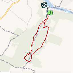
Randonnée Marche de 2,9 km à découvrir à Nouvelle-Aquitaine, Deux-Sèvres, Thouars. Cette randonnée est proposée par vanessa roux.
Description
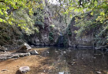
LA NATURE LE CALME UN PAYSAGE MAGNIFIQUE BIEN SE CHAUSSER DÉNIVELÉ.
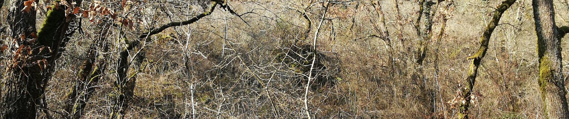
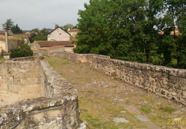
Localisation
Pays :
France
Région :
Nouvelle-Aquitaine
Département/Province :
Deux-Sèvres
Commune :
Thouars
Localité :
Sainte-Radegonde
Départ:(Dec)
Départ:(UTM)
709651 ; 5206664 (30T) N.
Commentaires
Randonnées à proximité
![Randonnée Marche Thouars - DEUX-SEVRES / THOUARS: CASCADE DE POMMIERS (Ruisseau du Presssoir) - Photo](https://media.geolcdn.com/t/375/260/1fef342e-da0b-4d13-af3b-9b142096ee93.jpg&format=jpg&maxdim=2)
![Marche Marche](https://static1.geolcdn.com/sitytour/trail-icons/101.png)
DEUX-SEVRES / THOUARS: CASCADE DE POMMIERS (Ruisseau du Presssoir)
Marche
Facile
Thouars,
Nouvelle-Aquitaine,
Deux-Sèvres,
France
![](/images/other/stat-length.png)
5,6 km | 6,8 km-effort
1h 32min
![](https://static1.geolcdn.com/siteimages/upload/files/16400158638029165_repeat_loop_refresh_sync_direction_icon.png)
Oui
![Randonnée Vélo de route Saint-Jean-de-Thouars - Thouars Airvault - Photo](https://media.geolcdn.com/t/375/260/54fe13f9-4794-4ff6-9bc7-e0e7ea39c465.jpg&format=jpg&maxdim=2)
![Vélo de route Vélo de route](https://static1.geolcdn.com/sitytour/trail-icons/201.png)
Thouars Airvault
Vélo de route
Moyen
Saint-Jean-de-Thouars,
Nouvelle-Aquitaine,
Deux-Sèvres,
France
![](/images/other/stat-length.png)
30 km | 34 km-effort
2h 6min
![](https://static1.geolcdn.com/siteimages/upload/files/16400158638029165_repeat_loop_refresh_sync_direction_icon.png)
Non
![Randonnée Vélo de route Saint-Jean-de-Thouars - thouars-saumur-rigny usse-Thouars - Photo](https://media.geolcdn.com/t/375/260/ext.jpg?maxdim=2&url=https%3A%2F%2Fstatic1.geolcdn.com%2Fsiteimages%2Fupload%2Ffiles%2F1524743154velo.jpg)
![Vélo de route Vélo de route](https://static1.geolcdn.com/sitytour/trail-icons/201.png)
thouars-saumur-rigny usse-Thouars
Vélo de route
Très facile
Saint-Jean-de-Thouars,
Nouvelle-Aquitaine,
Deux-Sèvres,
France
![](/images/other/stat-length.png)
168 km | 187 km-effort
16h 54min
![](https://static1.geolcdn.com/siteimages/upload/files/16400158638029165_repeat_loop_refresh_sync_direction_icon.png)
Oui
![Randonnée V.T.T. Thouars - F.ThouarsParthenay.J7/14 - Photo](https://media.geolcdn.com/t/375/260/ext.jpg?maxdim=2&url=https%3A%2F%2Fstatic1.geolcdn.com%2Fsiteimages%2Fupload%2Ffiles%2F1524743154velo.jpg)
![V.T.T. V.T.T.](https://static1.geolcdn.com/sitytour/trail-icons/202.png)
F.ThouarsParthenay.J7/14
V.T.T.
Très facile
Thouars,
Nouvelle-Aquitaine,
Deux-Sèvres,
France
![](/images/other/stat-length.png)
68 km | 79 km-effort
5min
![](https://static1.geolcdn.com/siteimages/upload/files/16400158638029165_repeat_loop_refresh_sync_direction_icon.png)
Non
![Randonnée Vélo Thouars - Thouars Airvault V2 - Photo](https://media.geolcdn.com/t/375/260/ext.jpg?maxdim=2&url=https%3A%2F%2Fstatic1.geolcdn.com%2Fsiteimages%2Fupload%2Ffiles%2F1524743154velo.jpg)
![Vélo Vélo](https://static1.geolcdn.com/sitytour/trail-icons/200.png)
Thouars Airvault V2
Vélo
Moyen
Thouars,
Nouvelle-Aquitaine,
Deux-Sèvres,
France
![](/images/other/stat-length.png)
21 km | 24 km-effort
2h 2min
![](https://static1.geolcdn.com/siteimages/upload/files/16400158638029165_repeat_loop_refresh_sync_direction_icon.png)
Non
![Randonnée Vélo Thouars - Thouars Airvault - Photo](https://media.geolcdn.com/t/375/260/ext.jpg?maxdim=2&url=https%3A%2F%2Fstatic1.geolcdn.com%2Fsiteimages%2Fupload%2Ffiles%2F1524743154velo.jpg)
![Vélo Vélo](https://static1.geolcdn.com/sitytour/trail-icons/200.png)
Thouars Airvault
Vélo
Moyen
Thouars,
Nouvelle-Aquitaine,
Deux-Sèvres,
France
![](/images/other/stat-length.png)
30 km | 35 km-effort
2h 2min
![](https://static1.geolcdn.com/siteimages/upload/files/16400158638029165_repeat_loop_refresh_sync_direction_icon.png)
Non
![Randonnée Marche Thouars - velofrancette étape 15 - Photo](https://media.geolcdn.com/t/375/260/ext.jpg?maxdim=2&url=https%3A%2F%2Fstatic1.geolcdn.com%2Fsiteimages%2Fupload%2Ffiles%2F1553511878bg_sport_marche.png)
![Marche Marche](https://static1.geolcdn.com/sitytour/trail-icons/101.png)
velofrancette étape 15
Marche
Facile
Thouars,
Nouvelle-Aquitaine,
Deux-Sèvres,
France
![](/images/other/stat-length.png)
30 km | 34 km-effort
Inconnu
![](https://static1.geolcdn.com/siteimages/upload/files/16400158638029165_repeat_loop_refresh_sync_direction_icon.png)
Non
![Randonnée Vélo Thouars - etape 15 - Photo](https://media.geolcdn.com/t/375/260/ext.jpg?maxdim=2&url=https%3A%2F%2Fstatic1.geolcdn.com%2Fsiteimages%2Fupload%2Ffiles%2F1524743154velo.jpg)
![Vélo Vélo](https://static1.geolcdn.com/sitytour/trail-icons/200.png)
etape 15
Vélo
Très facile
Thouars,
Nouvelle-Aquitaine,
Deux-Sèvres,
France
![](/images/other/stat-length.png)
30 km | 34 km-effort
Inconnu
![](https://static1.geolcdn.com/siteimages/upload/files/16400158638029165_repeat_loop_refresh_sync_direction_icon.png)
Non
![Randonnée Marche Thouars - SOULBROIS - Photo](https://media.geolcdn.com/t/375/260/ext.jpg?maxdim=2&url=https%3A%2F%2Fstatic1.geolcdn.com%2Fsiteimages%2Fupload%2Ffiles%2F1553511878bg_sport_marche.png)
![Marche Marche](https://static1.geolcdn.com/sitytour/trail-icons/101.png)
SOULBROIS
Marche
Très facile
Thouars,
Nouvelle-Aquitaine,
Deux-Sèvres,
France
![](/images/other/stat-length.png)
8,1 km | 8,8 km-effort
1h 57min
![](https://static1.geolcdn.com/siteimages/upload/files/16400158638029165_repeat_loop_refresh_sync_direction_icon.png)
Oui