![](/images/other/stat-length.png)
![Randonnée A pied Chaumes-en-Retz - jcyol44 arthon en retz via chéméré - Photo](https://media.geolcdn.com/t/1900/400/ext.pjpeg?maxdim=2&url=https%3A%2F%2Fstatic1.geolcdn.com%2Fsiteimages%2Fupload%2Ffiles%2F1545311037marcheuse_200dpi.jpg)
jcyol44 arthon en retz via chéméré
JCYOL44
Utilisateur
![Longueur](/images/other/stat-length.png)
![Altitude max](https://static1.geolcdn.com/siteimages/upload/files/1508320355ic_sort_altitude_max_24dp.png)
![Dénivelé positif](https://static1.geolcdn.com/siteimages/upload/files/1508320355ic_sort_den_pos_24dp.png)
![Km-Effort](/images/other/stat-length.png)
![Altitude min](https://static1.geolcdn.com/siteimages/upload/files/1508320355ic_sort_altitude_min_24dp.png)
![Dénivelé négatif](https://static1.geolcdn.com/siteimages/upload/files/1508320355ic_sort_den_neg_24dp.png)
![Boucle](https://static1.geolcdn.com/siteimages/upload/files/16400158638029165_repeat_loop_refresh_sync_direction_icon.png)
![A pied](https://static1.geolcdn.com/sitytour/trail-icons/100.png)
2h20
Difficulté : Très facile
![Scannez ce code QR pour ouvrir la randonnée dans l'application SityTrail](https://capi.geolives.com/qq0zvz2zws4bq2lad0pu/sitytour/trails/2035446/qr.png?size=200)
Application GPS de randonnée GRATUITE
À propos
Randonnée A pied de 9,6 km à découvrir à Pays de la Loire, Loire-Atlantique, Chaumes-en-Retz. Cette randonnée est proposée par JCYOL44.
Description
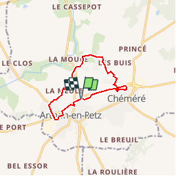
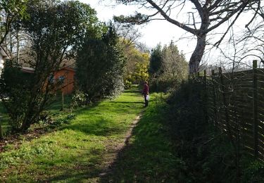
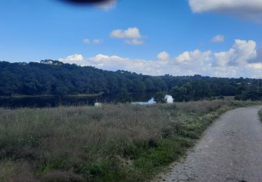
Petite boucle d'environ 10km sans difficulté..
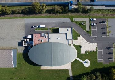
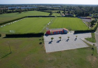
Départ / arrivée du parking de la salle de sports. Partir en longeant la D751 puis passer le pont sur votre droite .Sur la D5. Traverser la D5 en direction de La Meule. Sur votre gauche prendre un chemin qui vous emmène vers La Danjollerie. Arrivé au Plessis, tourner à droite jusqu'au parc de Chéméré; en faire le tour puis longer à nouveau la D751 jusqu'au parking.
Localisation
Commentaires
Randonnées à proximité
![Randonnée A pied Chaumes-en-Retz - Sentier pédestre des Iles Enchantées - Photo](https://media.geolcdn.com/t/375/260/8d9b3652-bedc-4903-8d23-e450b9c65d96.jpeg&format=jpg&maxdim=2)
![A pied A pied](https://static1.geolcdn.com/sitytour/trail-icons/100.png)
A pied
![](/images/other/stat-length.png)
![](https://static1.geolcdn.com/siteimages/upload/files/16400158638029165_repeat_loop_refresh_sync_direction_icon.png)
![Randonnée A pied Chaumes-en-Retz - Circuit des Chênes - Photo](https://media.geolcdn.com/t/375/260/7606bf5a-2198-4218-abf5-a4d4ae02cf42.jpeg&format=jpg&maxdim=2)
![A pied A pied](https://static1.geolcdn.com/sitytour/trail-icons/100.png)
A pied
![](/images/other/stat-length.png)
![](https://static1.geolcdn.com/siteimages/upload/files/16400158638029165_repeat_loop_refresh_sync_direction_icon.png)
![Randonnée Marche Chaumes-en-Retz - Arthon Chemere - Photo](https://media.geolcdn.com/t/375/260/5c2166da-4a74-4ba7-a499-c7af068420f8.jpg&format=jpg&maxdim=2)
![Marche Marche](https://static1.geolcdn.com/sitytour/trail-icons/101.png)
Marche
![](/images/other/stat-length.png)
![](https://static1.geolcdn.com/siteimages/upload/files/16400158638029165_repeat_loop_refresh_sync_direction_icon.png)
![Randonnée V.T.T. Chaumes-en-Retz - de Arthon en Retz par le Prépaud - Photo](https://media.geolcdn.com/t/375/260/ext.jpg?maxdim=2&url=https%3A%2F%2Fstatic1.geolcdn.com%2Fsiteimages%2Fupload%2Ffiles%2F1524743154velo.jpg)
![V.T.T. V.T.T.](https://static1.geolcdn.com/sitytour/trail-icons/202.png)
V.T.T.
![](/images/other/stat-length.png)
![](https://static1.geolcdn.com/siteimages/upload/files/16400158638029165_repeat_loop_refresh_sync_direction_icon.png)
![Randonnée V.T.C. Chaumes-en-Retz - Belle Épine lac de Pornic - Photo](https://media.geolcdn.com/t/375/260/4196bce5-8058-43cf-9aa2-712e6b61de2a.jpg&format=jpg&maxdim=2)
![V.T.C. V.T.C.](https://static1.geolcdn.com/sitytour/trail-icons/203.png)
V.T.C.
![](/images/other/stat-length.png)
![](https://static1.geolcdn.com/siteimages/upload/files/16400158638029165_repeat_loop_refresh_sync_direction_icon.png)
![Randonnée A pied Chaumes-en-Retz - D'Arthon à La Sicaudais - Photo](https://media.geolcdn.com/t/375/260/39754271-52c4-4067-8a63-e67370b7bbbe.jpeg&format=jpg&maxdim=2)
![A pied A pied](https://static1.geolcdn.com/sitytour/trail-icons/100.png)
A pied
![](/images/other/stat-length.png)
![](https://static1.geolcdn.com/siteimages/upload/files/16400158638029165_repeat_loop_refresh_sync_direction_icon.png)
![Randonnée A pied Chaumes-en-Retz - Circuit de Haute-Perche - Photo](https://media.geolcdn.com/t/375/260/39754271-52c4-4067-8a63-e67370b7bbbe.jpeg&format=jpg&maxdim=2)
![A pied A pied](https://static1.geolcdn.com/sitytour/trail-icons/100.png)
A pied
![](/images/other/stat-length.png)
![](https://static1.geolcdn.com/siteimages/upload/files/16400158638029165_repeat_loop_refresh_sync_direction_icon.png)
![Randonnée V.T.T. Chaumes-en-Retz - Belle épine/Ste Pazane - Photo](https://media.geolcdn.com/t/375/260/91857525-f683-4e66-91a0-3b82395a892f.jpg&format=jpg&maxdim=2)
![V.T.T. V.T.T.](https://static1.geolcdn.com/sitytour/trail-icons/202.png)
V.T.T.
![](/images/other/stat-length.png)
![](https://static1.geolcdn.com/siteimages/upload/files/16400158638029165_repeat_loop_refresh_sync_direction_icon.png)
![Randonnée Marche Chaumes-en-Retz - Les Chênes - Photo](https://media.geolcdn.com/t/375/260/ac7d3175-0270-486b-af63-acac79c92b63.jpg&format=jpg&maxdim=2)
![Marche Marche](https://static1.geolcdn.com/sitytour/trail-icons/101.png)
Marche
![](/images/other/stat-length.png)
![](https://static1.geolcdn.com/siteimages/upload/files/16400158638029165_repeat_loop_refresh_sync_direction_icon.png)