Randonnée Marche Le Tholy - tholy petit tholy - Photo

tholy petit tholy

 Fred Jspd
Fred Jspd

Utilisateur

© OpenStreetMap contributors
Longueur
Longueur
1,7 km
Altitude max
Altitude max
674 m
Dénivelé positif
Dénivelé positif
24 m
Km-Effort
Km-Effort  
2,2 km
Altitude min
Altitude min
611 m
Dénivelé négatif
Dénivelé négatif
63 m
Boucle
Boucle
Non
Date de création :
2019-02-02 10:47:02.206
Dernière modification :
2019-02-02 11:51:42.3

(0 Avis)

Marche
Marche
35m
Difficulté : Très facile

Scannez ce code QR pour ouvrir la randonnée dans l'application SityTrail

Application GPS de randonnée GRATUITE

Logo SityTrail SityTrail

IGN / Instituts géographiques

Télécharger SityTrail sur l'App Store Télécharger SityTrail sur Google Play

Logo SityTrail SityTrail World

Le monde est à vous

Télécharger SityTrail sur l'App Store Télécharger SityTrail sur Google Play Télécharger SityTrail sur Huawei AppGallery

À propos

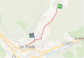
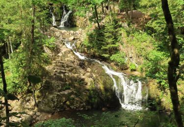
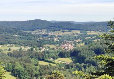
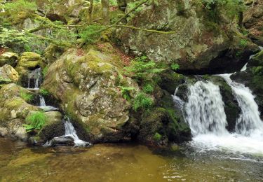
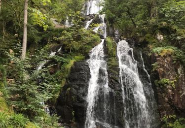
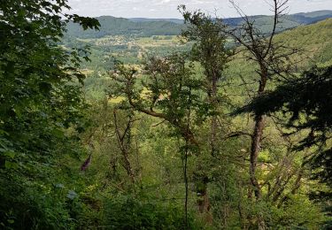
Randonnée Marche de 1,7 km à découvrir à Grand Est, Vosges, Le Tholy. Cette randonnée est proposée par Fred Jspd.

Description

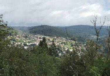
Descente au village de tholy depuis le petit tholy

Profil altimétrique

Localisation

Pays :
France
Région :
Grand Est
Département/Province :
Vosges
Commune :
Le Tholy
Localité :
Unknown
Départ:(UTM)
332851 ; 5328981 (32U) N.

Randonnées à proximité

Randonnée Randonnée équestre Le Tholy - 2022-06-03 Rando CVA Le Tholy Gerbamont - Photo
Randonnée équestre
GUIDE
holtzv

Randonnée équestre

Très difficile
Le Tholy, Grand Est, Vosges, France
28 km | 41 km-effort
6h 25min
Non
Randonnée Randonnée équestre Le Tholy - 2022-06-02 Rando CVA Le Tholy Tête des Cuveaux - Photo
Randonnée équestre
GUIDE
holtzv

Randonnée équestre

Difficile
Le Tholy, Grand Est, Vosges, France
28 km | 40 km-effort
5h 19min
Oui
Randonnée Randonnée équestre Le Tholy - 2022-06-01 Rando CVA Le Tholy Boucle Cascades du Tendon - Photo
Randonnée équestre
GUIDE
holtzv

Randonnée équestre

Difficile
Le Tholy, Grand Est, Vosges, France
24 km | 34 km-effort
5h 16min
Oui
Randonnée Marche Le Tholy - tendon  - Photo
Marche
michelelfn

Marche

Facile
(4)
Le Tholy, Grand Est, Vosges, France
9,1 km | 12,9 km-effort
3h 1min
Oui
Randonnée Marche Le Tholy - La grande cascade du Tendon au départ du Grand Caillou. - Photo
Marche
FouargePatrick

Marche

Difficile
Le Tholy, Grand Est, Vosges, France
9 km | 12,2 km-effort
2h 46min
Oui
Randonnée Marche La Forge - La roche des corbeaux, La Forge  - Photo
Marche
FouargePatrick

Marche

Moyen
La Forge, Grand Est, Vosges, France
7,8 km | 11,2 km-effort
2h 33min
Oui
Randonnée Marche Le Tholy - Le trou de l'enfer - Photo
Marche
nana1643

Marche

Moyen
Le Tholy, Grand Est, Vosges, France
10,2 km | 14,2 km-effort
2h 48min
Oui
Randonnée Marche Le Tholy - le trou d enfer - Photo
Marche
Didier-114

Marche

Facile
Le Tholy, Grand Est, Vosges, France
8,5 km | 12 km-effort
2h 45min
Oui
Randonnée Marche Le Tholy - les cascades - Photo
Marche
Didier-114

Marche

Très difficile
Le Tholy, Grand Est, Vosges, France
14,3 km | 21 km-effort
5h 52min
Oui


Fermer
Mes abonnements