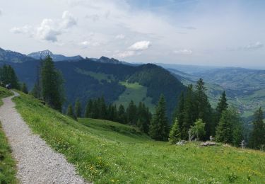
Randonnée Autre activité Wildhaus-Alt St. Johann - Chäserrugg -Gamsalp - Photo
 jschna
jschna

Utilisateur

© OpenStreetMap contributors
Longueur
Longueur
5 km
Altitude max
Altitude max
2264 m
Dénivelé positif
Dénivelé positif
84 m
Km-Effort
Km-Effort  
7,7 km
Altitude min
Altitude min
1767 m
Dénivelé négatif
Dénivelé négatif
564 m
Boucle
Boucle
Non
Date de création :
2014-12-11 00:00:00.0
Dernière modification :
2014-12-11 00:00:00.0

(0 Avis)

Autre activité
Autre activité
--
Difficulté : Inconnu

Scannez ce code QR pour ouvrir la randonnée dans l'application SityTrail

Application GPS de randonnée GRATUITE

Logo SityTrail SityTrail

IGN / Instituts géographiques

Télécharger SityTrail sur l'App Store Télécharger SityTrail sur Google Play

Logo SityTrail SityTrail World

Le monde est à vous

Télécharger SityTrail sur l'App Store Télécharger SityTrail sur Google Play Télécharger SityTrail sur Huawei AppGallery

À propos

Randonnée Autre activité de 5 km à découvrir à Saint-Gall, Wahlkreis Toggenburg, Wildhaus-Alt St. Johann. Cette randonnée est proposée par jschna.

Description

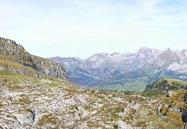
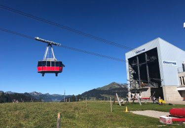
Mit der Bahn auf den Chäserrugg - wundeerbare Aussicht ins Sarganserland und auf den Säntis (Steinbockkolonie) - der erste Teil ist etwas steil und steinig, dann aber leicht und gut zum Gehen bis zur Gamsalp, wo der Wirt - Dres Forrer die Gäste verwöhnt.

Profil altimétrique

Localisation

Pays :
Suisse
Région :
Saint-Gall
Département/Province :
Wahlkreis Toggenburg
Commune :
Wildhaus-Alt St. Johann
Localité :
Unknown
Départ:(Dec)
Départ:(UTM)
523720 ; 5222453 (32T) N.

Randonnées à proximité

Randonnée A pied Walenstadt - Walenstadt - Pluder - Photo
A pied
GUIDE+

A pied

Facile
Walenstadt, Saint-Gall, Wahlkreis Sarganserland, Suisse
3 km | 3,3 km-effort
45min
Non
Randonnée A pied Walenstadt - Hochrugg - Tschingla - Photo
A pied
GUIDE+

A pied

Facile
Walenstadt, Saint-Gall, Wahlkreis Sarganserland, Suisse
3,1 km | 6,8 km-effort
1h 32min
Non
Randonnée A pied Walenstadt - Hochrugg - Tschingla - Photo
A pied
GUIDE+

A pied

Facile
Walenstadt, Saint-Gall, Wahlkreis Sarganserland, Suisse
5,1 km | 11,4 km-effort
2h 35min
Non
Randonnée A pied Walenstadt - Walenstadtberg - Quinten - Photo
A pied
GUIDE+

A pied

Facile
Walenstadt, Saint-Gall, Wahlkreis Sarganserland, Suisse
7 km | 11,3 km-effort
2h 33min
Non
Randonnée A pied Grabs - Geologischer Rundweg Gamserrugg - Photo
A pied
GUIDE+

A pied

Facile
Grabs, Saint-Gall, Wahlkreis Werdenberg, Suisse
5,1 km | 8,1 km-effort
1h 50min
Oui
Randonnée A pied Wildhaus-Alt St. Johann - Unterwasser-Halden-Egerten-Gräppelensee - Photo
A pied
GUIDE+

A pied

Facile
Wildhaus-Alt St. Johann, Saint-Gall, Wahlkreis Toggenburg, Suisse
3,9 km | 8,4 km-effort
1h 54min
Non
Randonnée A pied Wildhaus-Alt St. Johann - Sagenweg - Photo
A pied
GUIDE+

A pied

Facile
Wildhaus-Alt St. Johann, Saint-Gall, Wahlkreis Toggenburg, Suisse
11,3 km | 16,5 km-effort
3h 45min
Oui
Randonnée A pied Wildhaus-Alt St. Johann - Klangweg - Photo
A pied
GUIDE+

A pied

Facile
Wildhaus-Alt St. Johann, Saint-Gall, Wahlkreis Toggenburg, Suisse
3,9 km | 5,3 km-effort
1h 12min
Non
Randonnée Marche Wildhaus-Alt St. Johann - . Oberdorf - Strichboden en passant Chäserrugg - Photo
Marche
perenhout

Marche

Moyen
Wildhaus-Alt St. Johann, Saint-Gall, Wahlkreis Toggenburg, Suisse
21 km | 42 km-effort
6h 9min
Non


Fermer
Mes abonnements