![](/images/other/stat-length.png)
![Randonnée Marche Saint-Jean-des-Ollières - St_Jean_Ollieres_Garde - Photo](https://media.geolcdn.com/t/1900/400/ce0781ac-efe1-49f5-bff0-4f8f5a6e7638.jpg&format=pjpeg&maxdim=2)
St_Jean_Ollieres_Garde
jagarnier
Utilisateur GUIDE
![Longueur](/images/other/stat-length.png)
![Altitude max](https://static1.geolcdn.com/siteimages/upload/files/1508320355ic_sort_altitude_max_24dp.png)
![Dénivelé positif](https://static1.geolcdn.com/siteimages/upload/files/1508320355ic_sort_den_pos_24dp.png)
![Km-Effort](/images/other/stat-length.png)
![Altitude min](https://static1.geolcdn.com/siteimages/upload/files/1508320355ic_sort_altitude_min_24dp.png)
![Dénivelé négatif](https://static1.geolcdn.com/siteimages/upload/files/1508320355ic_sort_den_neg_24dp.png)
![Boucle](https://static1.geolcdn.com/siteimages/upload/files/16400158638029165_repeat_loop_refresh_sync_direction_icon.png)
![Marche](https://static1.geolcdn.com/sitytour/trail-icons/101.png)
3h26
Difficulté : Moyen
![Scannez ce code QR pour ouvrir la randonnée dans l'application SityTrail](https://capi.geolives.com/qq0zvz2zws4bq2lad0pu/sitytour/trails/2019963/qr.png?size=200)
Application GPS de randonnée GRATUITE
À propos
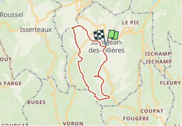
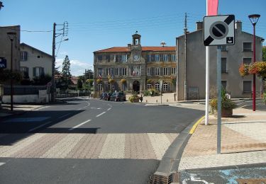
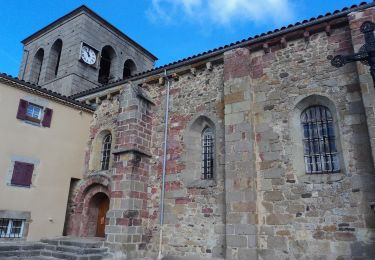
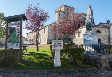
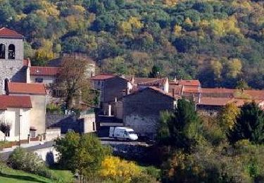
Randonnée Marche de 12,3 km à découvrir à Auvergne-Rhône-Alpes, Puy-de-Dôme, Saint-Jean-des-Ollières. Cette randonnée est proposée par jagarnier.
Description
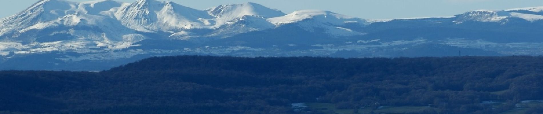
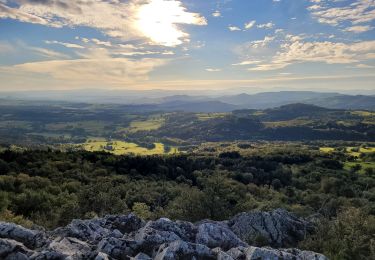
Du sommet du Pic de la Garde vous aurez un panorama à couper le souffle sur les volcans et le plus emblématique de tous : le puy de Dôme.
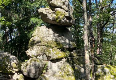
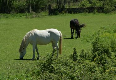
Cette randonnée vous offre aussi un point de vue sur la Comté, site classé Natura 2000 pour son intérêt écologique, faunistique et floristique. Ce massif forestier est l’un des plus riches d’Auvergne.
Localisation
Commentaires
Randonnées à proximité
![Randonnée A pied Saint-Jean-des-Ollières - Saint Jean des Ollières_Le pic de la Garde - Photo](https://media.geolcdn.com/t/375/260/ext.jpg?maxdim=2&url=https%3A%2F%2Fstatic1.geolcdn.com%2Fsiteimages%2Fupload%2Ffiles%2F1545311037marcheuse_200dpi.jpg)
![A pied A pied](https://static1.geolcdn.com/sitytour/trail-icons/100.png)
A pied
![](/images/other/stat-length.png)
![](https://static1.geolcdn.com/siteimages/upload/files/16400158638029165_repeat_loop_refresh_sync_direction_icon.png)
![Randonnée Marche Fayet-le-Château - Ronde des fours - Photo](https://media.geolcdn.com/t/375/260/e433297a-3dcb-40fe-9fd1-fddeffe80b31.jpg&format=jpg&maxdim=2)
![Marche Marche](https://static1.geolcdn.com/sitytour/trail-icons/101.png)
Marche
![](/images/other/stat-length.png)
![](https://static1.geolcdn.com/siteimages/upload/files/16400158638029165_repeat_loop_refresh_sync_direction_icon.png)
![Randonnée A pied Saint-Jean-des-Ollières - Le Pic de la Garde - Photo](https://media.geolcdn.com/t/375/260/37c6e52b-d429-4f79-ab40-81ca434effbe.jpeg&format=jpg&maxdim=2)
![A pied A pied](https://static1.geolcdn.com/sitytour/trail-icons/100.png)
A pied
![](/images/other/stat-length.png)
![](https://static1.geolcdn.com/siteimages/upload/files/16400158638029165_repeat_loop_refresh_sync_direction_icon.png)
![Randonnée A pied Isserteaux - Le Puy du Courdeloup - Photo](https://media.geolcdn.com/t/375/260/ed6d31e1-e0f6-496e-b66b-b509bc4f961d.jpeg&format=jpg&maxdim=2)
![A pied A pied](https://static1.geolcdn.com/sitytour/trail-icons/100.png)
A pied
![](/images/other/stat-length.png)
![](https://static1.geolcdn.com/siteimages/upload/files/16400158638029165_repeat_loop_refresh_sync_direction_icon.png)
![Randonnée A pied Brousse - Montboissier - Photo](https://media.geolcdn.com/t/375/260/58b2472c-4613-4842-b817-5379db2ce3ac.jpeg&format=jpg&maxdim=2)
![A pied A pied](https://static1.geolcdn.com/sitytour/trail-icons/100.png)
A pied
![](/images/other/stat-length.png)
![](https://static1.geolcdn.com/siteimages/upload/files/16400158638029165_repeat_loop_refresh_sync_direction_icon.png)
![Randonnée Marche Saint-Jean-des-Ollières - Saint-Jean-des-Ollières_Pic-de-la-Garde_T - Photo](https://media.geolcdn.com/t/375/260/c8ffecc3-4bf2-4c03-99d1-b0343eccec70.jpg&format=jpg&maxdim=2)
![Marche Marche](https://static1.geolcdn.com/sitytour/trail-icons/101.png)
Marche
![](/images/other/stat-length.png)
![](https://static1.geolcdn.com/siteimages/upload/files/16400158638029165_repeat_loop_refresh_sync_direction_icon.png)
![Randonnée Marche Sugères - Sugeres_Bois_Bord - Photo](https://media.geolcdn.com/t/375/260/87d3790b-761a-4d55-9a2a-4c935d727361.jpg&format=jpg&maxdim=2)
![Marche Marche](https://static1.geolcdn.com/sitytour/trail-icons/101.png)
Marche
![](/images/other/stat-length.png)
![](https://static1.geolcdn.com/siteimages/upload/files/16400158638029165_repeat_loop_refresh_sync_direction_icon.png)
![Randonnée Marche Isserteaux - Isserteaux_Courdeloup - Photo](https://media.geolcdn.com/t/375/260/78fce53c-4597-4c0b-988d-aad59792c50e.jpg&format=jpg&maxdim=2)
![Marche Marche](https://static1.geolcdn.com/sitytour/trail-icons/101.png)
Marche
![](/images/other/stat-length.png)
![](https://static1.geolcdn.com/siteimages/upload/files/16400158638029165_repeat_loop_refresh_sync_direction_icon.png)
![Randonnée Marche Saint-Dier-d'Auvergne - St_Dier_Ribes_Miodet - Photo](https://media.geolcdn.com/t/375/260/1ad077f2-ac13-4fa4-8893-456994b8d19d.jpg&format=jpg&maxdim=2)
![Marche Marche](https://static1.geolcdn.com/sitytour/trail-icons/101.png)
Marche
![](/images/other/stat-length.png)
![](https://static1.geolcdn.com/siteimages/upload/files/16400158638029165_repeat_loop_refresh_sync_direction_icon.png)