![](/images/other/stat-length.png)
![Randonnée Marche Molveno - Dolo 2019 - J2 - Crozz Dell' Altissimo - Graffer - - Photo](https://media.geolcdn.com/t/1900/400/ext.pjpeg?maxdim=2&url=https%3A%2F%2Fstatic1.geolcdn.com%2Fsiteimages%2Fupload%2Ffiles%2F1553511878bg_sport_marche.png)
Dolo 2019 - J2 - Crozz Dell' Altissimo - Graffer -
GAPIAN43
Utilisateur
![Longueur](/images/other/stat-length.png)
Longueur
9,1 km
![Altitude max](https://static1.geolcdn.com/siteimages/upload/files/1508320355ic_sort_altitude_max_24dp.png)
Altitude max
2451 m
![Dénivelé positif](https://static1.geolcdn.com/siteimages/upload/files/1508320355ic_sort_den_pos_24dp.png)
Dénivelé positif
1261 m
![Km-Effort](/images/other/stat-length.png)
Km-Effort
23 km
![Altitude min](https://static1.geolcdn.com/siteimages/upload/files/1508320355ic_sort_altitude_min_24dp.png)
Altitude min
1434 m
![Dénivelé négatif](https://static1.geolcdn.com/siteimages/upload/files/1508320355ic_sort_den_neg_24dp.png)
Dénivelé négatif
436 m
![Boucle](https://static1.geolcdn.com/siteimages/upload/files/16400158638029165_repeat_loop_refresh_sync_direction_icon.png)
Boucle
Non
Date de création :
2018-12-19 09:40:33.177
Dernière modification :
2019-07-26 14:35:50.853
![Marche](https://static1.geolcdn.com/sitytour/trail-icons/101.png)
4h54
Difficulté : Difficile
![Scannez ce code QR pour ouvrir la randonnée dans l'application SityTrail](https://capi.geolives.com/qq0zvz2zws4bq2lad0pu/sitytour/trails/2019953/qr.png?size=200)
Application GPS de randonnée GRATUITE
À propos
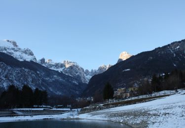
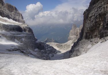
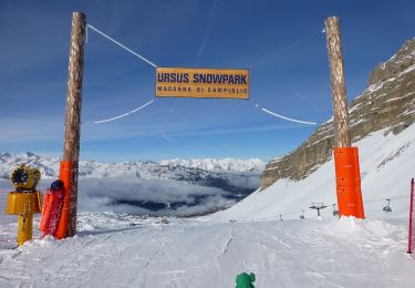
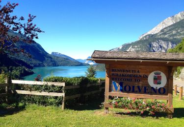
Randonnée Marche de 9,1 km à découvrir à Trentin-Haut-Adige, Provincia di Trento, Molveno. Cette randonnée est proposée par GAPIAN43.
Description
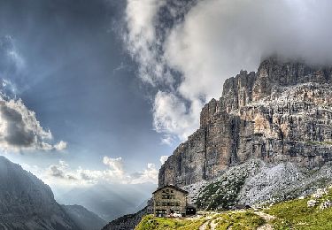
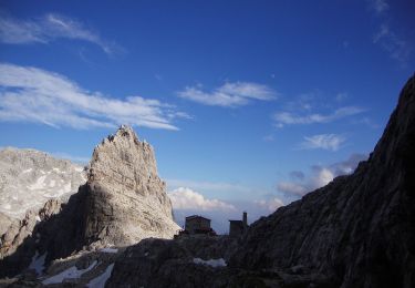
Brenta 2019 - Jour 2 - Rif Crozz -> Rif Graffer. Un passage difficile ensuite moyen. Très sauvage pas de végétation. Temps de marche environ 6h
Localisation
Pays :
Italie
Région :
Trentin-Haut-Adige
Département/Province :
Provincia di Trento
Commune :
Molveno
Localité :
Unknown
Départ:(Dec)
Départ:(UTM)
649097 ; 5114814 (32T) N.
Commentaires
Randonnées à proximité
![Randonnée A pied Molveno - Senter de la Mars - Photo](https://media.geolcdn.com/t/375/260/73a3f382-f1e1-4c06-92a6-bda5359b56f6.jpeg&format=jpg&maxdim=2)
![A pied A pied](https://static1.geolcdn.com/sitytour/trail-icons/100.png)
Senter de la Mars
A pied
Facile
Molveno,
Trentin-Haut-Adige,
Provincia di Trento,
Italie
![](/images/other/stat-length.png)
5,1 km | 13,4 km-effort
3h 2min
![](https://static1.geolcdn.com/siteimages/upload/files/16400158638029165_repeat_loop_refresh_sync_direction_icon.png)
Non
![Randonnée A pied Ville d'Anaunia - Via ferrata delle Bocchette](https://media.geolcdn.com/t/375/260/ffe87ce9-5fcb-4eba-b083-4e4365a3e81c.jpeg&format=jpg&maxdim=2)
![A pied A pied](https://static1.geolcdn.com/sitytour/trail-icons/100.png)
Via ferrata delle Bocchette "Alfredo e Rodolfo Benini"
A pied
Facile
Ville d'Anaunia,
Trentin-Haut-Adige,
Provincia di Trento,
Italie
![](/images/other/stat-length.png)
4,9 km | 11,1 km-effort
2h 30min
![](https://static1.geolcdn.com/siteimages/upload/files/16400158638029165_repeat_loop_refresh_sync_direction_icon.png)
Non
![Randonnée A pied Ville d'Anaunia - Via ferrata delle Palete - Photo](https://media.geolcdn.com/t/375/260/4fca5709-90bb-4975-869a-99a7dc9b585e.jpeg&format=jpg&maxdim=2)
![A pied A pied](https://static1.geolcdn.com/sitytour/trail-icons/100.png)
Via ferrata delle Palete
A pied
Moyen
Ville d'Anaunia,
Trentin-Haut-Adige,
Provincia di Trento,
Italie
![](/images/other/stat-length.png)
12,4 km | 25 km-effort
5h 38min
![](https://static1.geolcdn.com/siteimages/upload/files/16400158638029165_repeat_loop_refresh_sync_direction_icon.png)
Non
![Randonnée A pied San Lorenzo Dorsino - Sentiero della Ceda - Photo](https://media.geolcdn.com/t/375/260/e492bf64-9925-4916-83b3-8d59586a5288.jpeg&format=jpg&maxdim=2)
![A pied A pied](https://static1.geolcdn.com/sitytour/trail-icons/100.png)
Sentiero della Ceda
A pied
Moyen
San Lorenzo Dorsino,
Trentin-Haut-Adige,
Provincia di Trento,
Italie
![](/images/other/stat-length.png)
5,9 km | 20 km-effort
4h 35min
![](https://static1.geolcdn.com/siteimages/upload/files/16400158638029165_repeat_loop_refresh_sync_direction_icon.png)
Non
![Randonnée A pied Tre Ville - Via ferrata alpinistica](https://media.geolcdn.com/t/375/260/451c5a3f-de36-429c-9456-783cce8c692c.jpeg&format=jpg&maxdim=2)
![A pied A pied](https://static1.geolcdn.com/sitytour/trail-icons/100.png)
Via ferrata alpinistica "Daniele Martinazzi"
A pied
Facile
Tre Ville,
Trentin-Haut-Adige,
Provincia di Trento,
Italie
![](/images/other/stat-length.png)
3,9 km | 11,5 km-effort
2h 36min
![](https://static1.geolcdn.com/siteimages/upload/files/16400158638029165_repeat_loop_refresh_sync_direction_icon.png)
Non
![Randonnée A pied Molveno - IT-O314 - Photo](https://media.geolcdn.com/t/375/260/9640fd8a-f8d2-460c-bc3a-7db0a7b04cee.jpeg&format=jpg&maxdim=2)
![A pied A pied](https://static1.geolcdn.com/sitytour/trail-icons/100.png)
IT-O314
A pied
Moyen
Molveno,
Trentin-Haut-Adige,
Provincia di Trento,
Italie
![](/images/other/stat-length.png)
12,8 km | 23 km-effort
5h 10min
![](https://static1.geolcdn.com/siteimages/upload/files/16400158638029165_repeat_loop_refresh_sync_direction_icon.png)
Non
![Randonnée A pied Cavedago - IT-O352 - Photo](https://media.geolcdn.com/t/375/260/6abe9acf-2eff-4b9f-840f-c09176db15c9.jpeg&format=jpg&maxdim=2)
![A pied A pied](https://static1.geolcdn.com/sitytour/trail-icons/100.png)
IT-O352
A pied
Facile
Cavedago,
Trentin-Haut-Adige,
Provincia di Trento,
Italie
![](/images/other/stat-length.png)
5,4 km | 8,7 km-effort
1h 58min
![](https://static1.geolcdn.com/siteimages/upload/files/16400158638029165_repeat_loop_refresh_sync_direction_icon.png)
Non
![Randonnée A pied Molveno - IT-O612 - Photo](https://media.geolcdn.com/t/375/260/35430ee0-ea3d-4a52-911a-5fac9b65047d.jpeg&format=jpg&maxdim=2)
![A pied A pied](https://static1.geolcdn.com/sitytour/trail-icons/100.png)
IT-O612
A pied
Moyen
Molveno,
Trentin-Haut-Adige,
Provincia di Trento,
Italie
![](/images/other/stat-length.png)
9,2 km | 21 km-effort
4h 47min
![](https://static1.geolcdn.com/siteimages/upload/files/16400158638029165_repeat_loop_refresh_sync_direction_icon.png)
Non
![Randonnée A pied Tre Ville - Via Ferrata](https://media.geolcdn.com/t/375/260/bac15c31-5d66-4e3e-be6d-760e6dfe785e.jpeg&format=jpg&maxdim=2)
![A pied A pied](https://static1.geolcdn.com/sitytour/trail-icons/100.png)
Via Ferrata "Osvaldo Orsi"
A pied
Facile
Tre Ville,
Trentin-Haut-Adige,
Provincia di Trento,
Italie
![](/images/other/stat-length.png)
6,2 km | 13,8 km-effort
3h 8min
![](https://static1.geolcdn.com/siteimages/upload/files/16400158638029165_repeat_loop_refresh_sync_direction_icon.png)
Non