Randonnée Marche Châlonvillars - Autour de Chalonvillars - Photo
 lebrisgerard
lebrisgerard

Utilisateur

© OpenStreetMap contributors
Longueur
Longueur
3,9 km
Altitude max
Altitude max
431 m
Dénivelé positif
Dénivelé positif
64 m
Km-Effort
Km-Effort  
4,8 km
Altitude min
Altitude min
370 m
Dénivelé négatif
Dénivelé négatif
66 m
Boucle
Boucle
Oui
Date de création :
2018-11-20 18:16:17.135
Dernière modification :
2018-11-22 16:58:04.573

(0 Avis)

Marche
Marche
1h09
Difficulté : Facile

Scannez ce code QR pour ouvrir la randonnée dans l'application SityTrail

Application GPS de randonnée GRATUITE

Logo SityTrail SityTrail

IGN / Instituts géographiques

Télécharger SityTrail sur l'App Store Télécharger SityTrail sur Google Play

Logo SityTrail SityTrail World

Le monde est à vous

Télécharger SityTrail sur l'App Store Télécharger SityTrail sur Google Play Télécharger SityTrail sur Huawei AppGallery

À propos

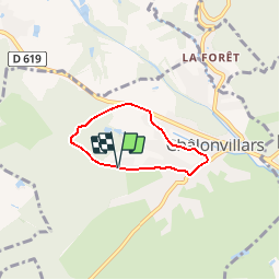
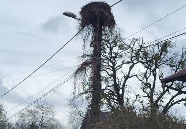
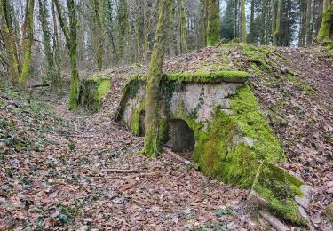
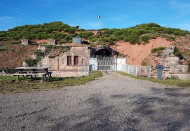
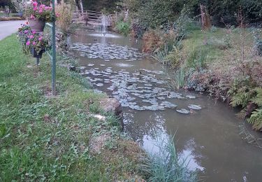
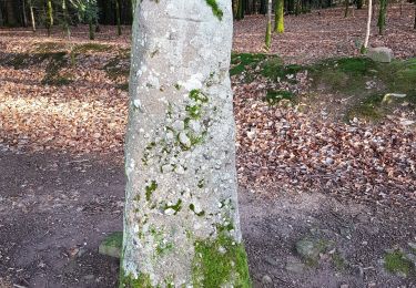
Randonnée Marche de 3,9 km à découvrir à Bourgogne-Franche-Comté, Haute-Saône, Châlonvillars. Cette randonnée est proposée par lebrisgerard.

Description

Rando facile pour se dégourdir les jambes après un bon repas

Profil altimétrique

Localisation

Pays :
France
Région :
Bourgogne-Franche-Comté
Département/Province :
Haute-Saône
Commune :
Châlonvillars
Localité :
Unknown
Départ:(UTM)
332870 ; 5278692 (32T) N.

Randonnées à proximité

Randonnée Marche Sermamagny - Veronne PC - Photo
Marche
Papamoju

Marche

Très facile
(2)
Sermamagny, Bourgogne-Franche-Comté, Territoire-de-Belfort, France
8,1 km | 9 km-effort
1h 59min
Oui
Randonnée Vélo électrique Essert - VTT - Essert - Salbert - Vétrigne - Miotte - Citadelle Belfort - Essert - Photo
Vélo électrique
Bart2015

Vélo électrique

Difficile
Essert, Bourgogne-Franche-Comté, Territoire-de-Belfort, France
42 km | 55 km-effort
4h 55min
Oui
Randonnée Moto Évette-Salbert - Moto - Evette - Grand Ballon - Honneck - Lacs de Longemer puis de Gérardmer - chapelle des Vés - Ballon d'Alsace - Photo
Moto
Bart2015

Moto

Difficile
Évette-Salbert, Bourgogne-Franche-Comté, Territoire-de-Belfort, France
195 km | 252 km-effort
5h 39min
Oui
Randonnée Vélo électrique Châlonvillars - VTT - Châlonvillars - Etobon - Ronchamp - Plancher-Bas - Malsaucy - Photo
Vélo électrique
Bart2015

Vélo électrique

Difficile
Châlonvillars, Bourgogne-Franche-Comté, Haute-Saône, France
71 km | 90 km-effort
5h 50min
Oui
Randonnée Marche Mandrevillars - Echenans et son fort - Photo
Marche
Bart2015

Marche

Très difficile
Mandrevillars, Bourgogne-Franche-Comté, Haute-Saône, France
14,8 km | 19,6 km-effort
4h 27min
Oui
Randonnée Marche Châlonvillars - Châlonvillars - Fort du Salbert - Evette-Salbert - Photo
Marche
Bart2015

Marche

Difficile
(1)
Châlonvillars, Bourgogne-Franche-Comté, Haute-Saône, France
11 km | 15,8 km-effort
3h 36min
Oui
Randonnée V.T.T. Châlonvillars - Châlonvillars - Fort Giromagny en passant au milieu des étangs - Photo
V.T.T.
Bart2015

V.T.T.

Très difficile
Châlonvillars, Bourgogne-Franche-Comté, Haute-Saône, France
40 km | 51 km-effort
3h 31min
Oui
Randonnée V.T.T. Châlonvillars - Châlonvillars - Menhir - Mandrevillars - Fort Essert et du Salbert - Photo
V.T.T.
Bart2015

V.T.T.

Très difficile
Châlonvillars, Bourgogne-Franche-Comté, Haute-Saône, France
31 km | 42 km-effort
2h 53min
Oui
Randonnée Marche Châlonvillars - Châlonvillars - le mehnir - Mandrevillars - Photo
Marche
Bart2015

Marche

Moyen
Châlonvillars, Bourgogne-Franche-Comté, Haute-Saône, France
13,4 km | 17,1 km-effort
2h 39min
Oui


Fermer
Mes abonnements