![](/images/other/stat-length.png)
![Randonnée Marche Saignelégier - Goumois-Vautenaivre-Pommerats(CH) - Photo](https://media.geolcdn.com/t/1900/400/ext.pjpeg?maxdim=2&url=https%3A%2F%2Fstatic1.geolcdn.com%2Fsiteimages%2Fupload%2Ffiles%2F1553511878bg_sport_marche.png)
Goumois-Vautenaivre-Pommerats(CH)
fredfred
Utilisateur
![Longueur](/images/other/stat-length.png)
Longueur
15,4 km
![Altitude max](https://static1.geolcdn.com/siteimages/upload/files/1508320355ic_sort_altitude_max_24dp.png)
Altitude max
926 m
![Dénivelé positif](https://static1.geolcdn.com/siteimages/upload/files/1508320355ic_sort_den_pos_24dp.png)
Dénivelé positif
628 m
![Km-Effort](/images/other/stat-length.png)
Km-Effort
24 km
![Altitude min](https://static1.geolcdn.com/siteimages/upload/files/1508320355ic_sort_altitude_min_24dp.png)
Altitude min
494 m
![Dénivelé négatif](https://static1.geolcdn.com/siteimages/upload/files/1508320355ic_sort_den_neg_24dp.png)
Dénivelé négatif
628 m
![Boucle](https://static1.geolcdn.com/siteimages/upload/files/16400158638029165_repeat_loop_refresh_sync_direction_icon.png)
Boucle
Oui
Date de création :
2016-03-09 00:00:00.0
Dernière modification :
2016-03-09 00:00:00.0
![Marche](https://static1.geolcdn.com/sitytour/trail-icons/101.png)
5h03
Difficulté : Moyen
![Scannez ce code QR pour ouvrir la randonnée dans l'application SityTrail](https://capi.geolives.com/qq0zvz2zws4bq2lad0pu/sitytour/trails/201585/qr.png?size=200)
Application GPS de randonnée GRATUITE
À propos
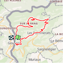
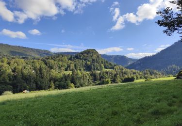
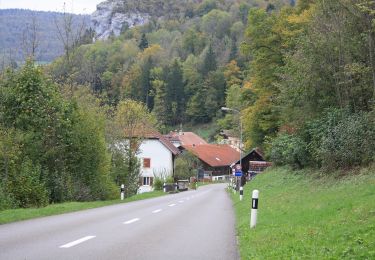
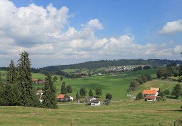
Randonnée Marche de 15,4 km à découvrir à Jura, District des Franches-Montagnes, Saignelégier. Cette randonnée est proposée par fredfred.
Description
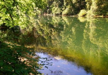
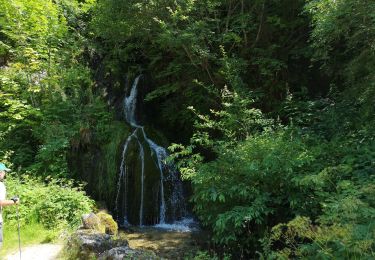
rando autour de Goumois, Vautenaivre et Les Pommerats.
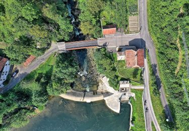
Passage sous le rocher du singe de goumois.
Chateau Cuny (ruiniforme)
Localisation
Pays :
Suisse
Région :
Jura
Département/Province :
District des Franches-Montagnes
Commune :
Saignelégier
Localité :
Unknown
Départ:(Dec)
Départ:(UTM)
345040 ; 5236284 (32T) N.
Commentaires
Randonnées à proximité
![Randonnée Marche Goumois - Circuit du barrage de la Goule - Photo](https://media.geolcdn.com/t/375/260/5b0019e2-a604-4bd2-9c4a-c096b01f1b2e.jpg&format=jpg&maxdim=2)
![Marche Marche](https://static1.geolcdn.com/sitytour/trail-icons/101.png)
Circuit du barrage de la Goule
Marche
Moyen
Goumois,
Bourgogne-Franche-Comté,
Doubs,
France
![](/images/other/stat-length.png)
13,8 km | 18,8 km-effort
3h 36min
![](https://static1.geolcdn.com/siteimages/upload/files/16400158638029165_repeat_loop_refresh_sync_direction_icon.png)
Oui
![Randonnée A pied Le Noirmont - La Goule - fixme - Photo](https://media.geolcdn.com/t/375/260/26c9f498-14fd-470d-95fd-f93787b84ec0.jpeg&format=jpg&maxdim=2)
![A pied A pied](https://static1.geolcdn.com/sitytour/trail-icons/100.png)
La Goule - fixme
A pied
Facile
Le Noirmont,
Jura,
District des Franches-Montagnes,
Suisse
![](/images/other/stat-length.png)
3,4 km | 4,5 km-effort
1h 0min
![](https://static1.geolcdn.com/siteimages/upload/files/16400158638029165_repeat_loop_refresh_sync_direction_icon.png)
Non
![Randonnée A pied Le Noirmont - La Goule - fixme - Photo](https://media.geolcdn.com/t/375/260/26c9f498-14fd-470d-95fd-f93787b84ec0.jpeg&format=jpg&maxdim=2)
![A pied A pied](https://static1.geolcdn.com/sitytour/trail-icons/100.png)
La Goule - fixme
A pied
Facile
Le Noirmont,
Jura,
District des Franches-Montagnes,
Suisse
![](/images/other/stat-length.png)
3,9 km | 8,2 km-effort
1h 51min
![](https://static1.geolcdn.com/siteimages/upload/files/16400158638029165_repeat_loop_refresh_sync_direction_icon.png)
Non
![Randonnée A pied Muriaux - Muriaux - Goumois - Photo](https://media.geolcdn.com/t/375/260/39340727-7fad-44c3-aed8-14f4632db308.jpeg&format=jpg&maxdim=2)
![A pied A pied](https://static1.geolcdn.com/sitytour/trail-icons/100.png)
Muriaux - Goumois
A pied
Facile
Muriaux,
Jura,
District des Franches-Montagnes,
Suisse
![](/images/other/stat-length.png)
4 km | 6,7 km-effort
1h 31min
![](https://static1.geolcdn.com/siteimages/upload/files/16400158638029165_repeat_loop_refresh_sync_direction_icon.png)
Non
![Marche Marche](https://static1.geolcdn.com/sitytour/trail-icons/101.png)
Les Sommêtres
Marche
Moyen
Goumois,
Bourgogne-Franche-Comté,
Doubs,
France
![](/images/other/stat-length.png)
24 km | 37 km-effort
7h 54min
![](https://static1.geolcdn.com/siteimages/upload/files/16400158638029165_repeat_loop_refresh_sync_direction_icon.png)
Non
![Randonnée Marche Charmauvillers - Goumois randonnée La Goule - Photo](https://media.geolcdn.com/t/375/260/21b4c51b-c2b4-4e0c-a0c1-612025391c50.jpg&format=jpg&maxdim=2)
![Marche Marche](https://static1.geolcdn.com/sitytour/trail-icons/101.png)
Goumois randonnée La Goule
Marche
Moyen
Charmauvillers,
Bourgogne-Franche-Comté,
Doubs,
France
![](/images/other/stat-length.png)
19,6 km | 35 km-effort
3h 5min
![](https://static1.geolcdn.com/siteimages/upload/files/16400158638029165_repeat_loop_refresh_sync_direction_icon.png)
Non
![Randonnée A pied Saignelégier - Moulin Jeannottat-Les Pommerats - Photo](https://media.geolcdn.com/t/375/260/ext.jpg?maxdim=2&url=https%3A%2F%2Fstatic1.geolcdn.com%2Fsiteimages%2Fupload%2Ffiles%2F1545311037marcheuse_200dpi.jpg)
![A pied A pied](https://static1.geolcdn.com/sitytour/trail-icons/100.png)
Moulin Jeannottat-Les Pommerats
A pied
Facile
Saignelégier,
Jura,
District des Franches-Montagnes,
Suisse
![](/images/other/stat-length.png)
4,3 km | 8,5 km-effort
1h 55min
![](https://static1.geolcdn.com/siteimages/upload/files/16400158638029165_repeat_loop_refresh_sync_direction_icon.png)
Non
![Randonnée Marche Goumois - Goumois - Photo](https://media.geolcdn.com/t/375/260/d0f49200-6ae5-4a6b-8236-c2c6eaab60f6.jpg&format=jpg&maxdim=2)
![Marche Marche](https://static1.geolcdn.com/sitytour/trail-icons/101.png)
Goumois
Marche
Facile
Goumois,
Bourgogne-Franche-Comté,
Doubs,
France
![](/images/other/stat-length.png)
13,6 km | 19,4 km-effort
5h 42min
![](https://static1.geolcdn.com/siteimages/upload/files/16400158638029165_repeat_loop_refresh_sync_direction_icon.png)
Oui
![Randonnée Marche Fessevillers - Étape 4 : Fessevillers à Bief d'Etoz - Photo](https://media.geolcdn.com/t/375/260/277dd886-30bb-40a5-b26e-59eee8200701.jpg&format=jpg&maxdim=2)
![Marche Marche](https://static1.geolcdn.com/sitytour/trail-icons/101.png)
Étape 4 : Fessevillers à Bief d'Etoz
Marche
Moyen
Fessevillers,
Bourgogne-Franche-Comté,
Doubs,
France
![](/images/other/stat-length.png)
15 km | 21 km-effort
5h 14min
![](https://static1.geolcdn.com/siteimages/upload/files/16400158638029165_repeat_loop_refresh_sync_direction_icon.png)
Non