


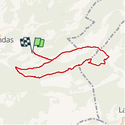

12,4 km | 22 km-effort

Utilisateur


Application GPS de randonnée GRATUITE
 SityTrail
IGN / Instituts géographiques
SityTrail World
Le monde est à vous
Randonnée Marche de 8,4 km à découvrir à Provence-Alpes-Côte d'Azur, Vaucluse, Gigondas. Cette randonnée est proposée par counoise.
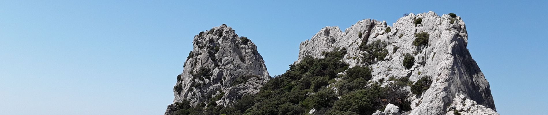
Randonnée difficile en raison du terrain, des pentes en debut de montée vers les Dentelles et l'absence de balisage sur certaines parties .
Pour le reste, c'est magique !


Marche

Marche

Marche

Marche

Marche

Marche

Marche

Marche
Marche