![](/images/other/stat-length.png)
![Randonnée V.T.C. Theix-Noyalo - Boucle Noyalo-Damgan - Photo](https://media.geolcdn.com/t/1900/400/5c3b5310-fa44-4152-9274-434fabcac185.jpg&format=pjpeg&maxdim=2)
Boucle Noyalo-Damgan
ilur56
Utilisateur
![Longueur](/images/other/stat-length.png)
Longueur
48 km
![Altitude max](https://static1.geolcdn.com/siteimages/upload/files/1508320355ic_sort_altitude_max_24dp.png)
Altitude max
39 m
![Dénivelé positif](https://static1.geolcdn.com/siteimages/upload/files/1508320355ic_sort_den_pos_24dp.png)
Dénivelé positif
293 m
![Km-Effort](/images/other/stat-length.png)
Km-Effort
51 km
![Altitude min](https://static1.geolcdn.com/siteimages/upload/files/1508320355ic_sort_altitude_min_24dp.png)
Altitude min
-1 m
![Dénivelé négatif](https://static1.geolcdn.com/siteimages/upload/files/1508320355ic_sort_den_neg_24dp.png)
Dénivelé négatif
293 m
![Boucle](https://static1.geolcdn.com/siteimages/upload/files/16400158638029165_repeat_loop_refresh_sync_direction_icon.png)
Boucle
Oui
Date de création :
2018-06-24 08:50:49.26
Dernière modification :
2018-06-24 19:17:59.128
![V.T.C.](https://static1.geolcdn.com/sitytour/trail-icons/203.png)
4h44
Difficulté : Facile
![Scannez ce code QR pour ouvrir la randonnée dans l'application SityTrail](https://capi.geolives.com/qq0zvz2zws4bq2lad0pu/sitytour/trails/2002784/qr.png?size=200)
Application GPS de randonnée GRATUITE
À propos
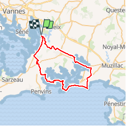
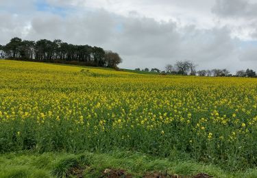
Randonnée V.T.C. de 48 km à découvrir à Bretagne, Morbihan, Theix-Noyalo. Cette randonnée est proposée par ilur56.
Description
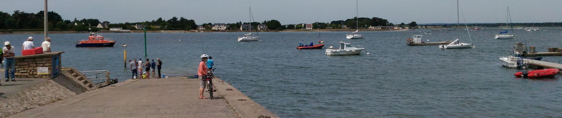
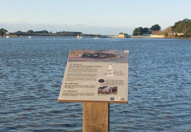
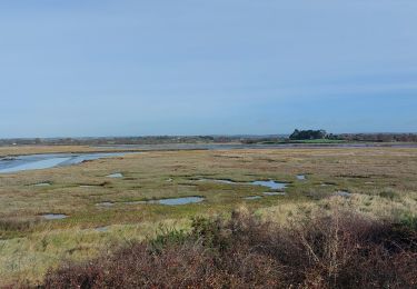
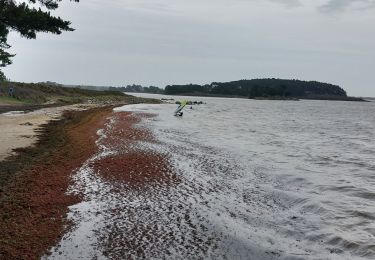
Petits chemins et petites routes. Traversée de la rivière de Pénerf avec le passeur du Lenn. Se renseigner sur les possibilités de passage.
Localisation
Pays :
France
Région :
Bretagne
Département/Province :
Morbihan
Commune :
Theix-Noyalo
Localité :
Unknown
Départ:(Dec)
Départ:(UTM)
523832 ; 5273282 (30T) N.
Commentaires
Randonnées à proximité
![Randonnée Marche Saint-Armel - Île TASCON- Le Passage 56 - Photo](https://media.geolcdn.com/t/375/260/ext.jpg?maxdim=2&url=https%3A%2F%2Fstatic1.geolcdn.com%2Fsiteimages%2Fupload%2Ffiles%2F1553511878bg_sport_marche.png)
![Marche Marche](https://static1.geolcdn.com/sitytour/trail-icons/101.png)
Île TASCON- Le Passage 56
Marche
Facile
(1)
Saint-Armel,
Bretagne,
Morbihan,
France
![](/images/other/stat-length.png)
11,5 km | 12,1 km-effort
2h 31min
![](https://static1.geolcdn.com/siteimages/upload/files/16400158638029165_repeat_loop_refresh_sync_direction_icon.png)
Oui
![Randonnée Marche Saint-Armel - St Armel en passant par l'Ile de Tason (Boucle) - Photo](https://media.geolcdn.com/t/375/260/ext.jpg?maxdim=2&url=https%3A%2F%2Fstatic1.geolcdn.com%2Fsiteimages%2Fupload%2Ffiles%2F1553511878bg_sport_marche.png)
![Marche Marche](https://static1.geolcdn.com/sitytour/trail-icons/101.png)
St Armel en passant par l'Ile de Tason (Boucle)
Marche
Moyen
(3)
Saint-Armel,
Bretagne,
Morbihan,
France
![](/images/other/stat-length.png)
20 km | 22 km-effort
4h 49min
![](https://static1.geolcdn.com/siteimages/upload/files/16400158638029165_repeat_loop_refresh_sync_direction_icon.png)
Oui
![Vélo électrique Vélo électrique](https://static1.geolcdn.com/sitytour/trail-icons/205.png)
Boucle De Surzur à Ambon
Vélo électrique
Moyen
Surzur,
Bretagne,
Morbihan,
France
![](/images/other/stat-length.png)
16 km | 17,6 km-effort
1h 15min
![](https://static1.geolcdn.com/siteimages/upload/files/16400158638029165_repeat_loop_refresh_sync_direction_icon.png)
Oui
![Randonnée Marche Séné - PR_56_Sene_IA_09_Circuit1b_Sentier-Des-Gabelous_20240311 - Photo](https://media.geolcdn.com/t/375/260/c2ea644e-e03f-4409-ac55-71c5dee67584.jpg&format=jpg&maxdim=2)
![Marche Marche](https://static1.geolcdn.com/sitytour/trail-icons/101.png)
PR_56_Sene_IA_09_Circuit1b_Sentier-Des-Gabelous_20240311
Marche
Très facile
Séné,
Bretagne,
Morbihan,
France
![](/images/other/stat-length.png)
10,1 km | 11 km-effort
1h 53min
![](https://static1.geolcdn.com/siteimages/upload/files/16400158638029165_repeat_loop_refresh_sync_direction_icon.png)
Oui
![Randonnée Marche Séné - PR_56_Sene_HA_08_Circuit3a_Du-Passage_20231205 - Photo](https://media.geolcdn.com/t/375/260/d5b7643d-c63d-4161-aaf0-6fe7e6e442e1.jpg&format=jpg&maxdim=2)
![Marche Marche](https://static1.geolcdn.com/sitytour/trail-icons/101.png)
PR_56_Sene_HA_08_Circuit3a_Du-Passage_20231205
Marche
Moyen
Séné,
Bretagne,
Morbihan,
France
![](/images/other/stat-length.png)
8,5 km | 9,7 km-effort
1h 47min
![](https://static1.geolcdn.com/siteimages/upload/files/16400158638029165_repeat_loop_refresh_sync_direction_icon.png)
Oui
![Randonnée Marche Séné - PR_56_Sene_GA_07_Circuit3b_Entre-Bocage-Et-Marais_20231115 - Photo](https://media.geolcdn.com/t/375/260/90de986c-3b14-49b7-b42b-f41416db033a.jpg&format=jpg&maxdim=2)
![Marche Marche](https://static1.geolcdn.com/sitytour/trail-icons/101.png)
PR_56_Sene_GA_07_Circuit3b_Entre-Bocage-Et-Marais_20231115
Marche
Moyen
Séné,
Bretagne,
Morbihan,
France
![](/images/other/stat-length.png)
7,8 km | 8,3 km-effort
1h 30min
![](https://static1.geolcdn.com/siteimages/upload/files/16400158638029165_repeat_loop_refresh_sync_direction_icon.png)
Oui
![Randonnée Marche Theix-Noyalo - PR_56_Theix-Noyalo_AA_01_Circuit3b_Vers-Corn-Er-Hoet_20230401 - Photo](https://media.geolcdn.com/t/375/260/53a27219-59ef-468a-9654-2c8ca963d998.jpg&format=jpg&maxdim=2)
![Marche Marche](https://static1.geolcdn.com/sitytour/trail-icons/101.png)
PR_56_Theix-Noyalo_AA_01_Circuit3b_Vers-Corn-Er-Hoet_20230401
Marche
Moyen
Theix-Noyalo,
Bretagne,
Morbihan,
France
![](/images/other/stat-length.png)
8,3 km | 9,9 km-effort
1h 40min
![](https://static1.geolcdn.com/siteimages/upload/files/16400158638029165_repeat_loop_refresh_sync_direction_icon.png)
Oui
![Randonnée Marche Séné - PR_56_Sene_FA_06_Circuit3b_Le-Bourg-Et-Ses-Rivages_20230206 - Photo](https://media.geolcdn.com/t/375/260/169b12f8-5799-478a-8a15-2ebf012a9c5c.jpg&format=jpg&maxdim=2)
![Marche Marche](https://static1.geolcdn.com/sitytour/trail-icons/101.png)
PR_56_Sene_FA_06_Circuit3b_Le-Bourg-Et-Ses-Rivages_20230206
Marche
Facile
Séné,
Bretagne,
Morbihan,
France
![](/images/other/stat-length.png)
3,3 km | 3,6 km-effort
43min
![](https://static1.geolcdn.com/siteimages/upload/files/16400158638029165_repeat_loop_refresh_sync_direction_icon.png)
Oui
![Randonnée Marche Séné - PR_56_Sene_DA_04_Circuit3b_De-La-Pointe-Du-Bill_20221231 - Photo](https://media.geolcdn.com/t/375/260/648f8142-1f31-4e26-9f18-51324015b55d.jpg&format=jpg&maxdim=2)
![Marche Marche](https://static1.geolcdn.com/sitytour/trail-icons/101.png)
PR_56_Sene_DA_04_Circuit3b_De-La-Pointe-Du-Bill_20221231
Marche
Très facile
Séné,
Bretagne,
Morbihan,
France
![](/images/other/stat-length.png)
7,3 km | 7,9 km-effort
1h 37min
![](https://static1.geolcdn.com/siteimages/upload/files/16400158638029165_repeat_loop_refresh_sync_direction_icon.png)
Oui