![](/images/other/stat-length.png)
![Randonnée Marche Charbonnières-les-Varennes - Beaunit_Narse - Photo](https://media.geolcdn.com/t/1900/400/2347cc26-eafa-4011-be79-b7d07d478152.jpg&format=pjpeg&maxdim=2)
Beaunit_Narse
jagarnier
Utilisateur GUIDE
![Longueur](/images/other/stat-length.png)
![Altitude max](https://static1.geolcdn.com/siteimages/upload/files/1508320355ic_sort_altitude_max_24dp.png)
![Dénivelé positif](https://static1.geolcdn.com/siteimages/upload/files/1508320355ic_sort_den_pos_24dp.png)
![Km-Effort](/images/other/stat-length.png)
![Altitude min](https://static1.geolcdn.com/siteimages/upload/files/1508320355ic_sort_altitude_min_24dp.png)
![Dénivelé négatif](https://static1.geolcdn.com/siteimages/upload/files/1508320355ic_sort_den_neg_24dp.png)
![Boucle](https://static1.geolcdn.com/siteimages/upload/files/16400158638029165_repeat_loop_refresh_sync_direction_icon.png)
![Marche](https://static1.geolcdn.com/sitytour/trail-icons/101.png)
2h30
Difficulté : Facile
![Scannez ce code QR pour ouvrir la randonnée dans l'application SityTrail](https://capi.geolives.com/qq0zvz2zws4bq2lad0pu/sitytour/trails/2001944/qr.png?size=200)
Application GPS de randonnée GRATUITE
À propos
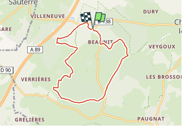
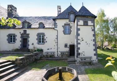
Randonnée Marche de 8,2 km à découvrir à Auvergne-Rhône-Alpes, Puy-de-Dôme, Charbonnières-les-Varennes. Cette randonnée est proposée par jagarnier.
Description
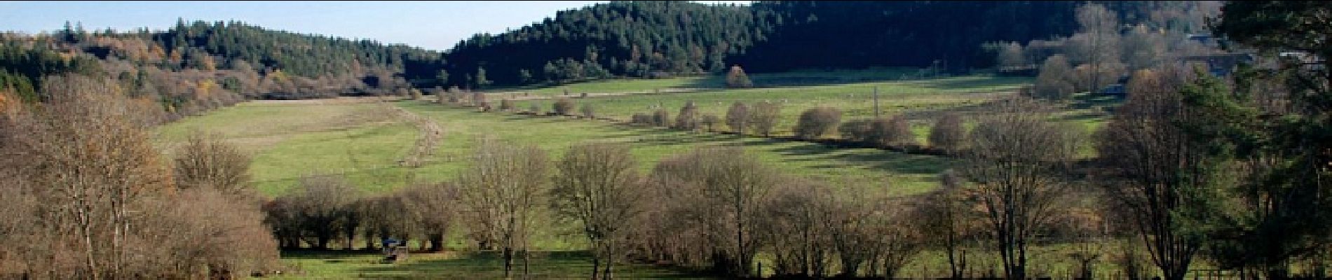
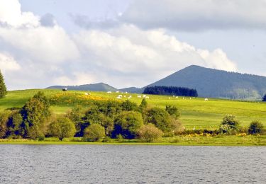
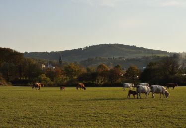
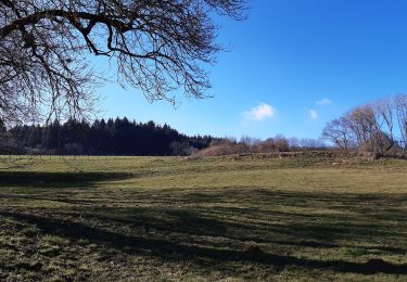
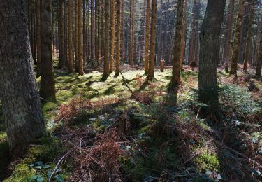
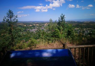
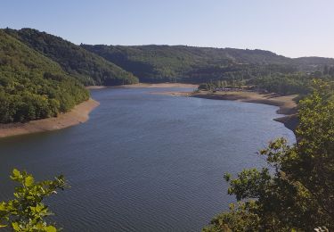
Une agréable balade près de l'ancien maar de Beaunit occupé par une narse (zone humide) et traversé par l'Ambène. Vous bénéficierez de belles vues sur les puys de Paugnat, de la Nugère, de Jumes, Louchadière, Tressous, des Bannières et la carrière de Tunisset.
Localisation
Commentaires
Randonnées à proximité
![Randonnée Marche Pulvérières - Pulverieres_Etang_Grand - Photo](https://media.geolcdn.com/t/375/260/422b13e9-38d7-4e06-b1aa-c671b113145c.jpg&format=jpg&maxdim=2)
![Marche Marche](https://static1.geolcdn.com/sitytour/trail-icons/101.png)
Marche
![](/images/other/stat-length.png)
![](https://static1.geolcdn.com/siteimages/upload/files/16400158638029165_repeat_loop_refresh_sync_direction_icon.png)
![Randonnée A pied Manzat - Aux Sources de la Morge - Photo](https://media.geolcdn.com/t/375/260/5410179d-bc75-4fce-aa40-6165831bf324.jpeg&format=jpg&maxdim=2)
![A pied A pied](https://static1.geolcdn.com/sitytour/trail-icons/100.png)
A pied
![](/images/other/stat-length.png)
![](https://static1.geolcdn.com/siteimages/upload/files/16400158638029165_repeat_loop_refresh_sync_direction_icon.png)
![Randonnée V.T.T. Loubeyrat - camping GCU loubeyrat, gour de tazenat - Photo](https://media.geolcdn.com/t/375/260/c16b9fbd-4727-4221-a9c8-7acae4d3d0c3.jpg&format=jpg&maxdim=2)
![V.T.T. V.T.T.](https://static1.geolcdn.com/sitytour/trail-icons/202.png)
V.T.T.
![](/images/other/stat-length.png)
![](https://static1.geolcdn.com/siteimages/upload/files/16400158638029165_repeat_loop_refresh_sync_direction_icon.png)
![Randonnée A pied Manzat - La Roche de Sauterre - Photo](https://media.geolcdn.com/t/375/260/8dba4542-9ef0-4bdf-8b1f-a5675463ca16.jpeg&format=jpg&maxdim=2)
![A pied A pied](https://static1.geolcdn.com/sitytour/trail-icons/100.png)
A pied
![](/images/other/stat-length.png)
![](https://static1.geolcdn.com/siteimages/upload/files/16400158638029165_repeat_loop_refresh_sync_direction_icon.png)
![Randonnée Marche Charbonnières-les-Varennes - Le Puy de Paugnat - Photo](https://media.geolcdn.com/t/375/260/b631891c-a86d-4ad8-811c-e5b56ec82195.jpg&format=jpg&maxdim=2)
![Marche Marche](https://static1.geolcdn.com/sitytour/trail-icons/101.png)
Marche
![](/images/other/stat-length.png)
![](https://static1.geolcdn.com/siteimages/upload/files/16400158638029165_repeat_loop_refresh_sync_direction_icon.png)
![Randonnée Marche Volvic - La grande Hêtraie et le Puy de Paugnat. - Photo](https://media.geolcdn.com/t/375/260/4c01e6e3-a8bd-4a83-9075-1c0f2c9aafb4.jpg&format=jpg&maxdim=2)
![Marche Marche](https://static1.geolcdn.com/sitytour/trail-icons/101.png)
Marche
![](/images/other/stat-length.png)
![](https://static1.geolcdn.com/siteimages/upload/files/16400158638029165_repeat_loop_refresh_sync_direction_icon.png)
![Randonnée Marche Charbonnières-les-Varennes - Charbonnieres_Manoir_Veygoux - Photo](https://media.geolcdn.com/t/375/260/cfb40e0d-7db6-4903-ba3b-6861e6d3cd75.jpg&format=jpg&maxdim=2)
![Marche Marche](https://static1.geolcdn.com/sitytour/trail-icons/101.png)
Marche
![](/images/other/stat-length.png)
![](https://static1.geolcdn.com/siteimages/upload/files/16400158638029165_repeat_loop_refresh_sync_direction_icon.png)
![Randonnée Course à pied Loubeyrat - jour 11 CAP Jeanot - Photo](https://media.geolcdn.com/t/375/260/ebbe0f7f-e642-4e04-8c2f-02adf97172ae.jpg&format=jpg&maxdim=2)
![Course à pied Course à pied](https://static1.geolcdn.com/sitytour/trail-icons/103.png)
Course à pied
![](/images/other/stat-length.png)
![](https://static1.geolcdn.com/siteimages/upload/files/16400158638029165_repeat_loop_refresh_sync_direction_icon.png)
![Randonnée Marche nordique Volvic - Le tour du Puy de Paugnat - Photo](https://media.geolcdn.com/t/375/260/a63ccebb-0154-469a-b4e3-715c7c47c054.jpg&format=jpg&maxdim=2)
![Marche nordique Marche nordique](https://static1.geolcdn.com/sitytour/trail-icons/102.png)
Marche nordique
![](/images/other/stat-length.png)
![](https://static1.geolcdn.com/siteimages/upload/files/16400158638029165_repeat_loop_refresh_sync_direction_icon.png)