


 - Photo 21")
 - Photo 22")
 - Photo 23")
 - Photo 24")
 - Photo 25")
 - Photo 26")
 - Photo 27")

12,6 km | 27 km-effort

Utilisateur


Application GPS de randonnée GRATUITE
 SityTrail
IGN / Instituts géographiques
SityTrail World
Le monde est à vous
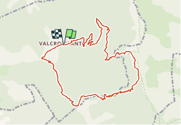
Randonnée Marche de 12 km à découvrir à Auvergne-Rhône-Alpes, Drôme, Die. Cette randonnée est proposée par Philindy26.
Départ de l'Abbaye de Valcroissant à Die (651m)...
Géolocalisation (Google Maps) : https://goo.gl/maps/t38pzYLnE1uLgqq67 .
Montée par le Fays (953 m), les Quatre Chemins (1021 m), le Comptoir à moutons (1520 m).
Là vous pourrez admirer des bouquetins.
Descente par le col de Fauchard (909 m), le col de l'Abbaye (848 m), le pas de la Roche (594 m) et retour sur l'Abbaye.
 - Photo 1")
 - Photo 2")
 - Photo 3")
 - Photo 4")
 - Photo 5")
 - Photo 6")
 - Photo 7")
 - Photo 8")
 - Photo 9")
 - Photo 10")
 - Photo 11")
 - Photo 12")
 - Photo 13")
 - Photo 14")
 - Photo 15")
 - Photo 16")
 - Photo 17")
 - Photo 18")
 - Photo 19")
 - Photo 20")
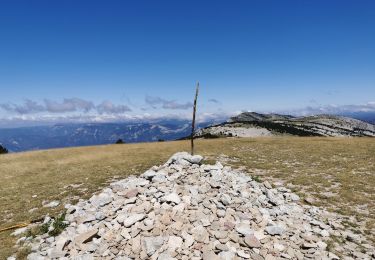
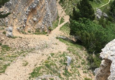
27 photos au total. Cliquez sur une photo pour les afficher toutes dans la galerie.


sport

Marche

Marche

sport

Marche
Marche
Marche
Marche
Marche