![](/images/other/stat-length.png)
![Randonnée Marche Saint-Cast-le-Guildo - PteBay-4Vaux (boucle) - Photo](https://media.geolcdn.com/t/1900/400/ext.pjpeg?maxdim=2&url=https%3A%2F%2Fservices.sitytrail.com%2FGeolivesWS%2FDownloadMedia.ashx%3FTrailID%3D197945%26Media%3D74ddbc39-543e-468b-88d9-ccecf8dda2c9.jpeg)
PteBay-4Vaux (boucle)
douneto
Utilisateur
![Longueur](/images/other/stat-length.png)
Longueur
8,7 km
![Altitude max](https://static1.geolcdn.com/siteimages/upload/files/1508320355ic_sort_altitude_max_24dp.png)
Altitude max
67 m
![Dénivelé positif](https://static1.geolcdn.com/siteimages/upload/files/1508320355ic_sort_den_pos_24dp.png)
Dénivelé positif
145 m
![Km-Effort](/images/other/stat-length.png)
Km-Effort
10,6 km
![Altitude min](https://static1.geolcdn.com/siteimages/upload/files/1508320355ic_sort_altitude_min_24dp.png)
Altitude min
8 m
![Dénivelé négatif](https://static1.geolcdn.com/siteimages/upload/files/1508320355ic_sort_den_neg_24dp.png)
Dénivelé négatif
146 m
![Boucle](https://static1.geolcdn.com/siteimages/upload/files/16400158638029165_repeat_loop_refresh_sync_direction_icon.png)
Boucle
Oui
Date de création :
2019-04-30 14:33:22.823
Dernière modification :
2019-04-30 14:33:23.088
![Marche](https://static1.geolcdn.com/sitytour/trail-icons/101.png)
2h30
Difficulté : Moyen
![Scannez ce code QR pour ouvrir la randonnée dans l'application SityTrail](https://capi.geolives.com/qq0zvz2zws4bq2lad0pu/sitytour/trails/197945/qr.png?size=200)
Application GPS de randonnée GRATUITE
À propos
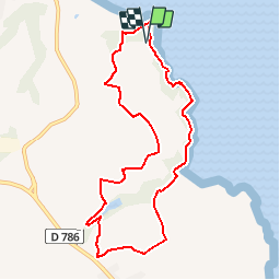
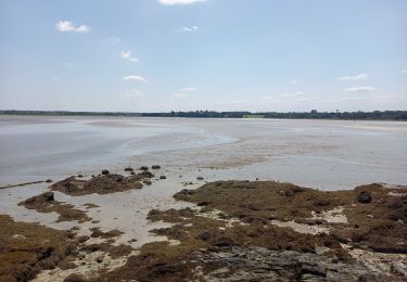
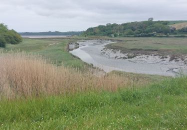
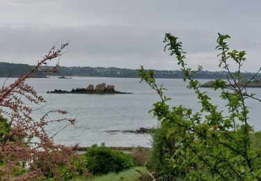
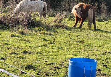
Randonnée Marche de 8,7 km à découvrir à Bretagne, Côtes-d'Armor, Saint-Cast-le-Guildo. Cette randonnée est proposée par douneto.
Description
Rando Juillet 2013
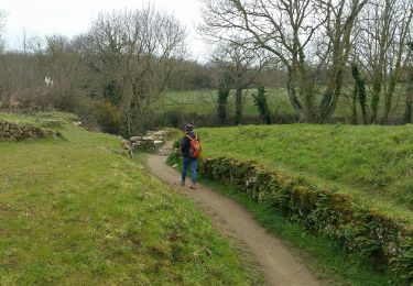
Moitié chemin et moitié route.
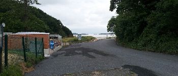
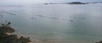
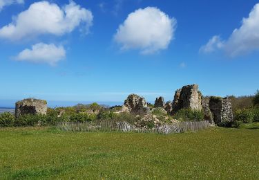
Fin de parcours retour vers pointe du Bay escarpé
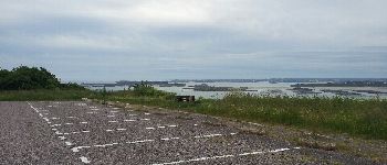
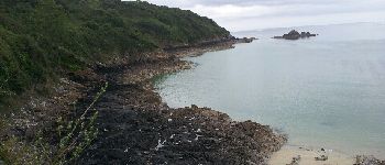
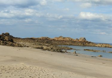
Départ parking de la pointe du Bay
Points d'intérêt
Localisation
Pays :
France
Région :
Bretagne
Département/Province :
Côtes-d'Armor
Commune :
Saint-Cast-le-Guildo
Localité :
Unknown
Départ:(Dec)
Départ:(UTM)
556759 ; 5384203 (30U) N.
Commentaires
Randonnées à proximité
![Randonnée Marche Saint-Cast-le-Guildo - 2017-08 St Cast-le Guildo - Photo](https://media.geolcdn.com/t/375/260/ext.jpg?maxdim=2&url=https%3A%2F%2Fservices.sitytrail.com%2FGeolivesWS%2FDownloadMedia.ashx%3FTrailID%3D820107%26Media%3Dfix__20170828153848.jpg)
![Marche Marche](https://static1.geolcdn.com/sitytour/trail-icons/101.png)
2017-08 St Cast-le Guildo
Marche
Facile
(1)
Saint-Cast-le-Guildo,
Bretagne,
Côtes-d'Armor,
France
![](/images/other/stat-length.png)
12,3 km | 15,6 km-effort
3h 28min
![](https://static1.geolcdn.com/siteimages/upload/files/16400158638029165_repeat_loop_refresh_sync_direction_icon.png)
Oui
![Marche Marche](https://static1.geolcdn.com/sitytour/trail-icons/101.png)
N°8 GR34 St Cast le Guildo -- Le Petit Trécelin
Marche
Très difficile
Saint-Cast-le-Guildo,
Bretagne,
Côtes-d'Armor,
France
![](/images/other/stat-length.png)
18,9 km | 24 km-effort
5h 23min
![](https://static1.geolcdn.com/siteimages/upload/files/16400158638029165_repeat_loop_refresh_sync_direction_icon.png)
Non
![Randonnée Marche Saint-Jacut-de-la-Mer - St Jacut de la Mer 7.7.23 - Photo](https://media.geolcdn.com/t/375/260/7c37f328-93e1-4d4a-83bf-ec0b125bb7cd.jpg&format=jpg&maxdim=2)
![Marche Marche](https://static1.geolcdn.com/sitytour/trail-icons/101.png)
St Jacut de la Mer 7.7.23
Marche
Facile
Saint-Jacut-de-la-Mer,
Bretagne,
Côtes-d'Armor,
France
![](/images/other/stat-length.png)
10,2 km | 11,8 km-effort
3h 20min
![](https://static1.geolcdn.com/siteimages/upload/files/16400158638029165_repeat_loop_refresh_sync_direction_icon.png)
Oui
![Randonnée Marche Saint-Cast-le-Guildo - GR_34_BD_10_St-Cast-Le-Guildo_Frehel_20230507 - Photo](https://media.geolcdn.com/t/375/260/068f3db5-6257-4ba4-9962-6c14136b62c6.jpg&format=jpg&maxdim=2)
![Marche Marche](https://static1.geolcdn.com/sitytour/trail-icons/101.png)
GR_34_BD_10_St-Cast-Le-Guildo_Frehel_20230507
Marche
Facile
Saint-Cast-le-Guildo,
Bretagne,
Côtes-d'Armor,
France
![](/images/other/stat-length.png)
18 km | 22 km-effort
5h 11min
![](https://static1.geolcdn.com/siteimages/upload/files/16400158638029165_repeat_loop_refresh_sync_direction_icon.png)
Non
![Randonnée Marche Saint-Jacut-de-la-Mer - GR_34_BC_09_St-Jacut-De-La-Mer_St-Cast-Le-Guildo_20230506 - Photo](https://media.geolcdn.com/t/375/260/a6421446-397c-40f2-8ef8-6251eb55e355.jpg&format=jpg&maxdim=2)
![Marche Marche](https://static1.geolcdn.com/sitytour/trail-icons/101.png)
GR_34_BC_09_St-Jacut-De-La-Mer_St-Cast-Le-Guildo_20230506
Marche
Facile
Saint-Jacut-de-la-Mer,
Bretagne,
Côtes-d'Armor,
France
![](/images/other/stat-length.png)
18,4 km | 23 km-effort
5h 9min
![](https://static1.geolcdn.com/siteimages/upload/files/16400158638029165_repeat_loop_refresh_sync_direction_icon.png)
Non
![Randonnée Marche Saint-Cast-le-Guildo - les 4 Vaux. Pen Guen - Photo](https://media.geolcdn.com/t/375/260/9c051867-9892-4ee3-a39c-78d231c8b844.jpg&format=jpg&maxdim=2)
![Marche Marche](https://static1.geolcdn.com/sitytour/trail-icons/101.png)
les 4 Vaux. Pen Guen
Marche
Moyen
Saint-Cast-le-Guildo,
Bretagne,
Côtes-d'Armor,
France
![](/images/other/stat-length.png)
6 km | 7,9 km-effort
1h 51min
![](https://static1.geolcdn.com/siteimages/upload/files/16400158638029165_repeat_loop_refresh_sync_direction_icon.png)
Oui
![Randonnée Marche Saint-Jacut-de-la-Mer - îles des hebihens - Photo](https://media.geolcdn.com/t/375/260/62e1a056-179a-4626-b808-38cbde70ac24.jpg&format=jpg&maxdim=2)
![Marche Marche](https://static1.geolcdn.com/sitytour/trail-icons/101.png)
îles des hebihens
Marche
Facile
Saint-Jacut-de-la-Mer,
Bretagne,
Côtes-d'Armor,
France
![](/images/other/stat-length.png)
7,5 km | 8,7 km-effort
2h 5min
![](https://static1.geolcdn.com/siteimages/upload/files/16400158638029165_repeat_loop_refresh_sync_direction_icon.png)
Oui
![Randonnée A pied Beaussais-sur-Mer - Chemin des Dolmens - Photo](https://media.geolcdn.com/t/375/260/5f97a76e-17db-4c60-a005-1a71e6a46136.jpeg&format=jpg&maxdim=2)
![A pied A pied](https://static1.geolcdn.com/sitytour/trail-icons/100.png)
Chemin des Dolmens
A pied
Facile
Beaussais-sur-Mer,
Bretagne,
Côtes-d'Armor,
France
![](/images/other/stat-length.png)
8,3 km | 9,5 km-effort
2h 8min
![](https://static1.geolcdn.com/siteimages/upload/files/16400158638029165_repeat_loop_refresh_sync_direction_icon.png)
Oui
![Randonnée Marche Créhen - St Jacut - île Ebihens - Photo](https://media.geolcdn.com/t/375/260/3210441b-681a-44fd-a32e-b60ec43af4b1.jpg&format=jpg&maxdim=2)
![Marche Marche](https://static1.geolcdn.com/sitytour/trail-icons/101.png)
St Jacut - île Ebihens
Marche
Facile
Créhen,
Bretagne,
Côtes-d'Armor,
France
![](/images/other/stat-length.png)
17,9 km | 21 km-effort
4h 15min
![](https://static1.geolcdn.com/siteimages/upload/files/16400158638029165_repeat_loop_refresh_sync_direction_icon.png)
Oui