


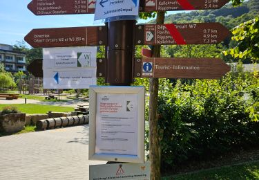
5,8 km | 7,3 km-effort


Utilisateur


Application GPS de randonnée GRATUITE
 SityTrail
IGN / Instituts géographiques
SityTrail World
Le monde est à vous
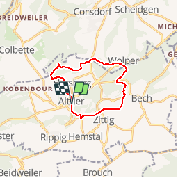
Randonnée Marche de 9,9 km à découvrir à Inconnu, Canton Echternach, Bech. Cette randonnée est proposée par flip96.
Müllerthal Extra Trail C 10km.
Gestart in Altrier waar parkeerplaats is aan kruising Op der Schanz met Heeschbregerwee.
Mooie, eenvoudige wandeling.
Opmerkingen? flip96@home.nl

Marche

Marche

Marche

Marche

Marche

Marche

Autre activité
Marche
Marche