![](/images/other/stat-length.png)
![Randonnée Course à pied Moëlan-sur-Mer - Balade de l'Allée Couverte et de la Fontaine de Sainte Thumette - Kersaux - Photo](https://media.geolcdn.com/t/1900/400/ext.pjpeg?maxdim=2&url=https%3A%2F%2Fservices.sitytrail.com%2FGeolivesWS%2FDownloadMedia.ashx%3FTrailID%3D191632%26Media%3D15274_3.jpg)
Balade de l'Allée Couverte et de la Fontaine de Sainte Thumette - Kersaux
tracegps
Utilisateur
![Longueur](/images/other/stat-length.png)
![Altitude max](https://static1.geolcdn.com/siteimages/upload/files/1508320355ic_sort_altitude_max_24dp.png)
![Dénivelé positif](https://static1.geolcdn.com/siteimages/upload/files/1508320355ic_sort_den_pos_24dp.png)
![Km-Effort](/images/other/stat-length.png)
![Altitude min](https://static1.geolcdn.com/siteimages/upload/files/1508320355ic_sort_altitude_min_24dp.png)
![Dénivelé négatif](https://static1.geolcdn.com/siteimages/upload/files/1508320355ic_sort_den_neg_24dp.png)
![Boucle](https://static1.geolcdn.com/siteimages/upload/files/16400158638029165_repeat_loop_refresh_sync_direction_icon.png)
![Course à pied](https://static1.geolcdn.com/sitytour/trail-icons/103.png)
1h00
Difficulté : Moyen
![Scannez ce code QR pour ouvrir la randonnée dans l'application SityTrail](https://capi.geolives.com/qq0zvz2zws4bq2lad0pu/sitytour/trails/191632/qr.png?size=200)
Application GPS de randonnée GRATUITE
À propos
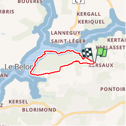
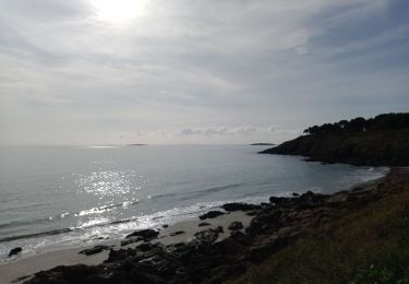
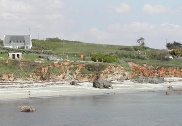
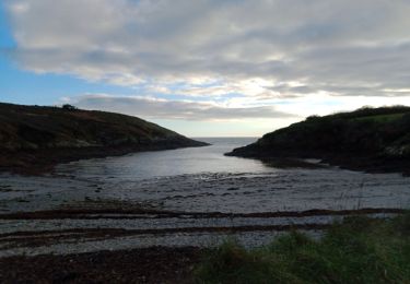
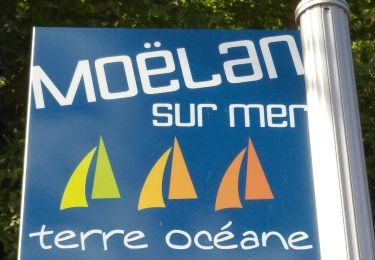
Randonnée Course à pied de 4,4 km à découvrir à Bretagne, Finistère, Moëlan-sur-Mer. Cette randonnée est proposée par tracegps.
Description
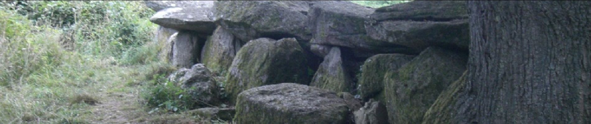
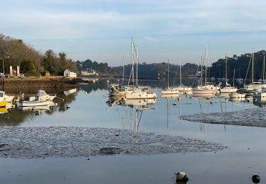
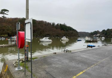
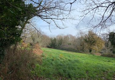
Jolie petite balade au départ de Kersaux (Kersauz) en passant par la fontaine et les sous bois le long de la rivière de Belon. Observez l'autre rive avec une superbe petite chapelle et une ostréiculture. A la sortie du bois, vous découvrirez une allée couverte remarquable pour traverser un petit village et rentrer à Kersaux par un sentier boisé.
Localisation
Commentaires
Randonnées à proximité
![Randonnée Marche Moëlan-sur-Mer - Belon 16 km - Photo](https://media.geolcdn.com/t/375/260/8216e2e0-afdb-49ef-bc45-06fb5d915a7a.jpg&format=jpg&maxdim=2)
![Marche Marche](https://static1.geolcdn.com/sitytour/trail-icons/101.png)
Marche
![](/images/other/stat-length.png)
![](https://static1.geolcdn.com/siteimages/upload/files/16400158638029165_repeat_loop_refresh_sync_direction_icon.png)
![Randonnée Marche Moëlan-sur-Mer - Merrien Doelan cote 11,5 km - Photo](https://media.geolcdn.com/t/375/260/599544b5-7665-42c5-9bba-b91c68249624.jpg&format=jpg&maxdim=2)
![Marche Marche](https://static1.geolcdn.com/sitytour/trail-icons/101.png)
Marche
![](/images/other/stat-length.png)
![](https://static1.geolcdn.com/siteimages/upload/files/16400158638029165_repeat_loop_refresh_sync_direction_icon.png)
![Randonnée Marche Névez - NEVEZ - Photo](https://media.geolcdn.com/t/375/260/f96a5c93-27bb-45a4-9758-032ea0ee3857.jpg&format=jpg&maxdim=2)
![Marche Marche](https://static1.geolcdn.com/sitytour/trail-icons/101.png)
![Randonnée Marche Moëlan-sur-Mer - routoirs à lin de Pouldouran - Photo](https://media.geolcdn.com/t/375/260/3361eba2-e966-4e2b-bed4-315e6af4295a.jpg&format=jpg&maxdim=2)
![Marche Marche](https://static1.geolcdn.com/sitytour/trail-icons/101.png)
Marche
![](/images/other/stat-length.png)
![](https://static1.geolcdn.com/siteimages/upload/files/16400158638029165_repeat_loop_refresh_sync_direction_icon.png)
![Randonnée A pied Moëlan-sur-Mer - FR-5 - Photo](https://media.geolcdn.com/t/375/260/7377c7e2-944d-4023-9c3d-895707207e3a.jpeg&format=jpg&maxdim=2)
![A pied A pied](https://static1.geolcdn.com/sitytour/trail-icons/100.png)
![Randonnée Marche Moëlan-sur-Mer - MOELAN Sur MER - Photo](https://media.geolcdn.com/t/375/260/9f5d6a9f-89a4-4a35-9d4e-86b22f763fe6.jpg&format=jpg&maxdim=2)
![Marche Marche](https://static1.geolcdn.com/sitytour/trail-icons/101.png)
Marche
![](/images/other/stat-length.png)
![](https://static1.geolcdn.com/siteimages/upload/files/16400158638029165_repeat_loop_refresh_sync_direction_icon.png)
![Randonnée Marche Moëlan-sur-Mer - MOËLAN sur MER - Photo](https://media.geolcdn.com/t/375/260/50c1b4de-5d6a-4ed2-b104-4b49e23459a5.jpg&format=jpg&maxdim=2)
![Marche Marche](https://static1.geolcdn.com/sitytour/trail-icons/101.png)
Marche
![](/images/other/stat-length.png)
![](https://static1.geolcdn.com/siteimages/upload/files/16400158638029165_repeat_loop_refresh_sync_direction_icon.png)
![Randonnée Marche Moëlan-sur-Mer - Belon 5,6 km - Photo](https://media.geolcdn.com/t/375/260/8ab5e063-1a65-4f04-9262-32fd932aab57.jpg&format=jpg&maxdim=2)
![Marche Marche](https://static1.geolcdn.com/sitytour/trail-icons/101.png)
![Randonnée Marche Névez - Port Menech 16 juin 19 - Photo](https://media.geolcdn.com/t/375/260/729938cc-6031-4199-8e1b-5827b94df26a.jpg&format=jpg&maxdim=2)
![Marche Marche](https://static1.geolcdn.com/sitytour/trail-icons/101.png)
Marche
![](/images/other/stat-length.png)
![](https://static1.geolcdn.com/siteimages/upload/files/16400158638029165_repeat_loop_refresh_sync_direction_icon.png)