![](/images/other/stat-length.png)
![Randonnée Marche Joyeuse - Le balcon du Freyssinet - Joyeuse - Photo](https://media.geolcdn.com/t/1900/400/ext.pjpeg?maxdim=2&url=https%3A%2F%2Fservices.sitytrail.com%2FGeolivesWS%2FDownloadMedia.ashx%3FTrailID%3D191628%26Media%3D15269_1.jpg)
Le balcon du Freyssinet - Joyeuse
tracegps
Utilisateur
![Longueur](/images/other/stat-length.png)
Longueur
6,7 km
![Altitude max](https://static1.geolcdn.com/siteimages/upload/files/1508320355ic_sort_altitude_max_24dp.png)
Altitude max
294 m
![Dénivelé positif](https://static1.geolcdn.com/siteimages/upload/files/1508320355ic_sort_den_pos_24dp.png)
Dénivelé positif
172 m
![Km-Effort](/images/other/stat-length.png)
Km-Effort
9 km
![Altitude min](https://static1.geolcdn.com/siteimages/upload/files/1508320355ic_sort_altitude_min_24dp.png)
Altitude min
160 m
![Dénivelé négatif](https://static1.geolcdn.com/siteimages/upload/files/1508320355ic_sort_den_neg_24dp.png)
Dénivelé négatif
170 m
![Boucle](https://static1.geolcdn.com/siteimages/upload/files/16400158638029165_repeat_loop_refresh_sync_direction_icon.png)
Boucle
Oui
Date de création :
2014-12-10 00:00:00.0
Dernière modification :
2014-12-10 00:00:00.0
![Marche](https://static1.geolcdn.com/sitytour/trail-icons/101.png)
1h45
Difficulté : Moyen
![Scannez ce code QR pour ouvrir la randonnée dans l'application SityTrail](https://capi.geolives.com/qq0zvz2zws4bq2lad0pu/sitytour/trails/191628/qr.png?size=200)
Application GPS de randonnée GRATUITE
À propos
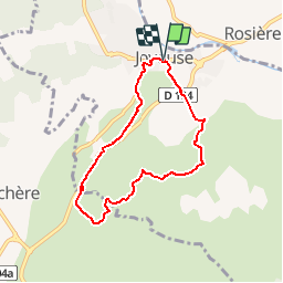
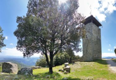
Randonnée Marche de 6,7 km à découvrir à Auvergne-Rhône-Alpes, Ardèche, Joyeuse. Cette randonnée est proposée par tracegps.
Description
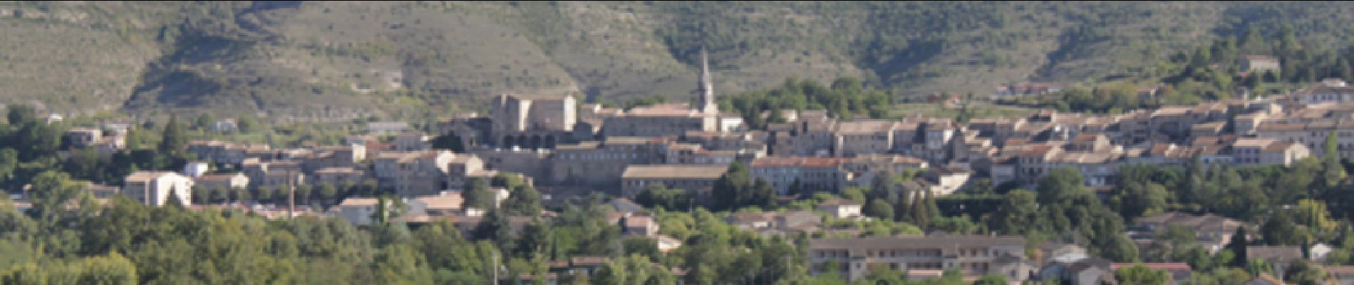
Balade proposée dans le Topo-Guide Ardèche. Départ de l'office du tourisme de Joyeuse pour cette boucle de 6,8 km qui vous fera découvrir les hauteurs entre Joyeuse et la côte du Freyssinet.
Localisation
Pays :
France
Région :
Auvergne-Rhône-Alpes
Département/Province :
Ardèche
Commune :
Joyeuse
Localité :
Unknown
Départ:(Dec)
Départ:(UTM)
598725 ; 4925923 (31T) N.
Commentaires
Randonnées à proximité
![Randonnée Marche Labeaume - Jardins suspendus de Labeaume - Photo](https://media.geolcdn.com/t/375/260/ext.jpg?maxdim=2&url=https%3A%2F%2Fservices.sitytrail.com%2FGeolivesWS%2FDownloadMedia.ashx%3FTrailID%3D339442%26Media%3Dfix__20140402152412.jpg)
![Marche Marche](https://static1.geolcdn.com/sitytour/trail-icons/101.png)
Jardins suspendus de Labeaume
Marche
Moyen
(1)
Labeaume,
Auvergne-Rhône-Alpes,
Ardèche,
France
![](/images/other/stat-length.png)
4,7 km | 6,6 km-effort
1h 31min
![](https://static1.geolcdn.com/siteimages/upload/files/16400158638029165_repeat_loop_refresh_sync_direction_icon.png)
Oui
![Randonnée Marche nordique Labeaume - labeaume chapias - Photo](https://media.geolcdn.com/t/375/260/ext.jpg?maxdim=2&url=https%3A%2F%2Fstatic1.geolcdn.com%2Fsiteimages%2Fupload%2Ffiles%2F1545311037marcheuse_200dpi.jpg)
![Marche nordique Marche nordique](https://static1.geolcdn.com/sitytour/trail-icons/102.png)
labeaume chapias
Marche nordique
Facile
(1)
Labeaume,
Auvergne-Rhône-Alpes,
Ardèche,
France
![](/images/other/stat-length.png)
12,7 km | 16,3 km-effort
2h 59min
![](https://static1.geolcdn.com/siteimages/upload/files/16400158638029165_repeat_loop_refresh_sync_direction_icon.png)
Oui
![Randonnée Marche Vernon - Vernon Tour de Brison 20km - Photo](https://media.geolcdn.com/t/375/260/1d443c17-2f68-4a33-bd33-d422959f5b68.jpg&format=jpg&maxdim=2)
![Marche Marche](https://static1.geolcdn.com/sitytour/trail-icons/101.png)
Vernon Tour de Brison 20km
Marche
Difficile
Vernon,
Auvergne-Rhône-Alpes,
Ardèche,
France
![](/images/other/stat-length.png)
19,9 km | 29 km-effort
6h 0min
![](https://static1.geolcdn.com/siteimages/upload/files/16400158638029165_repeat_loop_refresh_sync_direction_icon.png)
Oui
![Randonnée Marche Labeaume - Labaume - Photo](https://media.geolcdn.com/t/375/260/100f777b-ca43-4f22-8315-f8e51f0fe1ef.jpg&format=jpg&maxdim=2)
![Marche Marche](https://static1.geolcdn.com/sitytour/trail-icons/101.png)
Labaume
Marche
Moyen
(1)
Labeaume,
Auvergne-Rhône-Alpes,
Ardèche,
France
![](/images/other/stat-length.png)
13,4 km | 17,8 km-effort
5h 20min
![](https://static1.geolcdn.com/siteimages/upload/files/16400158638029165_repeat_loop_refresh_sync_direction_icon.png)
Oui
![Randonnée Marche Vernon - 07 Vernon 25 02 2021 - Photo](https://media.geolcdn.com/t/375/260/bf74ca26-a5ee-4a75-afb9-c1a8b51eb415.jpg&format=jpg&maxdim=2)
![Marche Marche](https://static1.geolcdn.com/sitytour/trail-icons/101.png)
07 Vernon 25 02 2021
Marche
Moyen
Vernon,
Auvergne-Rhône-Alpes,
Ardèche,
France
![](/images/other/stat-length.png)
16,7 km | 25 km-effort
4h 10min
![](https://static1.geolcdn.com/siteimages/upload/files/16400158638029165_repeat_loop_refresh_sync_direction_icon.png)
Oui
![Randonnée Marche Labeaume - Chapias - Photo](https://media.geolcdn.com/t/375/260/ext.jpg?maxdim=2&url=https%3A%2F%2Fstatic1.geolcdn.com%2Fsiteimages%2Fupload%2Ffiles%2F1553511878bg_sport_marche.png)
![Marche Marche](https://static1.geolcdn.com/sitytour/trail-icons/101.png)
Chapias
Marche
Moyen
(3)
Labeaume,
Auvergne-Rhône-Alpes,
Ardèche,
France
![](/images/other/stat-length.png)
10,3 km | 13,5 km-effort
3h 14min
![](https://static1.geolcdn.com/siteimages/upload/files/16400158638029165_repeat_loop_refresh_sync_direction_icon.png)
Oui
![Randonnée Course à pied Rosières - 13km - Photo](https://media.geolcdn.com/t/375/260/61681b10-36d4-4fbe-858a-0651fc8e085a.jpg&format=jpg&maxdim=2)
![Course à pied Course à pied](https://static1.geolcdn.com/sitytour/trail-icons/103.png)
13km
Course à pied
Très facile
Rosières,
Auvergne-Rhône-Alpes,
Ardèche,
France
![](/images/other/stat-length.png)
13,6 km | 16,1 km-effort
1h 34min
![](https://static1.geolcdn.com/siteimages/upload/files/16400158638029165_repeat_loop_refresh_sync_direction_icon.png)
Oui
![Randonnée Marche Labeaume - ARDECHE. LA BAUME. GORGES DE LA BAUME. LEBAUME.DOLMENS OE - Photo](https://media.geolcdn.com/t/375/260/7366c34a-b7d9-48a0-ae49-28be0ea93c3a.jpg&format=jpg&maxdim=2)
![Marche Marche](https://static1.geolcdn.com/sitytour/trail-icons/101.png)
ARDECHE. LA BAUME. GORGES DE LA BAUME. LEBAUME.DOLMENS OE
Marche
Moyen
Labeaume,
Auvergne-Rhône-Alpes,
Ardèche,
France
![](/images/other/stat-length.png)
12,5 km | 15,9 km-effort
4h 13min
![](https://static1.geolcdn.com/siteimages/upload/files/16400158638029165_repeat_loop_refresh_sync_direction_icon.png)
Oui
![Randonnée A pied Vernon - Vernon: La Tour de Brison. 20km - Photo](https://media.geolcdn.com/t/375/260/a0f7fd93-7ab0-4ce0-97c8-d7d4367da763.jpg&format=jpg&maxdim=2)
![A pied A pied](https://static1.geolcdn.com/sitytour/trail-icons/100.png)
Vernon: La Tour de Brison. 20km
A pied
Difficile
Vernon,
Auvergne-Rhône-Alpes,
Ardèche,
France
![](/images/other/stat-length.png)
19,7 km | 29 km-effort
6h 28min
![](https://static1.geolcdn.com/siteimages/upload/files/16400158638029165_repeat_loop_refresh_sync_direction_icon.png)
Oui
👍
cool