


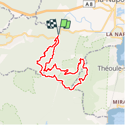

9 km | 14,2 km-effort

Utilisateur


Application GPS de randonnée GRATUITE
 SityTrail
IGN / Instituts géographiques
SityTrail World
Le monde est à vous
Randonnée Marche de 16,1 km à découvrir à Provence-Alpes-Côte d'Azur, Var, Fréjus. Cette randonnée est proposée par tracegps.
Randonnée de 16km pour 700m de dénivelé. Suivre le vallon des 3 Termes pour rejoindre la piste des "Œufs de Bouc", passer entre le Mt. St. Martin et le Mt. Pelet. Aller-retour possible jusqu'au sommet du Mt. Pelet d'où l'on bénéficie d'un superbe panorama sur l'Estérel. (dans ce cas ajouter environ 1 km et 100 m de dénivelé). Descendre jusqu'au pont Sarrazin puis remonter vers le col de la Cadière. De là, gagner le col des Trois Termes puis retour en passant par la Baisse du Sablier.
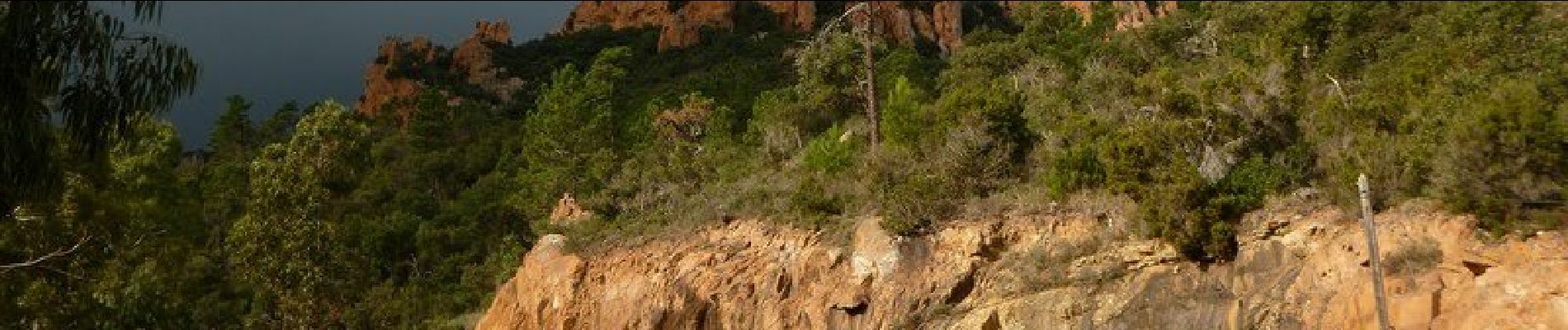
 au col des 3 Termes par le pont Sarrazin - St Jean de Cannes - Photo 1")
 au col des 3 Termes par le pont Sarrazin - St Jean de Cannes - Photo 2")
 au col des 3 Termes par le pont Sarrazin - St Jean de Cannes - Photo 3")
 au col des 3 Termes par le pont Sarrazin - St Jean de Cannes - Photo 4")
 au col des 3 Termes par le pont Sarrazin - St Jean de Cannes - Photo 5")
 au col des 3 Termes par le pont Sarrazin - St Jean de Cannes - Photo 6")

Marche

Marche

A pied

Marche
Marche

Marche

Marche

Marche
Marche