![](/images/other/stat-length.png)
![Randonnée V.T.T. Barrême - Espace VTT - FFC du Verdon et des Vallées de l'Asse - Le Tour de Lieye n°15 - Barrême - Photo](https://media.geolcdn.com/t/1900/400/ext.pjpeg?maxdim=2&url=https%3A%2F%2Fservices.sitytrail.com%2FGeolivesWS%2FDownloadMedia.ashx%3FTrailID%3D191439%26Media%3D15027_3.jpg)
Espace VTT - FFC du Verdon et des Vallées de l'Asse - Le Tour de Lieye n°15 - Barrême
tracegps
Utilisateur
![Longueur](/images/other/stat-length.png)
![Altitude max](https://static1.geolcdn.com/siteimages/upload/files/1508320355ic_sort_altitude_max_24dp.png)
![Dénivelé positif](https://static1.geolcdn.com/siteimages/upload/files/1508320355ic_sort_den_pos_24dp.png)
![Km-Effort](/images/other/stat-length.png)
![Altitude min](https://static1.geolcdn.com/siteimages/upload/files/1508320355ic_sort_altitude_min_24dp.png)
![Dénivelé négatif](https://static1.geolcdn.com/siteimages/upload/files/1508320355ic_sort_den_neg_24dp.png)
![Boucle](https://static1.geolcdn.com/siteimages/upload/files/16400158638029165_repeat_loop_refresh_sync_direction_icon.png)
![V.T.T.](https://static1.geolcdn.com/sitytour/trail-icons/202.png)
2h30
Difficulté : Difficile
![Scannez ce code QR pour ouvrir la randonnée dans l'application SityTrail](https://capi.geolives.com/qq0zvz2zws4bq2lad0pu/sitytour/trails/191439/qr.png?size=200)
Application GPS de randonnée GRATUITE
À propos
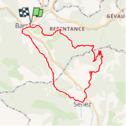
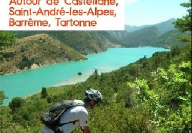
Randonnée V.T.T. de 19 km à découvrir à Provence-Alpes-Côte d'Azur, Alpes-de-Haute-Provence, Barrême. Cette randonnée est proposée par tracegps.
Description
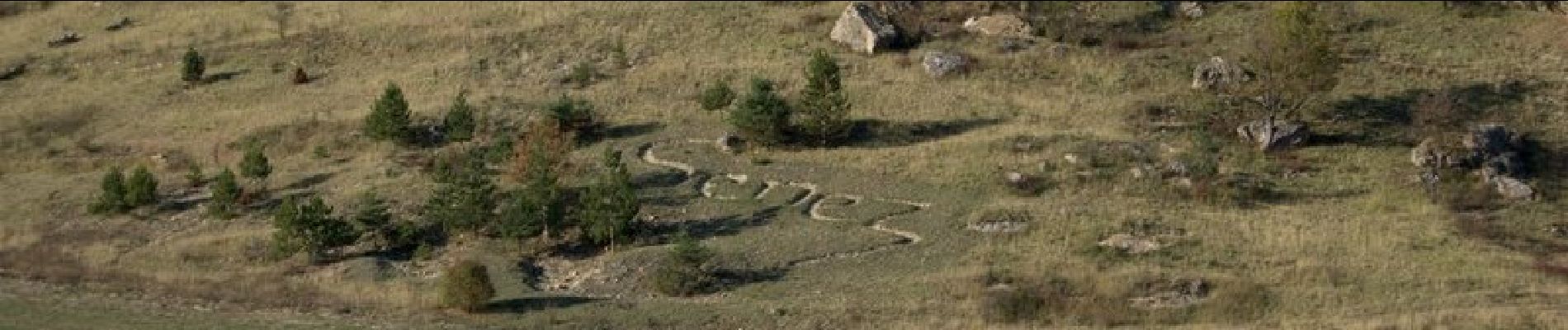
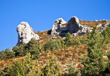
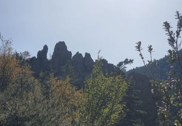
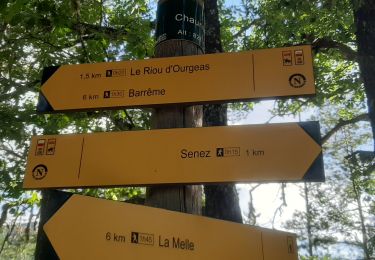
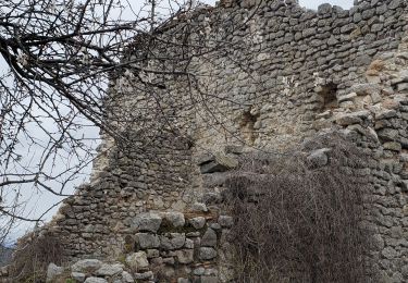
Circuit proposé par l'Espace VTT - FFC du Verdon et des Vallées de l'Asse et la Communauté de Communes du Moyen Verdon. Circuit officiel labellisé par la Fédération Française de Cyclisme. Départ du parking St-Antoine sur la N 202 à Barrême. Après avoir quitté le village en passant devant l'ancienne distillerie de lavande, le parcours débute en empruntant la Voie Impériale en rive gauche de l'Asse de Blieux (alternance piste / single) puis rejoint Senez, ancien évêché avec son palais épiscopal et sa superbe cathédrale classée. Une montée sur petite route permet d'atteindre le col de la Pierre Plantée à partir duquel l'itinéraire continue à grimper vers le sommet de Lièye sur une piste carrossable. La descente sur Barrême s'effectue par un single très ludique sinuant à travers une hêtraie somptueuse, puis le long d'une croupe jusqu'aux prairies pastorales d'Arbitelle.
Localisation
Commentaires
Randonnées à proximité
![Randonnée Marche Senez - La Voie Impériale (Etape 2 : Senez - Chaudon-Norante (La Clappe)) - Photo](https://media.geolcdn.com/t/375/260/ext.jpg?maxdim=2&url=https%3A%2F%2Fservices.sitytrail.com%2FGeolivesWS%2FDownloadMedia.ashx%3FTrailID%3D191398%26Media%3D14973_3.jpg)
![Marche Marche](https://static1.geolcdn.com/sitytour/trail-icons/101.png)
Marche
![](/images/other/stat-length.png)
![](https://static1.geolcdn.com/siteimages/upload/files/16400158638029165_repeat_loop_refresh_sync_direction_icon.png)
![Randonnée Marche Barrême - 18-10-2022 Pied Marcelin - Château plus haut - Photo](https://media.geolcdn.com/t/375/260/95321ed0-8bdf-4371-8c77-b796551d86e3.jpg&format=jpg&maxdim=2)
![Marche Marche](https://static1.geolcdn.com/sitytour/trail-icons/101.png)
Marche
![](/images/other/stat-length.png)
![](https://static1.geolcdn.com/siteimages/upload/files/16400158638029165_repeat_loop_refresh_sync_direction_icon.png)
![Randonnée Marche Senez - SENEZ , clue de la Melle. , chapelle de la Melle , o s - Photo](https://media.geolcdn.com/t/375/260/65810687-8f9e-42d8-af58-1816ae33fe23.jpg&format=jpg&maxdim=2)
![Marche Marche](https://static1.geolcdn.com/sitytour/trail-icons/101.png)
Marche
![](/images/other/stat-length.png)
![](https://static1.geolcdn.com/siteimages/upload/files/16400158638029165_repeat_loop_refresh_sync_direction_icon.png)
![Randonnée Marche Saint-Jacques - SAINT JACQUES. PRE DE SIROM . ENTRE PUY , PIED MARCELLIN . Chateau plus haut , Chaudon , col de Chaudon , - Photo](https://media.geolcdn.com/t/375/260/10843d7f-6054-4b63-b0e2-784a6ac69544.jpg&format=jpg&maxdim=2)
![Marche Marche](https://static1.geolcdn.com/sitytour/trail-icons/101.png)
Marche
![](/images/other/stat-length.png)
![](https://static1.geolcdn.com/siteimages/upload/files/16400158638029165_repeat_loop_refresh_sync_direction_icon.png)
![Randonnée Marche Barrême - barrême chateau plus haut chaudon 19.5km 860m - Photo](https://media.geolcdn.com/t/375/260/84d893d5-e67c-4bae-9aa3-757788e39a80.jpg&format=jpg&maxdim=2)
![Marche Marche](https://static1.geolcdn.com/sitytour/trail-icons/101.png)
Marche
![](/images/other/stat-length.png)
![](https://static1.geolcdn.com/siteimages/upload/files/16400158638029165_repeat_loop_refresh_sync_direction_icon.png)
![Randonnée Cheval Senez - La Voie Impériale (Etape 2 : Senez - Chaudon-Norante (La Clappe)) - Photo](https://media.geolcdn.com/t/375/260/ext.jpg?maxdim=2&url=https%3A%2F%2Fservices.sitytrail.com%2FGeolivesWS%2FDownloadMedia.ashx%3FTrailID%3D191399%26Media%3D14973_6.jpg)
![Cheval Cheval](https://static1.geolcdn.com/sitytour/trail-icons/300.png)
Cheval
![](/images/other/stat-length.png)
![](https://static1.geolcdn.com/siteimages/upload/files/16400158638029165_repeat_loop_refresh_sync_direction_icon.png)
![Randonnée Marche Barrême - Barème-château plus haut-St Jacques - Photo](https://media.geolcdn.com/t/375/260/9c47007e-bff7-429d-a65c-2f3c50e199d7.jpg&format=jpg&maxdim=2)
![Marche Marche](https://static1.geolcdn.com/sitytour/trail-icons/101.png)
Marche
![](/images/other/stat-length.png)
![](https://static1.geolcdn.com/siteimages/upload/files/16400158638029165_repeat_loop_refresh_sync_direction_icon.png)
![Randonnée A pied Chaudon-Norante - Château plus Haut - Photo](https://media.geolcdn.com/t/375/260/ext.jpg?maxdim=2&url=https%3A%2F%2Fstatic1.geolcdn.com%2Fsiteimages%2Fupload%2Ffiles%2F1545311037marcheuse_200dpi.jpg)
![A pied A pied](https://static1.geolcdn.com/sitytour/trail-icons/100.png)
A pied
![](/images/other/stat-length.png)
![](https://static1.geolcdn.com/siteimages/upload/files/16400158638029165_repeat_loop_refresh_sync_direction_icon.png)
![Randonnée V.T.T. Barrême - Espace VTT - FFC du Verdon et des Vallées de l'Asse - le tour des Barres n°16 - Barrême - Photo](https://media.geolcdn.com/t/375/260/ext.jpg?maxdim=2&url=https%3A%2F%2Fservices.sitytrail.com%2FGeolivesWS%2FDownloadMedia.ashx%3FTrailID%3D191459%26Media%3D15053_2.jpg)
![V.T.T. V.T.T.](https://static1.geolcdn.com/sitytour/trail-icons/202.png)
V.T.T.
![](/images/other/stat-length.png)
![](https://static1.geolcdn.com/siteimages/upload/files/16400158638029165_repeat_loop_refresh_sync_direction_icon.png)