Randonnée Marche Larochette - Mullerthal Extra Trail A - Photo

Mullerthal Extra Trail A

 flip96
flip96

Utilisateur

© OpenStreetMap contributors
Longueur
Longueur
25 km
Altitude max
Altitude max
426 m
Dénivelé positif
Dénivelé positif
656 m
Km-Effort
Km-Effort  
34 km
Altitude min
Altitude min
256 m
Dénivelé négatif
Dénivelé négatif
662 m
Boucle
Boucle
Oui
Date de création :
2014-12-10 00:00:00.0
Dernière modification :
2014-12-10 00:00:00.0

(0 Avis)

Marche
Marche
4h00
Difficulté : Moyen

Scannez ce code QR pour ouvrir la randonnée dans l'application SityTrail

Application GPS de randonnée GRATUITE

Logo SityTrail SityTrail

IGN / Instituts géographiques

Télécharger SityTrail sur l'App Store Télécharger SityTrail sur Google Play

Logo SityTrail SityTrail World

Le monde est à vous

Télécharger SityTrail sur l'App Store Télécharger SityTrail sur Google Play Télécharger SityTrail sur Huawei AppGallery

À propos

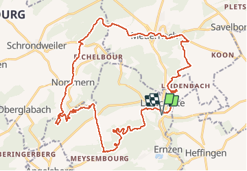
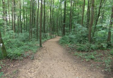
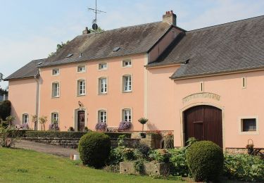
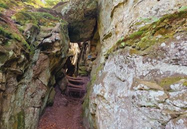
Randonnée Marche de 25 km à découvrir à Inconnu, Canton Mersch, Larochette. Cette randonnée est proposée par flip96.

Description

Extra trail A van Mullerthal Trail. Gestart in Larochette, parkeren nabij Rue de Mersch is gratis.
Opmerkingen? flip96@home.nl


Profil altimétrique

Localisation

Pays :
Luxembourg
Région :
Inconnu
Département/Province :
Canton Mersch
Commune :
Larochette
Localité :
Unknown
Départ:(Dec)
Départ:(UTM)
299769 ; 5518228 (32U) N.

Randonnées à proximité

Randonnée Marche Larochette - MÜLLERTHAL  (Larochette -superbe parcours ds les formations rocheuses) - Photo
Marche
GerardBouche

Marche

Facile
(1)
Larochette, Inconnu, Canton Mersch, Luxembourg
12,5 km | 16,5 km-effort
3h 31min
Oui
Randonnée Marche Vallée de l'Ernz - Medernach M4 - Müllerthal  - Photo
Marche
GUIDE
mumu.larandonneuse

Marche

Moyen
(1)
Vallée de l'Ernz, Inconnu, Canton Diekirch, Luxembourg
13,7 km | 19,5 km-effort
4h 25min
Oui
Randonnée A pied Larochette - Rundwanderweg L4 - Photo
A pied
PRO

A pied

Facile
Larochette, Inconnu, Canton Mersch, Luxembourg
10,9 km | 14,7 km-effort
3h 19min
Oui
Randonnée A pied Waldbillig - W1 Hiking Tour - Photo
A pied
PRO

A pied

Facile
Waldbillig, Inconnu, Canton Echternach, Luxembourg
6,8 km | 8,4 km-effort
1h 54min
Oui
Randonnée A pied Waldbillig - W5 Hiking Tour - Photo
A pied
PRO

A pied

Facile
Waldbillig, Inconnu, Canton Echternach, Luxembourg
10,2 km | 13,7 km-effort
3h 6min
Oui
Randonnée A pied Larochette - Rundwanderweg L2 - Photo
A pied
PRO

A pied

Facile
(1)
Larochette, Inconnu, Canton Mersch, Luxembourg
8,1 km | 10,3 km-effort
2h 21min
Non
Randonnée Marche Junglinster - Itinérant Luxembourg Jour 3: Graulinster- Echternach - Photo
Marche
chessyca

Marche

Très difficile
Junglinster, Inconnu, Canton Grevenmacher, Luxembourg
30 km | 37 km-effort
6h 51min
Non
Randonnée A pied Vallée de l'Ernz - M5 - Medernach - Photo
A pied
PRO

A pied

Facile
Vallée de l'Ernz, Inconnu, Canton Diekirch, Luxembourg
8 km | 10,7 km-effort
2h 25min
Oui
Randonnée A pied Larochette - M4 - Medernach - Photo
A pied
PRO

A pied

Facile
(1)
Larochette, Inconnu, Canton Mersch, Luxembourg
7,6 km | 10 km-effort
2h 16min
Oui


Fermer
Mes abonnements