![](/images/other/stat-length.png)
![Randonnée Marche Wincrange - ESCAPARDENNE EISLECK TRAIL - Etape 3 - Asselborn - Houffalize - Photo](https://media.geolcdn.com/t/1900/400/ext.pjpeg?maxdim=2&url=https%3A%2F%2Fservices.sitytrail.com%2FGeolivesWS%2FDownloadMedia.ashx%3FTrailID%3D186895%26Media%3Da5b80c1c-f23e-4376-a571-c75287df618e.jpg)
ESCAPARDENNE EISLECK TRAIL - Etape 3 - Asselborn - Houffalize
Escapardenne
Escapardenne, évadez-vous du quotidien GUIDE+
![Longueur](/images/other/stat-length.png)
![Altitude max](https://static1.geolcdn.com/siteimages/upload/files/1508320355ic_sort_altitude_max_24dp.png)
![Dénivelé positif](https://static1.geolcdn.com/siteimages/upload/files/1508320355ic_sort_den_pos_24dp.png)
![Km-Effort](/images/other/stat-length.png)
![Altitude min](https://static1.geolcdn.com/siteimages/upload/files/1508320355ic_sort_altitude_min_24dp.png)
![Dénivelé négatif](https://static1.geolcdn.com/siteimages/upload/files/1508320355ic_sort_den_neg_24dp.png)
![Boucle](https://static1.geolcdn.com/siteimages/upload/files/16400158638029165_repeat_loop_refresh_sync_direction_icon.png)
![Marche](https://static1.geolcdn.com/sitytour/trail-icons/101.png)
--
Difficulté : Inconnu
![Scannez ce code QR pour ouvrir la randonnée dans l'application SityTrail](https://capi.geolives.com/qq0zvz2zws4bq2lad0pu/sitytour/trails/186895/qr.png?size=200)
Application GPS de randonnée GRATUITE
À propos
Randonnée Marche de 22 km à découvrir à Inconnu, Canton Clervaux, Wincrange. Cette randonnée est proposée par Escapardenne.
Description
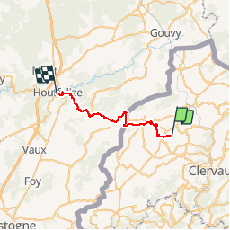
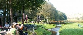
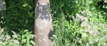
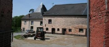
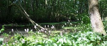
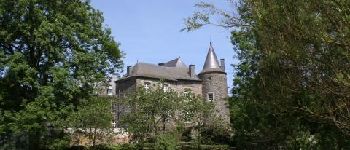
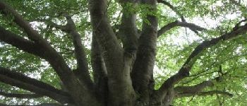
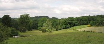
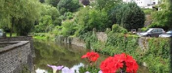
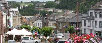
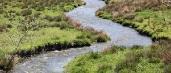
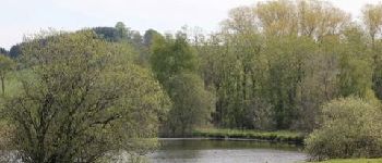
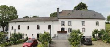
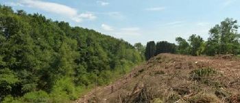
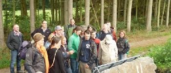
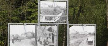
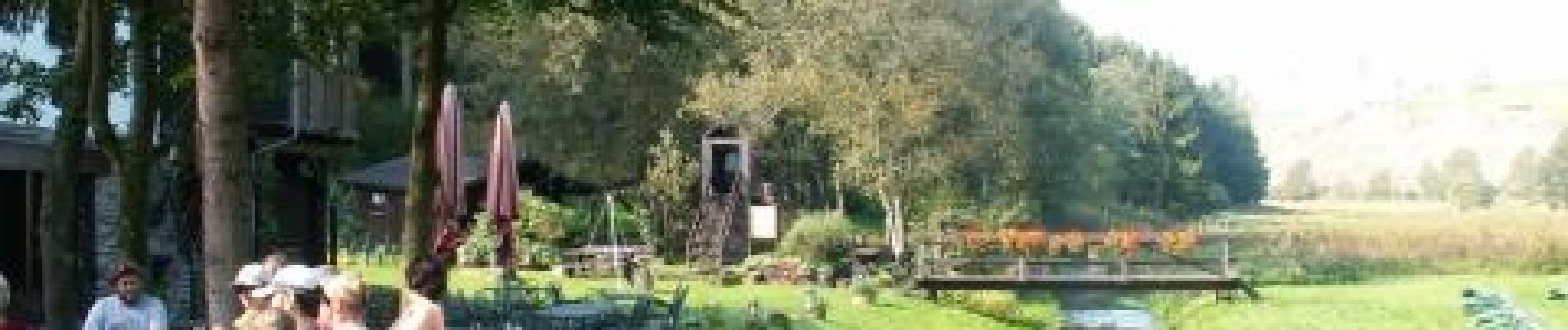
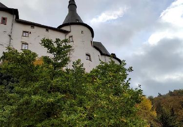
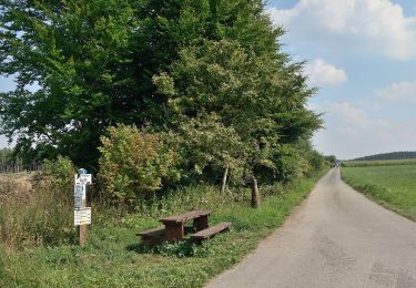
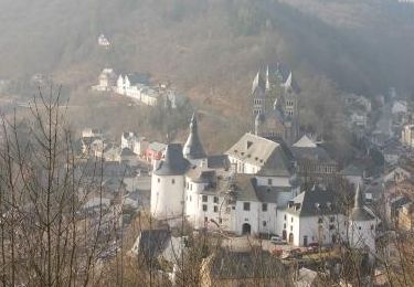
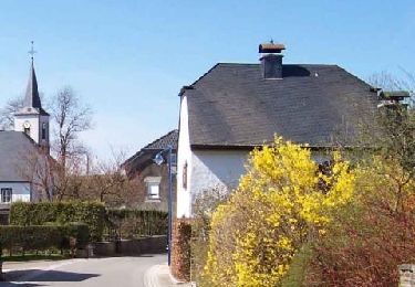
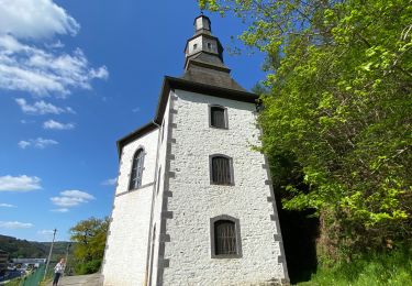
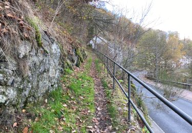
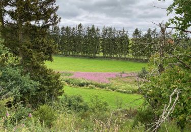
Au départ du moulin d’Asselborn le chemin suit la vallée jusqu’au site d’Emeschbaach traversant de riches zones naturelles et protégées. La randonnée rejoint ensuite le plateau agricole avant d’atteindre les étangs de Weiler et de continuer vers Hoffelt, près des vestiges du canal entre Meuse et Moselle. La frontière est toute proche… après avir arpenté la ligne frère, la borne 265 marque l’entrée en Belgique. Buret, Bernistap, Tavigny… trois villages pour évoquer ici aussi les travaux pharaoniques de Guillaume d’Orange ! Le sentier se dirige vers Alhoumont et la vue se dégage. Pas pour bien longtemps car l’ensemble forestier des Blancs Bois conduit le randonneur vers l’Ermitage et la Fosse d’Outh avant d’atteindre la sympathique cité de Houffalize.
Points d'intérêt
Localisation
Commentaires
Randonnées à proximité
![Randonnée Marche Clervaux - Clervaux - Sentier local CL 5 - Photo](https://media.geolcdn.com/t/375/260/4d9c17af-90bd-4623-96d9-f2a288b490ef.jpg&format=jpg&maxdim=2)
![Marche Marche](https://static1.geolcdn.com/sitytour/trail-icons/101.png)
Marche
![](/images/other/stat-length.png)
![](https://static1.geolcdn.com/siteimages/upload/files/16400158638029165_repeat_loop_refresh_sync_direction_icon.png)
![Randonnée Marche Clervaux - Clervaux - Sentier local CL 2 - Photo](https://media.geolcdn.com/t/375/260/378df12a-c7ca-4826-9832-7c942624e739.jpg&format=jpg&maxdim=2)
![Marche Marche](https://static1.geolcdn.com/sitytour/trail-icons/101.png)
Marche
![](/images/other/stat-length.png)
![](https://static1.geolcdn.com/siteimages/upload/files/16400158638029165_repeat_loop_refresh_sync_direction_icon.png)
![Randonnée Marche Clervaux - Eislek Pad Clervaux - Photo](https://media.geolcdn.com/t/375/260/a09f0ff8-a7ec-4176-a920-c74694117be0.jpg&format=jpg&maxdim=2)
![Marche Marche](https://static1.geolcdn.com/sitytour/trail-icons/101.png)
Marche
![](/images/other/stat-length.png)
![](https://static1.geolcdn.com/siteimages/upload/files/16400158638029165_repeat_loop_refresh_sync_direction_icon.png)
![Randonnée A pied Wincrange - Autopédestre Hachiville - Photo](https://media.geolcdn.com/t/375/260/4ecbbf06-7efa-45c5-b0a1-f1e080ea6e0f.jpeg&format=jpg&maxdim=2)
![A pied A pied](https://static1.geolcdn.com/sitytour/trail-icons/100.png)
A pied
![](/images/other/stat-length.png)
![](https://static1.geolcdn.com/siteimages/upload/files/16400158638029165_repeat_loop_refresh_sync_direction_icon.png)
![Randonnée Marche Clervaux - Boucle Les paysages cachés - Tronçon 4 - Clervaux - Kautenbach - Photo](https://media.geolcdn.com/t/375/260/ext.jpg?maxdim=2&url=https%3A%2F%2Fservices.sitytrail.com%2FGeolivesWS%2FDownloadMedia.ashx%3FTrailID%3D186890%26Media%3D90f81d4e-606b-4dcc-b8fd-d174effe43fc.jpg)
![Marche Marche](https://static1.geolcdn.com/sitytour/trail-icons/101.png)
Marche
![](/images/other/stat-length.png)
![](https://static1.geolcdn.com/siteimages/upload/files/16400158638029165_repeat_loop_refresh_sync_direction_icon.png)
![Randonnée Marche Troisvierges - Boucle Entre Woltz et Our - Tronçon 1 - Troisvierges - Weiswampach - Photo](https://media.geolcdn.com/t/375/260/ext.jpg?maxdim=2&url=https%3A%2F%2Fservices.sitytrail.com%2FGeolivesWS%2FDownloadMedia.ashx%3FTrailID%3D186885%26Media%3Ddf1dbdd6-bafa-4baa-8694-c7fed5adc463.jpg)
![Marche Marche](https://static1.geolcdn.com/sitytour/trail-icons/101.png)
Marche
![](/images/other/stat-length.png)
![](https://static1.geolcdn.com/siteimages/upload/files/16400158638029165_repeat_loop_refresh_sync_direction_icon.png)
![Randonnée Marche Clervaux - Randonnée CL02 - Photo](https://media.geolcdn.com/t/375/260/bb422fcb-3477-43d2-8ac8-41400bf08bbc.jpeg&format=jpg&maxdim=2)
![Marche Marche](https://static1.geolcdn.com/sitytour/trail-icons/101.png)
Marche
![](/images/other/stat-length.png)
![](https://static1.geolcdn.com/siteimages/upload/files/16400158638029165_repeat_loop_refresh_sync_direction_icon.png)
![Randonnée Marche Clervaux - Clervaux Abbaye et Mecher 10 km boucle - Photo](https://media.geolcdn.com/t/375/260/511fe587-f595-4c49-b220-32b06facd07f.jpg&format=jpg&maxdim=2)
![Marche Marche](https://static1.geolcdn.com/sitytour/trail-icons/101.png)
Marche
![](/images/other/stat-length.png)
![](https://static1.geolcdn.com/siteimages/upload/files/16400158638029165_repeat_loop_refresh_sync_direction_icon.png)
![Randonnée Marche Wincrange - Escapardenne Eisleck Trail: Moulin d'Asselborn - Houffalize - Photo](https://media.geolcdn.com/t/375/260/92df795c-9ebe-4619-8d75-350f07c2d083.jpeg&format=jpg&maxdim=2)
![Marche Marche](https://static1.geolcdn.com/sitytour/trail-icons/101.png)
Marche
![](/images/other/stat-length.png)
![](https://static1.geolcdn.com/siteimages/upload/files/16400158638029165_repeat_loop_refresh_sync_direction_icon.png)