![](/images/other/stat-length.png)
![Randonnée Marche Gouvy - Boucle - Du Plateau des Tailles à Bernistap - Tronçon 3 - Steinbach - Houffalize - Photo](https://media.geolcdn.com/t/1900/400/ext.pjpeg?maxdim=2&url=https%3A%2F%2Fservices.sitytrail.com%2FGeolivesWS%2FDownloadMedia.ashx%3FTrailID%3D186875%26Media%3D56d9d03f-ff6b-405c-8f93-286875e8ff90.jpg)
Boucle - Du Plateau des Tailles à Bernistap - Tronçon 3 - Steinbach - Houffalize
Escapardenne
Escapardenne, évadez-vous du quotidien GUIDE+
![Longueur](/images/other/stat-length.png)
![Altitude max](https://static1.geolcdn.com/siteimages/upload/files/1508320355ic_sort_altitude_max_24dp.png)
![Dénivelé positif](https://static1.geolcdn.com/siteimages/upload/files/1508320355ic_sort_den_pos_24dp.png)
![Km-Effort](/images/other/stat-length.png)
![Altitude min](https://static1.geolcdn.com/siteimages/upload/files/1508320355ic_sort_altitude_min_24dp.png)
![Dénivelé négatif](https://static1.geolcdn.com/siteimages/upload/files/1508320355ic_sort_den_neg_24dp.png)
![Boucle](https://static1.geolcdn.com/siteimages/upload/files/16400158638029165_repeat_loop_refresh_sync_direction_icon.png)
![Marche](https://static1.geolcdn.com/sitytour/trail-icons/101.png)
--
Difficulté : Inconnu
![Scannez ce code QR pour ouvrir la randonnée dans l'application SityTrail](https://capi.geolives.com/qq0zvz2zws4bq2lad0pu/sitytour/trails/186875/qr.png?size=200)
Application GPS de randonnée GRATUITE
À propos
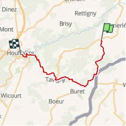
Randonnée Marche de 16,2 km à découvrir à Wallonie, Luxembourg, Gouvy. Cette randonnée est proposée par Escapardenne.
Description
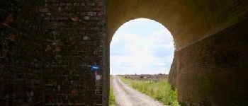
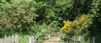
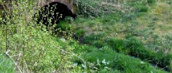
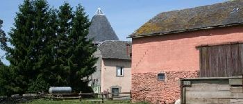
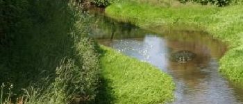
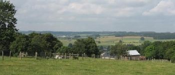
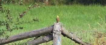
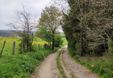
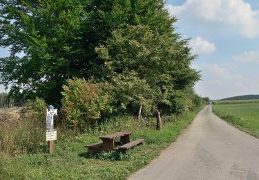
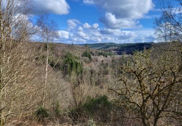
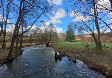
Tronçon 3 de la boucle "Du plateau des Tailles au canal de Bernistap" (55 Km).Au départ de Houffalize, la boucle - partagée en trois étapes - vous emmène vers le village d’Achouffe et la Vallée des Fées. En traversant le Bois de la Cedrogne vous vous dirigez vers les Fagnes. Après avoir enjambé l’autoroute E 25, vous prenez la direction de la commune de Gouvy où vous traversez les villages de Mont-le-Ban, Cherain, Rettigny et Steinbach. A la frontière belgo luxembourgeoise, vous retrouvez le tracé du Trail en passant par le canal de Bernistap pour rejoindre ensuite Houffalize. Bonne randonnée!
Points d'intérêt
Localisation
Commentaires
Randonnées à proximité
![Randonnée Marche Gouvy - Au fil de l'eau - Gouvy - Photo](https://media.geolcdn.com/t/375/260/fd3fbf79-417f-4fef-bcc5-76d7dce912c8.jpg&format=jpg&maxdim=2)
![Marche Marche](https://static1.geolcdn.com/sitytour/trail-icons/101.png)
Marche
![](/images/other/stat-length.png)
![](https://static1.geolcdn.com/siteimages/upload/files/16400158638029165_repeat_loop_refresh_sync_direction_icon.png)
![Randonnée A pied Wincrange - Autopédestre Hachiville - Photo](https://media.geolcdn.com/t/375/260/4ecbbf06-7efa-45c5-b0a1-f1e080ea6e0f.jpeg&format=jpg&maxdim=2)
![A pied A pied](https://static1.geolcdn.com/sitytour/trail-icons/100.png)
A pied
![](/images/other/stat-length.png)
![](https://static1.geolcdn.com/siteimages/upload/files/16400158638029165_repeat_loop_refresh_sync_direction_icon.png)
![Randonnée sport Houffalize - Le canal de Bernistap - Photo](https://media.geolcdn.com/t/375/260/ext.jpg?maxdim=2&url=https%3A%2F%2Fsecurestorage.geolives.com%2Fsitytour%2Ftrail-bg%2Fdefault.jpg)
sport
![](/images/other/stat-length.png)
![](https://static1.geolcdn.com/siteimages/upload/files/16400158638029165_repeat_loop_refresh_sync_direction_icon.png)
![Randonnée Marche Houffalize - CETTURU 2018 - Photo](https://media.geolcdn.com/t/375/260/ext.jpg?maxdim=2&url=https%3A%2F%2Fstatic1.geolcdn.com%2Fsiteimages%2Fupload%2Ffiles%2F1553511878bg_sport_marche.png)
![Marche Marche](https://static1.geolcdn.com/sitytour/trail-icons/101.png)
Marche
![](/images/other/stat-length.png)
![](https://static1.geolcdn.com/siteimages/upload/files/16400158638029165_repeat_loop_refresh_sync_direction_icon.png)
![Randonnée Marche Gouvy - Cherain - Gouvy - Photo](https://media.geolcdn.com/t/375/260/ext.jpg?maxdim=2&url=https%3A%2F%2Fstatic1.geolcdn.com%2Fsiteimages%2Fupload%2Ffiles%2F1553511878bg_sport_marche.png)
![Marche Marche](https://static1.geolcdn.com/sitytour/trail-icons/101.png)
Marche
![](/images/other/stat-length.png)
![](https://static1.geolcdn.com/siteimages/upload/files/16400158638029165_repeat_loop_refresh_sync_direction_icon.png)
![Randonnée Marche Houffalize - Tavigny de groene parels Houffalize - 12 km RT - Photo](https://media.geolcdn.com/t/375/260/ext.jpg?maxdim=2&url=https%3A%2F%2Fstatic1.geolcdn.com%2Fsiteimages%2Fupload%2Ffiles%2F1553511878bg_sport_marche.png)
![Marche Marche](https://static1.geolcdn.com/sitytour/trail-icons/101.png)
Marche
![](/images/other/stat-length.png)
![](https://static1.geolcdn.com/siteimages/upload/files/16400158638029165_repeat_loop_refresh_sync_direction_icon.png)
![Randonnée Marche Houffalize - Cetturu 060224 - Photo](https://media.geolcdn.com/t/375/260/c7cd2281-794f-430a-8f14-1eb98b48be19.jpg&format=jpg&maxdim=2)
![Marche Marche](https://static1.geolcdn.com/sitytour/trail-icons/101.png)
Marche
![](/images/other/stat-length.png)
![](https://static1.geolcdn.com/siteimages/upload/files/16400158638029165_repeat_loop_refresh_sync_direction_icon.png)
![Randonnée Marche Houffalize - rando cetturu - Photo](https://media.geolcdn.com/t/375/260/2974781e-72aa-4c37-9db3-3c845619ad8d.jpg&format=jpg&maxdim=2)
![Marche Marche](https://static1.geolcdn.com/sitytour/trail-icons/101.png)
Marche
![](/images/other/stat-length.png)
![](https://static1.geolcdn.com/siteimages/upload/files/16400158638029165_repeat_loop_refresh_sync_direction_icon.png)
![Randonnée A pied Gouvy - GrWandARd 33:Brisy bossen en weiden aan de Oost-Ourthe - Photo](https://media.geolcdn.com/t/375/260/4e1c6be1-5137-443f-a562-71a83efe2499.jpg&format=jpg&maxdim=2)
![A pied A pied](https://static1.geolcdn.com/sitytour/trail-icons/100.png)
A pied
![](/images/other/stat-length.png)
![](https://static1.geolcdn.com/siteimages/upload/files/16400158638029165_repeat_loop_refresh_sync_direction_icon.png)
tronçon 3