


12,1 km | 25 km-effort


Utilisateur


Application GPS de randonnée GRATUITE
 SityTrail
IGN / Instituts géographiques
SityTrail World
Le monde est à vous
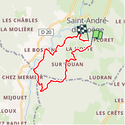
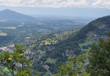
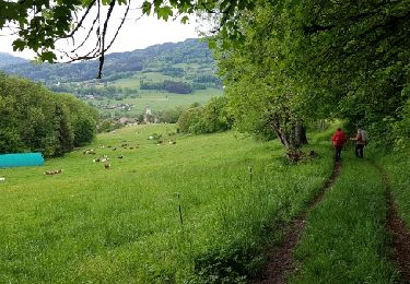
Randonnée Cheval de 6,6 km à découvrir à Auvergne-Rhône-Alpes, Haute-Savoie, Saint-André-de-Boëge. Cette randonnée est proposée par badello.
Montée progressive dans les bois depuis Saint-André avant une grande descente (raide par endroits et empruntée aussi par les VTT), passage par la meulière à Vachat et retour en montée non loin de la Menoge. Courte balade, avec de bons dénivelés.
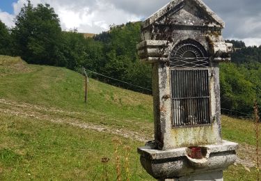
 - Photo 1")
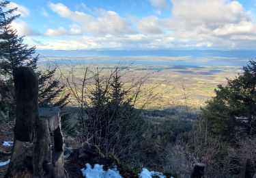
 - Photo 2")
Marche
Marche
Marche
Marche
Marche

A pied

Marche

Ski de randonnée

V.T.T.