![](/images/other/stat-length.png)
![Randonnée Marche Cheillé - Cheillé - Photo](https://media.geolcdn.com/t/1900/400/ext.pjpeg?maxdim=2&url=https%3A%2F%2Fservices.sitytrail.com%2FGeolivesWS%2FDownloadMedia.ashx%3FTrailID%3D184021%26Media%3Dee00f109-a916-49d7-bc23-60fc10b2e139.jpg)
Cheillé
LEMENIO
Utilisateur
![Longueur](/images/other/stat-length.png)
Longueur
4,8 km
![Altitude max](https://static1.geolcdn.com/siteimages/upload/files/1508320355ic_sort_altitude_max_24dp.png)
Altitude max
97 m
![Dénivelé positif](https://static1.geolcdn.com/siteimages/upload/files/1508320355ic_sort_den_pos_24dp.png)
Dénivelé positif
98 m
![Km-Effort](/images/other/stat-length.png)
Km-Effort
6,1 km
![Altitude min](https://static1.geolcdn.com/siteimages/upload/files/1508320355ic_sort_altitude_min_24dp.png)
Altitude min
41 m
![Dénivelé négatif](https://static1.geolcdn.com/siteimages/upload/files/1508320355ic_sort_den_neg_24dp.png)
Dénivelé négatif
100 m
![Boucle](https://static1.geolcdn.com/siteimages/upload/files/16400158638029165_repeat_loop_refresh_sync_direction_icon.png)
Boucle
Oui
Date de création :
2014-12-10 00:00:00.0
Dernière modification :
2014-12-10 00:00:00.0
![Marche](https://static1.geolcdn.com/sitytour/trail-icons/101.png)
1h18
Difficulté : Très facile
![Scannez ce code QR pour ouvrir la randonnée dans l'application SityTrail](https://capi.geolives.com/qq0zvz2zws4bq2lad0pu/sitytour/trails/184021/qr.png?size=200)
Application GPS de randonnée GRATUITE
À propos
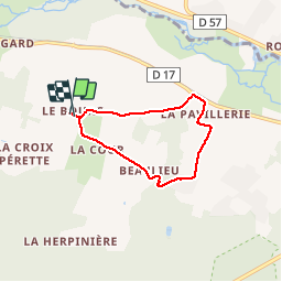
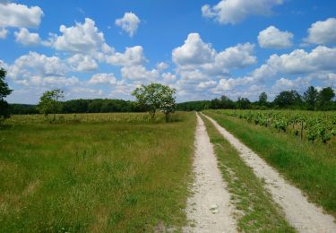
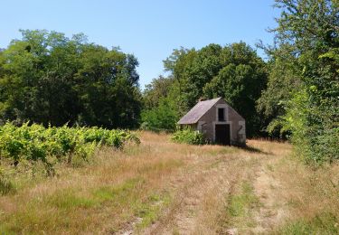
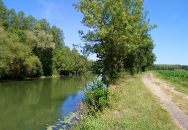
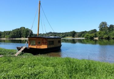
Randonnée Marche de 4,8 km à découvrir à Centre-Val de Loire, Indre-et-Loire, Cheillé. Cette randonnée est proposée par LEMENIO.
Description
Départ place de l'église : Commencer le circuit en montant la côte à gauche. cliquer sur l'icône du circuit pour photo et histoire.
Localisation
Pays :
France
Région :
Centre-Val de Loire
Département/Province :
Indre-et-Loire
Commune :
Cheillé
Localité :
Unknown
Départ:(Dec)
Départ:(UTM)
303748 ; 5237419 (31T) N.
Commentaires
Randonnées à proximité
![Randonnée Marche Rivarennes - Rivarennes - Zig zag GR3 Cheillé - 23.4km 405m 5h05 (50mn) - 2024 06 09 - Photo](https://media.geolcdn.com/t/375/260/a700836a-a1be-4ab5-8f09-42ab101fa387.jpg&format=jpg&maxdim=2)
![Marche Marche](https://static1.geolcdn.com/sitytour/trail-icons/101.png)
Rivarennes - Zig zag GR3 Cheillé - 23.4km 405m 5h05 (50mn) - 2024 06 09
Marche
Moyen
Rivarennes,
Centre-Val de Loire,
Indre-et-Loire,
France
![](/images/other/stat-length.png)
23 km | 29 km-effort
5h 5min
![](https://static1.geolcdn.com/siteimages/upload/files/16400158638029165_repeat_loop_refresh_sync_direction_icon.png)
Oui
![Randonnée Marche Lignières-de-Touraine - Lignières-de-Touraine - Zig zag Château de l'Islette - 25.9km 365m 5h30 (30mn) - 2024 05 26 - Photo](https://media.geolcdn.com/t/375/260/185ea1ff-808f-469f-bf38-e6f6a9b76503.jpg&format=jpg&maxdim=2)
![Marche Marche](https://static1.geolcdn.com/sitytour/trail-icons/101.png)
Lignières-de-Touraine - Zig zag Château de l'Islette - 25.9km 365m 5h30 (30mn...
Marche
Facile
Lignières-de-Touraine,
Centre-Val de Loire,
Indre-et-Loire,
France
![](/images/other/stat-length.png)
25 km | 30 km-effort
5h 30min
![](https://static1.geolcdn.com/siteimages/upload/files/16400158638029165_repeat_loop_refresh_sync_direction_icon.png)
Oui
![Randonnée Marche Cheillé - Cheillé - GR3 Abbaye de Turpenay Château de la Cour - 18.9km 280m 4h05 - 2022 02 05 - Photo](https://media.geolcdn.com/t/375/260/b7e79bc0-bce7-46b1-93d1-40c275ee6472.jpg&format=jpg&maxdim=2)
![Marche Marche](https://static1.geolcdn.com/sitytour/trail-icons/101.png)
Cheillé - GR3 Abbaye de Turpenay Château de la Cour - 18.9km 280m 4h05 - 2022...
Marche
Moyen
Cheillé,
Centre-Val de Loire,
Indre-et-Loire,
France
![](/images/other/stat-length.png)
18,9 km | 23 km-effort
4h 5min
![](https://static1.geolcdn.com/siteimages/upload/files/16400158638029165_repeat_loop_refresh_sync_direction_icon.png)
Oui
![Randonnée Marche Azay-le-Rideau - Azay-le-Rideau - l'Islette - 17km 220m 4h05 (20mn) - 2021 06 12 - Photo](https://media.geolcdn.com/t/375/260/ed17a717-c8e8-4396-b1e0-0d3bc31c4be8.jpg&format=jpg&maxdim=2)
![Marche Marche](https://static1.geolcdn.com/sitytour/trail-icons/101.png)
Azay-le-Rideau - l'Islette - 17km 220m 4h05 (20mn) - 2021 06 12
Marche
Facile
Azay-le-Rideau,
Centre-Val de Loire,
Indre-et-Loire,
France
![](/images/other/stat-length.png)
17 km | 20 km-effort
4h 5min
![](https://static1.geolcdn.com/siteimages/upload/files/16400158638029165_repeat_loop_refresh_sync_direction_icon.png)
Oui
![Randonnée Marche Cheillé - Cheillé - Circuits 1 et 2 - 13.2km 225m 2h40 - 2020 07 18 - Photo](https://media.geolcdn.com/t/375/260/6e9838f9-1aad-41b5-8530-bd037ffd24b6.jpg&format=jpg&maxdim=2)
![Marche Marche](https://static1.geolcdn.com/sitytour/trail-icons/101.png)
Cheillé - Circuits 1 et 2 - 13.2km 225m 2h40 - 2020 07 18
Marche
Facile
Cheillé,
Centre-Val de Loire,
Indre-et-Loire,
France
![](/images/other/stat-length.png)
13,2 km | 16,2 km-effort
2h 40min
![](https://static1.geolcdn.com/siteimages/upload/files/16400158638029165_repeat_loop_refresh_sync_direction_icon.png)
Oui
![Randonnée Marche Rivarennes - Rivarennes - Circuit 1 - 18.2km 225m 3h55 - 2020 07 13 - Photo](https://media.geolcdn.com/t/375/260/787eacec-2808-4b7a-b7e4-990b0e9f64fa.jpg&format=jpg&maxdim=2)
![Marche Marche](https://static1.geolcdn.com/sitytour/trail-icons/101.png)
Rivarennes - Circuit 1 - 18.2km 225m 3h55 - 2020 07 13
Marche
Facile
Rivarennes,
Centre-Val de Loire,
Indre-et-Loire,
France
![](/images/other/stat-length.png)
18,2 km | 21 km-effort
3h 55min
![](https://static1.geolcdn.com/siteimages/upload/files/16400158638029165_repeat_loop_refresh_sync_direction_icon.png)
Oui
![Randonnée Marche Lignières-de-Touraine - Lignières-de-Touraine - la Chapelle-aux-Naux circuits 1 et 2 - 24km 175m 4h45 (45mn) - 2016 08 07 - Photo](https://media.geolcdn.com/t/375/260/ext.jpg?maxdim=2&url=https%3A%2F%2Fservices.sitytrail.com%2FGeolivesWS%2FDownloadMedia.ashx%3FTrailID%3D613659%26Media%3Dfix__20160807145330.jpg)
![Marche Marche](https://static1.geolcdn.com/sitytour/trail-icons/101.png)
Lignières-de-Touraine - la Chapelle-aux-Naux circuits 1 et 2 - 24km 175m 4h45...
Marche
Moyen
Lignières-de-Touraine,
Centre-Val de Loire,
Indre-et-Loire,
France
![](/images/other/stat-length.png)
24 km | 27 km-effort
4h 45min
![](https://static1.geolcdn.com/siteimages/upload/files/16400158638029165_repeat_loop_refresh_sync_direction_icon.png)
Oui
![Randonnée Marche Lignières-de-Touraine - Lignière de Touraine-Le 26-09-2013- Distance 10,4 km - Auteur tintin37 - Photo](https://media.geolcdn.com/t/375/260/ext.jpg?maxdim=2&url=https%3A%2F%2Fstatic1.geolcdn.com%2Fsiteimages%2Fupload%2Ffiles%2F1553511878bg_sport_marche.png)
![Marche Marche](https://static1.geolcdn.com/sitytour/trail-icons/101.png)
Lignière de Touraine-Le 26-09-2013- Distance 10,4 km - Auteur tintin37
Marche
Moyen
(2)
Lignières-de-Touraine,
Centre-Val de Loire,
Indre-et-Loire,
France
![](/images/other/stat-length.png)
10,4 km | 11,8 km-effort
2h 30min
![](https://static1.geolcdn.com/siteimages/upload/files/16400158638029165_repeat_loop_refresh_sync_direction_icon.png)
Oui
![Randonnée Vélo Cheillé - Au Pays d'Azay-le-Rideau - Photo](https://media.geolcdn.com/t/375/260/ext.jpg?maxdim=2&url=https%3A%2F%2Fstatic1.geolcdn.com%2Fsiteimages%2Fupload%2Ffiles%2F1524743154velo.jpg)
![Vélo Vélo](https://static1.geolcdn.com/sitytour/trail-icons/200.png)
Au Pays d'Azay-le-Rideau
Vélo
Facile
(1)
Cheillé,
Centre-Val de Loire,
Indre-et-Loire,
France
![](/images/other/stat-length.png)
53 km | 58 km-effort
2h 40min
![](https://static1.geolcdn.com/siteimages/upload/files/16400158638029165_repeat_loop_refresh_sync_direction_icon.png)
Non