![](/images/other/stat-length.png)
![Randonnée Marche Eupen - Ternell - Circuit Natura 2000, des sites qui valent le détour - Lg12 - Photo](https://media.geolcdn.com/t/1900/400/ext.pjpeg?maxdim=2&url=https%3A%2F%2Fservices.sitytrail.com%2FGeolivesWS%2FDownloadMedia.ashx%3FTrailID%3D182858%26Media%3Da7d1c14e-5b64-4c91-947c-97ec3c0170ba.jpg)
Ternell - Circuit Natura 2000, des sites qui valent le détour - Lg12
Natura 2000
Randonnées de Natura 2000 GUIDE+
![Longueur](/images/other/stat-length.png)
![Altitude max](https://static1.geolcdn.com/siteimages/upload/files/1508320355ic_sort_altitude_max_24dp.png)
![Dénivelé positif](https://static1.geolcdn.com/siteimages/upload/files/1508320355ic_sort_den_pos_24dp.png)
![Km-Effort](/images/other/stat-length.png)
![Altitude min](https://static1.geolcdn.com/siteimages/upload/files/1508320355ic_sort_altitude_min_24dp.png)
![Dénivelé négatif](https://static1.geolcdn.com/siteimages/upload/files/1508320355ic_sort_den_neg_24dp.png)
![Boucle](https://static1.geolcdn.com/siteimages/upload/files/16400158638029165_repeat_loop_refresh_sync_direction_icon.png)
![Marche](https://static1.geolcdn.com/sitytour/trail-icons/101.png)
1h50
Difficulté : Facile
![Scannez ce code QR pour ouvrir la randonnée dans l'application SityTrail](https://capi.geolives.com/qq0zvz2zws4bq2lad0pu/sitytour/trails/182858/qr.png?size=200)
Application GPS de randonnée GRATUITE
À propos
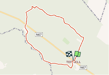
Randonnée Marche de 8 km à découvrir à Wallonie, Liège, Eupen. Cette randonnée est proposée par Natura 2000.
Description
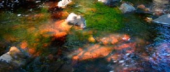
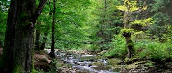
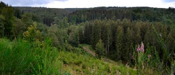
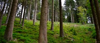
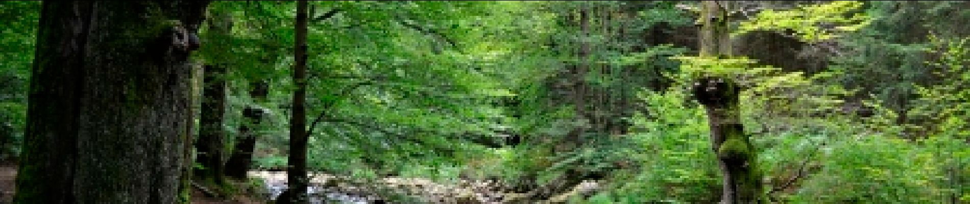
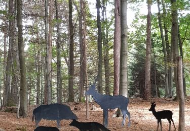
Partez à la rencontre d’un élément essentiel pour la biodiversité forestière : le bois mort. Vieux troncs
boursouflés, moignons de branches, bois couverts de
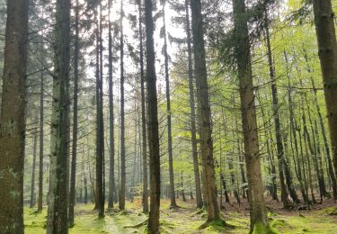
champignons ou criblés de trous de pics et d’insectes, … jalonnent le sentier comme autant d’oeuvres d’art remplies de vie. Cette promenade parcourt deux sites Natura 2000 : lorsque vous longez le Getzbach, vous traversez le site "Affluents
du lac d’Eupen" ; ensuite, vous remontez sur la crête pour mieux replonger vers la
"Vallée de la Helle", qui a donné son nom au second site.
Points d'intérêt
Localisation
Commentaires
Randonnées à proximité
![Randonnée Marche Eupen - RB-Lg-05_Barrage-d'Eupen - Photo](https://media.geolcdn.com/t/375/260/ext.jpg?maxdim=2&url=https%3A%2F%2Fservices.sitytrail.com%2FGeolivesWS%2FDownloadMedia.ashx%3FTrailID%3D179562%26Media%3D7980f674-60b2-4319-848f-6714eb887ad5.jpg)
![Marche Marche](https://static1.geolcdn.com/sitytour/trail-icons/101.png)
Marche
![](/images/other/stat-length.png)
![](https://static1.geolcdn.com/siteimages/upload/files/16400158638029165_repeat_loop_refresh_sync_direction_icon.png)
![Randonnée Marche Eupen - Barrage d'Eupen - Photo](https://media.geolcdn.com/t/375/260/90a093c8-ca4c-4f2d-8dba-28de0ca9565e.jpg&format=jpg&maxdim=2)
![Marche Marche](https://static1.geolcdn.com/sitytour/trail-icons/101.png)
Marche
![](/images/other/stat-length.png)
![](https://static1.geolcdn.com/siteimages/upload/files/16400158638029165_repeat_loop_refresh_sync_direction_icon.png)
![Randonnée Marche Eupen - Barrage d'Eupen - Photo](https://media.geolcdn.com/t/375/260/aecf99e8-444d-43fd-940e-03b123a2fe72.jpg&format=jpg&maxdim=2)
![Marche Marche](https://static1.geolcdn.com/sitytour/trail-icons/101.png)
Marche
![](/images/other/stat-length.png)
![](https://static1.geolcdn.com/siteimages/upload/files/16400158638029165_repeat_loop_refresh_sync_direction_icon.png)
![Randonnée Marche Eupen - RB-Lg-05_Barrage-d'Eupen_via-raccourci - Photo](https://media.geolcdn.com/t/375/260/ext.jpg?maxdim=2&url=https%3A%2F%2Fservices.sitytrail.com%2FGeolivesWS%2FDownloadMedia.ashx%3FTrailID%3D209405%26Media%3D2f0b60af-bd30-4227-95f2-7ed80e415229.jpg)
![Marche Marche](https://static1.geolcdn.com/sitytour/trail-icons/101.png)
Marche
![](/images/other/stat-length.png)
![](https://static1.geolcdn.com/siteimages/upload/files/16400158638029165_repeat_loop_refresh_sync_direction_icon.png)
![Randonnée Marche Eupen - Hautes Fagnes hohes Venn 20 km - Photo](https://media.geolcdn.com/t/375/260/6f1cadd0-76cd-4012-82b6-befbf33ff4a3.jpg&format=jpg&maxdim=2)
![Marche Marche](https://static1.geolcdn.com/sitytour/trail-icons/101.png)
Marche
![](/images/other/stat-length.png)
![](https://static1.geolcdn.com/siteimages/upload/files/16400158638029165_repeat_loop_refresh_sync_direction_icon.png)
![Randonnée Marche Baelen - geitsbush portfays - Photo](https://media.geolcdn.com/t/375/260/ext.jpg?maxdim=2&url=https%3A%2F%2Fservices.sitytrail.com%2FGeolivesWS%2FDownloadMedia.ashx%3FTrailID%3D1105616%26Media%3Dfix__20190203144609.jpg)
![Marche Marche](https://static1.geolcdn.com/sitytour/trail-icons/101.png)
Marche
![](/images/other/stat-length.png)
![](https://static1.geolcdn.com/siteimages/upload/files/16400158638029165_repeat_loop_refresh_sync_direction_icon.png)
![Randonnée Marche Eupen - Eupen, par bois, prairies et chemins - Photo](https://media.geolcdn.com/t/375/260/ext.jpg?maxdim=2&url=https%3A%2F%2Fservices.sitytrail.com%2FGeolivesWS%2FDownloadMedia.ashx%3FTrailID%3D757615%26Media%3D20170521143224.jpg)
![Marche Marche](https://static1.geolcdn.com/sitytour/trail-icons/101.png)
Marche
![](/images/other/stat-length.png)
![](https://static1.geolcdn.com/siteimages/upload/files/16400158638029165_repeat_loop_refresh_sync_direction_icon.png)
![Randonnée Marche Eupen - La maison forestiere de Ternell - Photo](https://media.geolcdn.com/t/375/260/ext.jpg?maxdim=2&url=https%3A%2F%2Fstatic1.geolcdn.com%2Fsiteimages%2Fupload%2Ffiles%2F1553511878bg_sport_marche.png)
![Marche Marche](https://static1.geolcdn.com/sitytour/trail-icons/101.png)
Marche
![](/images/other/stat-length.png)
![](https://static1.geolcdn.com/siteimages/upload/files/16400158638029165_repeat_loop_refresh_sync_direction_icon.png)
![Randonnée Marche Eupen - 20250120 - Barrage Eupen 6.4 Km - Photo](https://media.geolcdn.com/t/375/260/e1fc0c94-0101-453e-bad2-8f407786fbf8.jpeg&format=jpg&maxdim=2)
![Marche Marche](https://static1.geolcdn.com/sitytour/trail-icons/101.png)
Marche
![](/images/other/stat-length.png)
![](https://static1.geolcdn.com/siteimages/upload/files/16400158638029165_repeat_loop_refresh_sync_direction_icon.png)
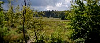
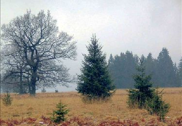
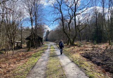
Balisage croix verte. Pratiquement tout le temps dans les bois. Peu de paysages. Beaux parcours le long des ruisseaux où chemins plus sportifs