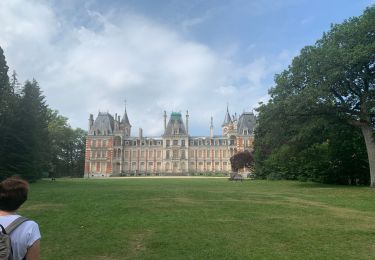
36 km | 40 km-effort
chanteau 2013
bouboumael
Utilisateur
Longueur
10,2 km
Altitude max
139 m
Dénivelé positif
57 m
Km-Effort
11 km
Altitude min
121 m
Dénivelé négatif
56 m
Boucle
Oui
Date de création :
2014-12-10 00:00:00.0
Dernière modification :
2014-12-10 00:00:00.0
2h27
Difficulté : Inconnu
Application GPS de randonnée GRATUITE
À propos
Randonnée Marche de 10,2 km à découvrir à Centre-Val de Loire, Loiret, Chanteau. Cette randonnée est proposée par bouboumael.
Localisation
Pays :
France
Région :
Centre-Val de Loire
Département/Province :
Loiret
Commune :
Chanteau
Localité :
Unknown
Départ:(Dec)
Départ:(UTM)
421237 ; 5313200 (31T) N.
Commentaires
Randonnées à proximité
Du château de Charbonnière au château de Chamerolles
V.T.T.
Moyen
Saint-Jean-de-Braye,
Centre-Val de Loire,
Loiret,
France
3h 0min
Non
Charbonnière 2
Marche
Saint-Jean-de-Braye,
Centre-Val de Loire,
Loiret,
France
4,5 km | 5 km-effort
1h 4min
Oui
Forêt orléans - Saran
Marche nordique
Très facile
Saran,
Centre-Val de Loire,
Loiret,
France
8,9 km | 9,7 km-effort
1h 40min
Oui
Rando Semoy
Vélo de route
Facile
Semoy,
Centre-Val de Loire,
Loiret,
France
11,1 km | 12,2 km-effort
1h 36min
Oui
Saran Marche du Givre
Marche
Très facile
Saran,
Centre-Val de Loire,
Loiret,
France
12,3 km | 13,5 km-effort
1h 47min
Non
orléans st denis prés martel
Autre activité
Très facile
Fleury-les-Aubrais,
Centre-Val de Loire,
Loiret,
France
243 km | 276 km-effort
2h 10min
Non
Forêt
Vélo
Très facile
Semoy,
Centre-Val de Loire,
Loiret,
France
17,3 km | 19,3 km-effort
1h 5min
Oui
Forêt Orleans et voie ferrée
Vélo
Très facile
Semoy,
Centre-Val de Loire,
Loiret,
France
12,4 km | 14 km-effort
46min
Oui
Forêt Orléans-Charbonnière
Vélo
Très facile
Semoy,
Centre-Val de Loire,
Loiret,
France
9,6 km | 10,8 km-effort
38min
Oui