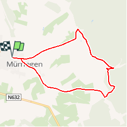
![](/images/other/stat-length.png)
![Randonnée Marche Bullange - Mürringen - Circuit Natura 2000, des sites qui valent le détour - Lg10 - Photo](https://media.geolcdn.com/t/1900/400/ext.pjpeg?maxdim=2&url=https%3A%2F%2Fservices.sitytrail.com%2FGeolivesWS%2FDownloadMedia.ashx%3FTrailID%3D181911%26Media%3Dd1ada83f-52ce-4c18-b96f-8cdb6dcdeefb.jpg)
Mürringen - Circuit Natura 2000, des sites qui valent le détour - Lg10
Natura 2000
Randonnées de Natura 2000 GUIDE+
![Longueur](/images/other/stat-length.png)
![Altitude max](https://static1.geolcdn.com/siteimages/upload/files/1508320355ic_sort_altitude_max_24dp.png)
![Dénivelé positif](https://static1.geolcdn.com/siteimages/upload/files/1508320355ic_sort_den_pos_24dp.png)
![Km-Effort](/images/other/stat-length.png)
![Altitude min](https://static1.geolcdn.com/siteimages/upload/files/1508320355ic_sort_altitude_min_24dp.png)
![Dénivelé négatif](https://static1.geolcdn.com/siteimages/upload/files/1508320355ic_sort_den_neg_24dp.png)
![Boucle](https://static1.geolcdn.com/siteimages/upload/files/16400158638029165_repeat_loop_refresh_sync_direction_icon.png)
![Marche](https://static1.geolcdn.com/sitytour/trail-icons/101.png)
1h50
Difficulté : Facile
![Scannez ce code QR pour ouvrir la randonnée dans l'application SityTrail](https://capi.geolives.com/qq0zvz2zws4bq2lad0pu/sitytour/trails/181911/qr.png?size=200)
Application GPS de randonnée GRATUITE
À propos
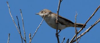
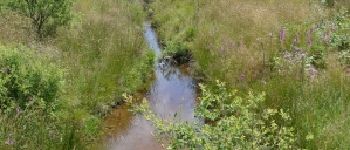
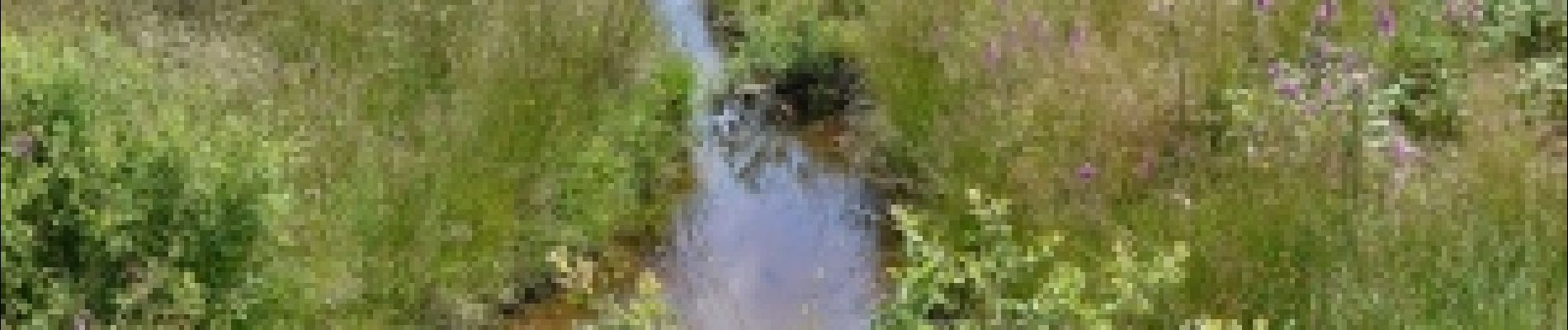
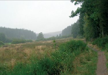
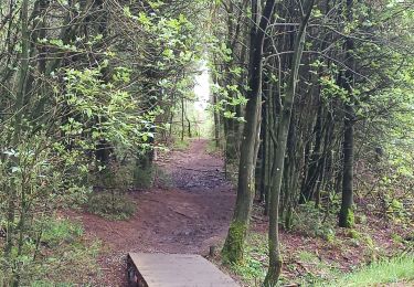
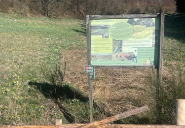
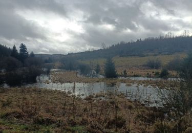
Randonnée Marche de 7,1 km à découvrir à Wallonie, Liège, Bullange. Cette randonnée est proposée par Natura 2000.
Description
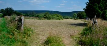
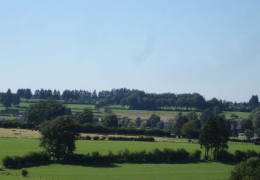
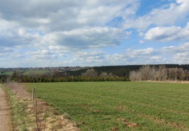
Entre la frontière Allemande et le lac de Bütgenbach, cette promenade vous emmène dans une vallée typique de la
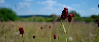
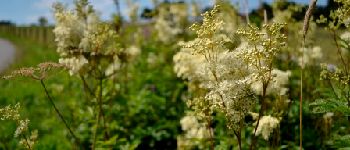
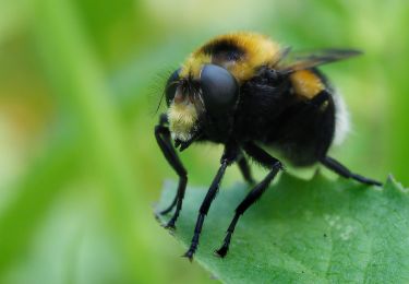
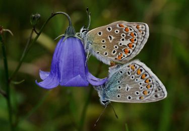
Haute Ardenne orientale, somptueuse mosaïque de milieux naturels rares tels que d’anciens prés maigres
de fauche, des landes ou encore des milieux tourbeux. Tous présentent un grand
intérêt biologique. Bienvenue dans le site Natura 2000 "Vallée de la Holzwarche".
Points d'intérêt
Localisation
Commentaires
Randonnées à proximité
![Randonnée Marche Bullange - RB-Lg-07_Krinkelt - Photo](https://media.geolcdn.com/t/375/260/ext.jpg?maxdim=2&url=https%3A%2F%2Fservices.sitytrail.com%2FGeolivesWS%2FDownloadMedia.ashx%3FTrailID%3D179565%26Media%3Dc51bfdfa-2f3a-47fc-b12d-6def8be3ad34.jpg)
![Marche Marche](https://static1.geolcdn.com/sitytour/trail-icons/101.png)
Marche
![](/images/other/stat-length.png)
![](https://static1.geolcdn.com/siteimages/upload/files/16400158638029165_repeat_loop_refresh_sync_direction_icon.png)
![Randonnée Marche Butgenbach - Butgenbach lac et environs - Photo](https://media.geolcdn.com/t/375/260/1cc5a1a5-5393-4407-895e-d7863ada15a3.jpg&format=jpg&maxdim=2)
![Marche Marche](https://static1.geolcdn.com/sitytour/trail-icons/101.png)
Marche
![](/images/other/stat-length.png)
![](https://static1.geolcdn.com/siteimages/upload/files/16400158638029165_repeat_loop_refresh_sync_direction_icon.png)
![Randonnée A pied Bullange - Balade des Jonquilles Krinkelt 12 Km - Photo](https://media.geolcdn.com/t/375/260/634345eb-5787-4f3c-9ced-f45f24f65838.jpg&format=jpg&maxdim=2)
![A pied A pied](https://static1.geolcdn.com/sitytour/trail-icons/100.png)
A pied
![](/images/other/stat-length.png)
![](https://static1.geolcdn.com/siteimages/upload/files/16400158638029165_repeat_loop_refresh_sync_direction_icon.png)
![Randonnée Marche Bullange - Rocherath - Photo](https://media.geolcdn.com/t/375/260/9865e976-42a9-4272-b5a8-4a981efc6f01.jpg&format=jpg&maxdim=2)
![Marche Marche](https://static1.geolcdn.com/sitytour/trail-icons/101.png)
![Randonnée Marche Bullange - Bullange vers lac de Butenbach - Photo](https://media.geolcdn.com/t/375/260/03e2d925-2beb-4e9c-9342-fcfdf31f7daa.jpg&format=jpg&maxdim=2)
![Marche Marche](https://static1.geolcdn.com/sitytour/trail-icons/101.png)
Marche
![](/images/other/stat-length.png)
![](https://static1.geolcdn.com/siteimages/upload/files/16400158638029165_repeat_loop_refresh_sync_direction_icon.png)
![Randonnée A pied Bullange - GrWandArd 15 Büchholz de pracht van het NP Eifel - Photo](https://media.geolcdn.com/t/375/260/0ae2ff0c-760f-408b-9aeb-c9e415472963.jpg&format=jpg&maxdim=2)
![A pied A pied](https://static1.geolcdn.com/sitytour/trail-icons/100.png)
A pied
![](/images/other/stat-length.png)
![](https://static1.geolcdn.com/siteimages/upload/files/16400158638029165_repeat_loop_refresh_sync_direction_icon.png)
![Randonnée Marche Bullange - Enkelbergermühle - Photo](https://media.geolcdn.com/t/375/260/3d7866fb-ce22-48f1-ac64-4b561fccb9aa.jpg&format=jpg&maxdim=2)
![Marche Marche](https://static1.geolcdn.com/sitytour/trail-icons/101.png)
Marche
![](/images/other/stat-length.png)
![](https://static1.geolcdn.com/siteimages/upload/files/16400158638029165_repeat_loop_refresh_sync_direction_icon.png)
![Randonnée A pied Bullange - Vallée de la Holzwarche - Photo](https://media.geolcdn.com/t/375/260/65d6ef04-b201-4cb3-a967-1a9fa6c005a5.jpeg&format=jpg&maxdim=2)
![A pied A pied](https://static1.geolcdn.com/sitytour/trail-icons/100.png)
A pied
![](/images/other/stat-length.png)
![](https://static1.geolcdn.com/siteimages/upload/files/16400158638029165_repeat_loop_refresh_sync_direction_icon.png)
![Randonnée A pied Bullange - Rund um den See - Photo](https://media.geolcdn.com/t/375/260/cac08000-d68b-426e-b2c6-1c6cf4781a94.jpeg&format=jpg&maxdim=2)
![A pied A pied](https://static1.geolcdn.com/sitytour/trail-icons/100.png)
A pied
![](/images/other/stat-length.png)
![](https://static1.geolcdn.com/siteimages/upload/files/16400158638029165_repeat_loop_refresh_sync_direction_icon.png)
Beau paysage. 30/10/17.