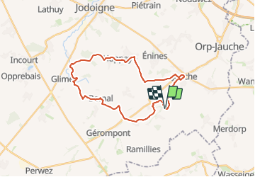
![](/images/other/stat-length.png)
![Randonnée Marche Orp-Jauche - RB-Bw-02 - Folx-les-Caves - Via variante - Photo](https://media.geolcdn.com/t/1900/400/ext.pjpeg?maxdim=2&url=https%3A%2F%2Fservices.sitytrail.com%2FGeolivesWS%2FDownloadMedia.ashx%3FTrailID%3D179577%26Media%3Dc9e8c77a-c3f0-47a1-8c90-911d33267101.jpg)
RB-Bw-02 - Folx-les-Caves - Via variante
GR Rando
Randonnez sur et autour des GR ® wallons (Sentiers de Grande Randonnée). PRO
![Longueur](/images/other/stat-length.png)
![Altitude max](https://static1.geolcdn.com/siteimages/upload/files/1508320355ic_sort_altitude_max_24dp.png)
![Dénivelé positif](https://static1.geolcdn.com/siteimages/upload/files/1508320355ic_sort_den_pos_24dp.png)
![Km-Effort](/images/other/stat-length.png)
![Altitude min](https://static1.geolcdn.com/siteimages/upload/files/1508320355ic_sort_altitude_min_24dp.png)
![Dénivelé négatif](https://static1.geolcdn.com/siteimages/upload/files/1508320355ic_sort_den_neg_24dp.png)
![Boucle](https://static1.geolcdn.com/siteimages/upload/files/16400158638029165_repeat_loop_refresh_sync_direction_icon.png)
![Marche](https://static1.geolcdn.com/sitytour/trail-icons/101.png)
6h17
Difficulté : Facile
![Scannez ce code QR pour ouvrir la randonnée dans l'application SityTrail](https://capi.geolives.com/qq0zvz2zws4bq2lad0pu/sitytour/trails/179577/qr.png?size=200)
Application GPS de randonnée GRATUITE
À propos
Randonnée Marche de 25 km à découvrir à Wallonie, Brabant wallon, Orp-Jauche. Cette randonnée est proposée par GR Rando.
Description
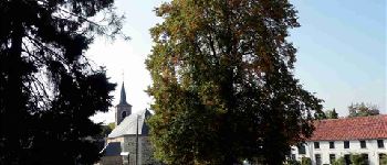
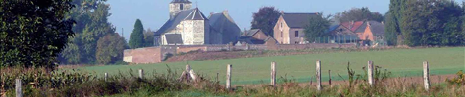
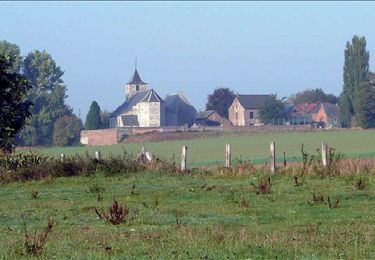
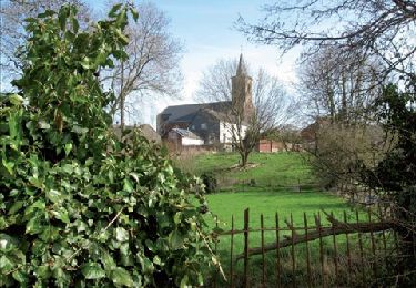
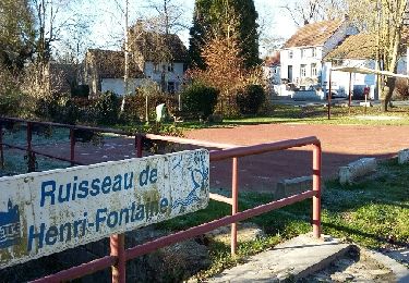
Folx-les-Caves – Autre-Église – Bomal – Jauchelette – Huppaye – Molenbais-Saint-Pierre – Jauche – Folx-les-Caves
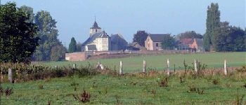
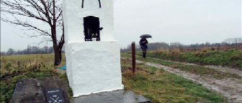
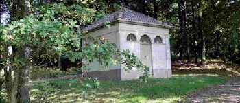
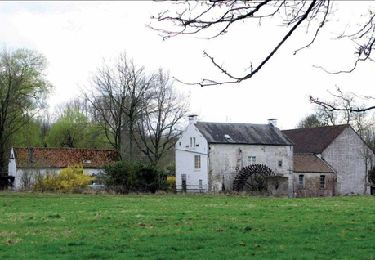
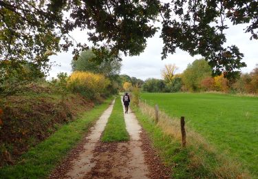
Sentiment de liberté absolue. Très peu de routes, guère de sentiers. Surtout des chemins, avec une bonne ration de pavés et d’herbe pas toujours rase. Entre les villages, la plupart de peu d’importance, une réelle sensation d’espace…
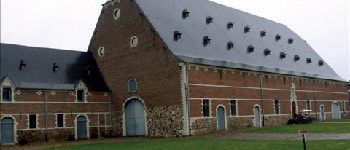
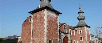
Nombreuses fermes aux porches monumentaux.
Cartographie et documentation
Carte IGN au 1:20 000, 40/3-4 « Jodoigne – Jauche ».
Carte de la commune d’Orp-Jauche.
Carte de promenades de la Hesbaye brabançonne au 1:30 000, reprenant les 34 promenades des six communes de l’est du Brabant wallon. Cette carte est accompagnée
d’un carnet descriptif.
Topo-guide du GR 579 « Bruxelles – Liège ».
Où se désaltérer et se restaurer
Á Folx-les-Caves, à 50 mètres de la place, café «A mon l’ketch » (fermé le lundi,
ouvert en semaine à partir de 16 heures et le week-end dès 10 heures). Nous y avons été gentiment accueillis à l’issue de notre randonnée.
Le restaurant « la Colonbière » n’ouvre que sur réservation.
À Jauche : café « Le Rustique ». Il y a également plusieurs restaurants (dont « Le Bout en Train » dans l’ancienne gare) et une friterie.
Face à l’ancienne gare de Ramillies (à 350 m de la RB) :
café « Local des Colombophiles ».
Points d'intérêt
Localisation
Commentaires
Randonnées à proximité
![Randonnée Marche Orp-Jauche - RB-Bw-02 - Folx-les-Caves - Via raccourci 2 - Photo](https://media.geolcdn.com/t/375/260/ext.jpg?maxdim=2&url=https%3A%2F%2Fservices.sitytrail.com%2FGeolivesWS%2FDownloadMedia.ashx%3FTrailID%3D218648%26Media%3Dc9e8c77a-c3f0-47a1-8c90-911d33267101.jpg)
![Marche Marche](https://static1.geolcdn.com/sitytour/trail-icons/101.png)
Marche
![](/images/other/stat-length.png)
![](https://static1.geolcdn.com/siteimages/upload/files/16400158638029165_repeat_loop_refresh_sync_direction_icon.png)
![Randonnée Marche Orp-Jauche - RB-Bw-02 - Folx-les-Caves - Photo](https://media.geolcdn.com/t/375/260/ext.jpg?maxdim=2&url=https%3A%2F%2Fservices.sitytrail.com%2FGeolivesWS%2FDownloadMedia.ashx%3FTrailID%3D218641%26Media%3Dc9e8c77a-c3f0-47a1-8c90-911d33267101.jpg)
![Marche Marche](https://static1.geolcdn.com/sitytour/trail-icons/101.png)
Marche
![](/images/other/stat-length.png)
![](https://static1.geolcdn.com/siteimages/upload/files/16400158638029165_repeat_loop_refresh_sync_direction_icon.png)
![Randonnée Marche Orp-Jauche - RB-Bw-01 - Orp-le-Grand - Photo](https://media.geolcdn.com/t/375/260/ext.jpg?maxdim=2&url=https%3A%2F%2Fservices.sitytrail.com%2FGeolivesWS%2FDownloadMedia.ashx%3FTrailID%3D218532%26Media%3D2b25bbe0-0fd5-407f-bf14-f349bb03461d.jpg)
![Marche Marche](https://static1.geolcdn.com/sitytour/trail-icons/101.png)
Marche
![](/images/other/stat-length.png)
![](https://static1.geolcdn.com/siteimages/upload/files/16400158638029165_repeat_loop_refresh_sync_direction_icon.png)
![Randonnée Marche Orp-Jauche - RB-Bw-01 - Orp-le-Grand - Via variante - Photo](https://media.geolcdn.com/t/375/260/ext.jpg?maxdim=2&url=https%3A%2F%2Fservices.sitytrail.com%2FGeolivesWS%2FDownloadMedia.ashx%3FTrailID%3D179575%26Media%3D1fb01559-2292-4faf-8acf-655ff0b406da.jpg)
![Marche Marche](https://static1.geolcdn.com/sitytour/trail-icons/101.png)
Marche
![](/images/other/stat-length.png)
![](https://static1.geolcdn.com/siteimages/upload/files/16400158638029165_repeat_loop_refresh_sync_direction_icon.png)
![Marche Marche](https://static1.geolcdn.com/sitytour/trail-icons/101.png)
Marche
![](/images/other/stat-length.png)
![](https://static1.geolcdn.com/siteimages/upload/files/16400158638029165_repeat_loop_refresh_sync_direction_icon.png)
![Randonnée Marche Orp-Jauche - RB-Bw-01 - Orp-le-Grand - Via raccourci - Photo](https://media.geolcdn.com/t/375/260/ext.jpg?maxdim=2&url=https%3A%2F%2Fservices.sitytrail.com%2FGeolivesWS%2FDownloadMedia.ashx%3FTrailID%3D218537%26Media%3D2b25bbe0-0fd5-407f-bf14-f349bb03461d.jpg)
![Marche Marche](https://static1.geolcdn.com/sitytour/trail-icons/101.png)
Marche
![](/images/other/stat-length.png)
![](https://static1.geolcdn.com/siteimages/upload/files/16400158638029165_repeat_loop_refresh_sync_direction_icon.png)
![Randonnée Marche Orp-Jauche - Orp le Grand Nathalie Demain 29 11 2016 - Photo](https://media.geolcdn.com/t/375/260/ext.jpg?maxdim=2&url=https%3A%2F%2Fservices.sitytrail.com%2FGeolivesWS%2FDownloadMedia.ashx%3FTrailID%3D666139%26Media%3Dfix__20161129124748.jpg)
![Marche Marche](https://static1.geolcdn.com/sitytour/trail-icons/101.png)
Marche
![](/images/other/stat-length.png)
![](https://static1.geolcdn.com/siteimages/upload/files/16400158638029165_repeat_loop_refresh_sync_direction_icon.png)
![Randonnée Marche Wasseiges - 20240307 - TOTEMUS Wasseiges- 3.2 Km - Photo](https://media.geolcdn.com/t/375/260/c42a9b7b-cd65-45b2-bbb9-49294bcad449.jpeg&format=jpg&maxdim=2)
![Marche Marche](https://static1.geolcdn.com/sitytour/trail-icons/101.png)
Marche
![](/images/other/stat-length.png)
![](https://static1.geolcdn.com/siteimages/upload/files/16400158638029165_repeat_loop_refresh_sync_direction_icon.png)
![Randonnée Marche Ramillies - Ramillies - Photo](https://media.geolcdn.com/t/375/260/ext.jpg?maxdim=2&url=https%3A%2F%2Fstatic1.geolcdn.com%2Fsiteimages%2Fupload%2Ffiles%2F1553511878bg_sport_marche.png)
![Marche Marche](https://static1.geolcdn.com/sitytour/trail-icons/101.png)
Marche
![](/images/other/stat-length.png)
![](https://static1.geolcdn.com/siteimages/upload/files/16400158638029165_repeat_loop_refresh_sync_direction_icon.png)
heel mooie wandeling met afwisselende wandelpaden en landschappen. Jauchette heeft heel mooie dorpskern.
Très belle campagne beaux village
Superbe