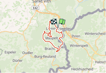
![](/images/other/stat-length.png)
![Randonnée Marche Saint-Vith - RB-Lg-08_Lommersweiler - Photo](https://media.geolcdn.com/t/1900/400/ext.pjpeg?maxdim=2&url=https%3A%2F%2Fservices.sitytrail.com%2FGeolivesWS%2FDownloadMedia.ashx%3FTrailID%3D179566%26Media%3D34b93d32-cd75-4b58-b84c-dd7aa7c61885.jpg)
RB-Lg-08_Lommersweiler
GR Rando
Randonnez sur et autour des GR ® wallons (Sentiers de Grande Randonnée). PRO
![Longueur](/images/other/stat-length.png)
![Altitude max](https://static1.geolcdn.com/siteimages/upload/files/1508320355ic_sort_altitude_max_24dp.png)
![Dénivelé positif](https://static1.geolcdn.com/siteimages/upload/files/1508320355ic_sort_den_pos_24dp.png)
![Km-Effort](/images/other/stat-length.png)
![Altitude min](https://static1.geolcdn.com/siteimages/upload/files/1508320355ic_sort_altitude_min_24dp.png)
![Dénivelé négatif](https://static1.geolcdn.com/siteimages/upload/files/1508320355ic_sort_den_neg_24dp.png)
![Boucle](https://static1.geolcdn.com/siteimages/upload/files/16400158638029165_repeat_loop_refresh_sync_direction_icon.png)
![Marche](https://static1.geolcdn.com/sitytour/trail-icons/101.png)
6h18
Difficulté : Très difficile
![Scannez ce code QR pour ouvrir la randonnée dans l'application SityTrail](https://capi.geolives.com/qq0zvz2zws4bq2lad0pu/sitytour/trails/179566/qr.png?size=200)
Application GPS de randonnée GRATUITE
À propos
Randonnée Marche de 21 km à découvrir à Wallonie, Liège, Saint-Vith. Cette randonnée est proposée par GR Rando.
Description
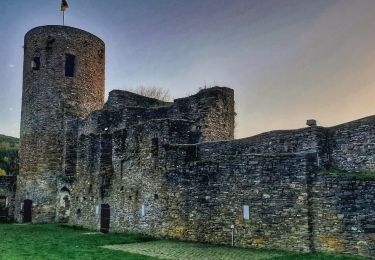
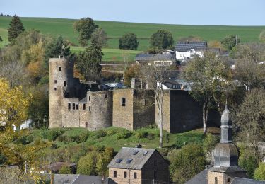
Lommersweiler – Hemmeres – Auel – Maspelt – Neidingen - Lommersweiler
Cartographie et documentation
Carte IGN au 1 : 20 000, 56/7-8 « Burg-Reuland – Gross-Bohlscheid ».
Carte IGN de promenades au 1 : 25 000 « » (Tou. 0088)
Topo-guide du GR 56 « Cantons de l’Est et Parc naturel Hautes Fagnes – Nord-
Eifel ».
Où se désaltérer et se restaurer :
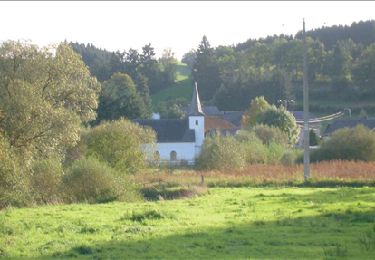
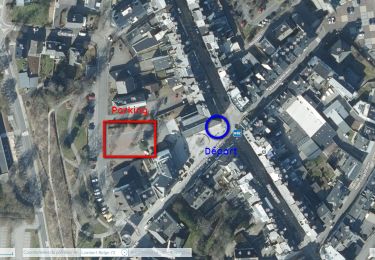
Il faudra vous rabattre sur la ville de Saint-Vith qui n’est qu’à quelques kilomètres.
Infos touristiques
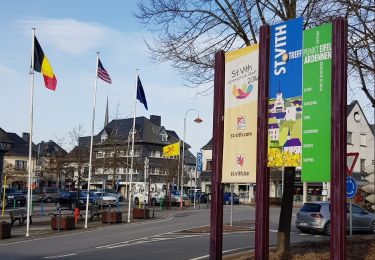
Syndicat d’Initiative de Saint-Vith : www.st.vith.be
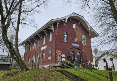
« Musée de la vie rurale » à 4780 Saint-Vith, Schwarzer Weg, 6 – www.zvs.be
« Musée de la Bière de Rodt », Rodt 89A, 4784Saint-Vith, www.biermuseum.be
Points d'intérêt
Localisation
Commentaires
Randonnées à proximité
![Randonnée Marche Saint-Vith - St Vith - Photo](https://media.geolcdn.com/t/375/260/d0dd3b78-7ec5-4080-b084-a9f6aaad51fd.jpg&format=jpg&maxdim=2)
![Marche Marche](https://static1.geolcdn.com/sitytour/trail-icons/101.png)
Marche
![](/images/other/stat-length.png)
![](https://static1.geolcdn.com/siteimages/upload/files/16400158638029165_repeat_loop_refresh_sync_direction_icon.png)
![Randonnée Marche Saint-Vith - RB-Lg-08_Lommersweiler_via-racc - Photo](https://media.geolcdn.com/t/375/260/ext.jpg?maxdim=2&url=https%3A%2F%2Fservices.sitytrail.com%2FGeolivesWS%2FDownloadMedia.ashx%3FTrailID%3D209419%26Media%3D8658b813-efb8-4716-8028-e5a806af61f9.jpg)
![Marche Marche](https://static1.geolcdn.com/sitytour/trail-icons/101.png)
Marche
![](/images/other/stat-length.png)
![](https://static1.geolcdn.com/siteimages/upload/files/16400158638029165_repeat_loop_refresh_sync_direction_icon.png)
![Randonnée Marche Saint-Vith - 20230103 - TOTEMUS Saint-Vith - 6.7 Km - Photo](https://media.geolcdn.com/t/375/260/05c4dc1c-0ce8-497a-889e-8103e5332ca7.jpg&format=jpg&maxdim=2)
![Marche Marche](https://static1.geolcdn.com/sitytour/trail-icons/101.png)
Marche
![](/images/other/stat-length.png)
![](https://static1.geolcdn.com/siteimages/upload/files/16400158638029165_repeat_loop_refresh_sync_direction_icon.png)
![Randonnée Marche Burg-Reuland - Balade à Burg-Reuland - Photo](https://media.geolcdn.com/t/375/260/4a1fc727-7ca9-43e9-9048-777c0d3a2d5c.jpeg&format=jpg&maxdim=2)
![Marche Marche](https://static1.geolcdn.com/sitytour/trail-icons/101.png)
Marche
![](/images/other/stat-length.png)
![](https://static1.geolcdn.com/siteimages/upload/files/16400158638029165_repeat_loop_refresh_sync_direction_icon.png)
![Marche Marche](https://static1.geolcdn.com/sitytour/trail-icons/101.png)
Marche
![](/images/other/stat-length.png)
![](https://static1.geolcdn.com/siteimages/upload/files/16400158638029165_repeat_loop_refresh_sync_direction_icon.png)
![Randonnée Marche Saint-Vith - St-Vith - Photo](https://media.geolcdn.com/t/375/260/7831892f-a4f2-4308-98c6-69c81cc1340b.jpg&format=jpg&maxdim=2)
![Marche Marche](https://static1.geolcdn.com/sitytour/trail-icons/101.png)
![Randonnée Marche Saint-Vith - Saint-Vith 🎅🎄✨️ - Photo](https://media.geolcdn.com/t/375/260/8b9fa4c8-7d27-4a42-bbd5-20b2381d1e8f.jpg&format=jpg&maxdim=2)
![Marche Marche](https://static1.geolcdn.com/sitytour/trail-icons/101.png)
Marche
![](/images/other/stat-length.png)
![](https://static1.geolcdn.com/siteimages/upload/files/16400158638029165_repeat_loop_refresh_sync_direction_icon.png)
![A pied A pied](https://static1.geolcdn.com/sitytour/trail-icons/100.png)
A pied
![](/images/other/stat-length.png)
![](https://static1.geolcdn.com/siteimages/upload/files/16400158638029165_repeat_loop_refresh_sync_direction_icon.png)
![Randonnée Marche Burg-Reuland - Burg Reuland 180423 - Photo](https://media.geolcdn.com/t/375/260/3c36ae65-aa52-40a7-a98c-9e9f1b9442b7.jpg&format=jpg&maxdim=2)
![Marche Marche](https://static1.geolcdn.com/sitytour/trail-icons/101.png)
Marche
![](/images/other/stat-length.png)
![](https://static1.geolcdn.com/siteimages/upload/files/16400158638029165_repeat_loop_refresh_sync_direction_icon.png)
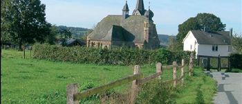
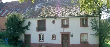
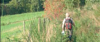
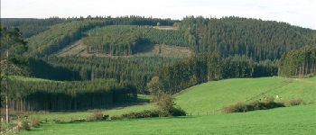
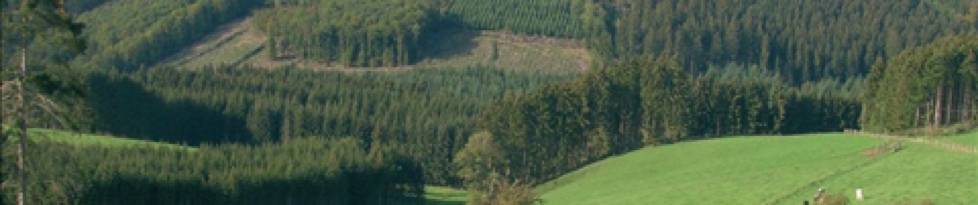
très belles vues beaux parcours boisés
Fait en aout 2011. tres beaux paysages