


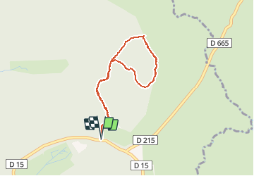

11 km | 15,4 km-effort


Utilisateur


Application GPS de randonnée GRATUITE
 SityTrail
IGN / Instituts géographiques
SityTrail World
Le monde est à vous
Randonnée Marche de 3,5 km à découvrir à Occitanie, Aveyron, Laguiole. Cette randonnée est proposée par tracegps.
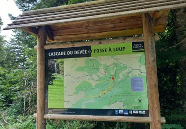
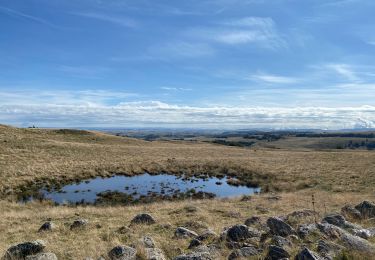
Le circuit botanique de Laguiole est un circuit pédestre très facile sur le plateau de l'Aubrac. Le parcours est bien indiqué et le sentier est facile à suivre même en hiver avec la neige. Vous pourrez trouver une description plus précise sur randozone.com.

Marche

Marche
Marche

Marche
Marche
Marche

Marche
Marche