![](/images/other/stat-length.png)
![Randonnée Marche Sainte-Colombe - La crête de la Montagne de Chabre - Ste Colombe - Photo](https://media.geolcdn.com/t/1900/400/ext.pjpeg?maxdim=2&url=https%3A%2F%2Fservices.sitytrail.com%2FGeolivesWS%2FDownloadMedia.ashx%3FTrailID%3D173181%26Media%3D14763_2.jpg)
La crête de la Montagne de Chabre - Ste Colombe
tracegps
Utilisateur
![Longueur](/images/other/stat-length.png)
![Altitude max](https://static1.geolcdn.com/siteimages/upload/files/1508320355ic_sort_altitude_max_24dp.png)
![Dénivelé positif](https://static1.geolcdn.com/siteimages/upload/files/1508320355ic_sort_den_pos_24dp.png)
![Km-Effort](/images/other/stat-length.png)
![Altitude min](https://static1.geolcdn.com/siteimages/upload/files/1508320355ic_sort_altitude_min_24dp.png)
![Dénivelé négatif](https://static1.geolcdn.com/siteimages/upload/files/1508320355ic_sort_den_neg_24dp.png)
![Boucle](https://static1.geolcdn.com/siteimages/upload/files/16400158638029165_repeat_loop_refresh_sync_direction_icon.png)
![Marche](https://static1.geolcdn.com/sitytour/trail-icons/101.png)
7h00
Difficulté : Très difficile
![Scannez ce code QR pour ouvrir la randonnée dans l'application SityTrail](https://capi.geolives.com/qq0zvz2zws4bq2lad0pu/sitytour/trails/173181/qr.png?size=200)
Application GPS de randonnée GRATUITE
À propos
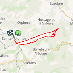
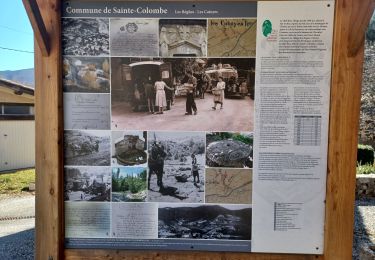
Randonnée Marche de 23 km à découvrir à Provence-Alpes-Côte d'Azur, Hautes-Alpes, Sainte-Colombe. Cette randonnée est proposée par tracegps.
Description
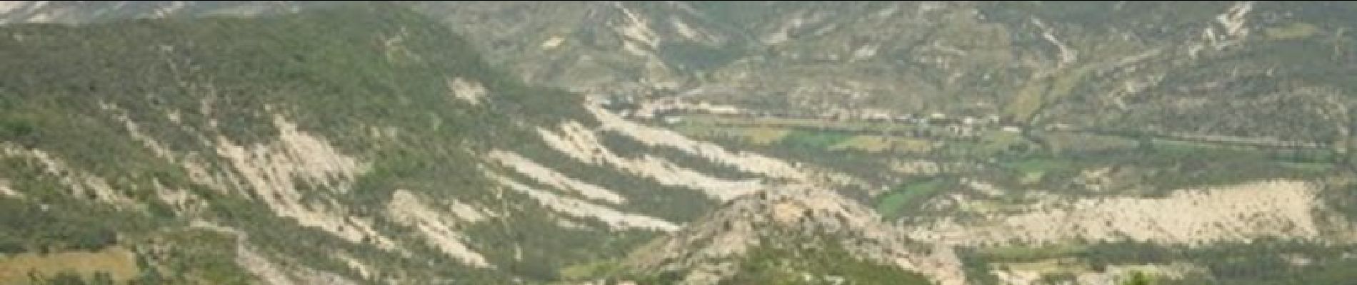
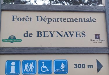
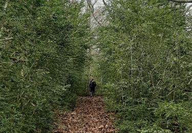
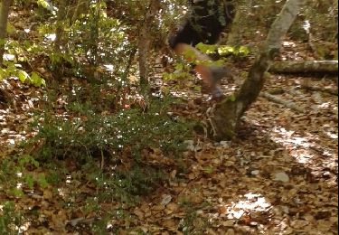
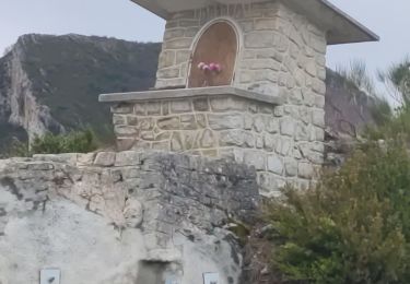
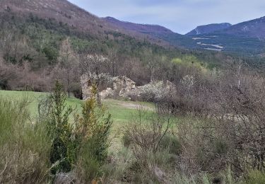
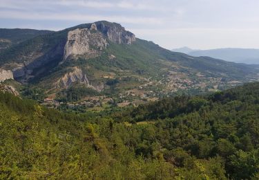
Longue rando sur une crête entre la terre et le ciel avec des vues magnifiques, une véritable splendeur. Parking à Ste Colombe. Partir au sud et monter vers la crête, parvenu à un col au dessus de la Touisse, prendre à gauche le sentier de crête. Itinéraire assez tortueux mais balisé. Passer au col de st Ange et poursuivre direction est jusqu'aux antennes puis à une table d'orientation. Quitter la crête et descendre la route goudronnée (hélas), couper une épingle et prendre un chemin forestier. Couper une autre épingle avant de passer au col de la Crousette. Continuer sur ce chemin forestier et prendre à droite à chaque fourche (balisage) pour retourner au col du départ, et descendre sur Ste Colombe. Bonne randonnée. PS: la rando peut être écourtée en allant garer la voiture à la "maison forestière de Beynaves" au pied du col st anges par le GR puis suivre la trace GPS et retour au col de la Crousette et le col st Anges.
Localisation
Commentaires
Randonnées à proximité
![Randonnée Marche Sainte-Colombe - ORPIERRES . DEPART CHEVALET . BEYNAVES . MONTAGNE SAINT MICHEL . AR N - Photo](https://media.geolcdn.com/t/375/260/20a96408-d155-4851-ac8c-c625bffcf962.jpg&format=jpg&maxdim=2)
![Marche Marche](https://static1.geolcdn.com/sitytour/trail-icons/101.png)
Marche
![](/images/other/stat-length.png)
![](https://static1.geolcdn.com/siteimages/upload/files/16400158638029165_repeat_loop_refresh_sync_direction_icon.png)
![Randonnée Marche Sainte-Colombe - SAINTE COLOMBE , les Bègues, autour des versants du Céans o l - Photo](https://media.geolcdn.com/t/375/260/32ebd511-d9af-4e86-9fe3-3ac4fc66c4b2.jpg&format=jpg&maxdim=2)
![Marche Marche](https://static1.geolcdn.com/sitytour/trail-icons/101.png)
Marche
![](/images/other/stat-length.png)
![](https://static1.geolcdn.com/siteimages/upload/files/16400158638029165_repeat_loop_refresh_sync_direction_icon.png)
![Randonnée Marche Sainte-Colombe - SAINTE COLOMBE . 05 . Pas de Sainte Colombe o m s - Photo](https://media.geolcdn.com/t/375/260/81962515-6c25-41a2-9c57-59c34af424da.jpg&format=jpg&maxdim=2)
![Marche Marche](https://static1.geolcdn.com/sitytour/trail-icons/101.png)
Marche
![](/images/other/stat-length.png)
![](https://static1.geolcdn.com/siteimages/upload/files/16400158638029165_repeat_loop_refresh_sync_direction_icon.png)
![Randonnée Marche Sainte-Colombe - st colombe la](https://media.geolcdn.com/t/375/260/ext.jpg?maxdim=2&url=https%3A%2F%2Fservices.sitytrail.com%2FGeolivesWS%2FDownloadMedia.ashx%3FTrailID%3D791502%26Media%3Dfix__20160430095733.jpg)
![Marche Marche](https://static1.geolcdn.com/sitytour/trail-icons/101.png)
Marche
![](/images/other/stat-length.png)
![](https://static1.geolcdn.com/siteimages/upload/files/16400158638029165_repeat_loop_refresh_sync_direction_icon.png)
![Randonnée Marche Orpierre - rocher st Michel - Photo](https://media.geolcdn.com/t/375/260/ext.jpg?maxdim=2&url=https%3A%2F%2Fservices.sitytrail.com%2FGeolivesWS%2FDownloadMedia.ashx%3FTrailID%3D569402%26Media%3Dfix__20160425114304.jpg)
![Marche Marche](https://static1.geolcdn.com/sitytour/trail-icons/101.png)
Marche
![](/images/other/stat-length.png)
![](https://static1.geolcdn.com/siteimages/upload/files/16400158638029165_repeat_loop_refresh_sync_direction_icon.png)
![Randonnée Marche Sainte-Colombe - catoyes - Photo](https://media.geolcdn.com/t/375/260/ac87557a-0021-44d7-a91c-c330dd7837f6.jpg&format=jpg&maxdim=2)
![Marche Marche](https://static1.geolcdn.com/sitytour/trail-icons/101.png)
Marche
![](/images/other/stat-length.png)
![](https://static1.geolcdn.com/siteimages/upload/files/16400158638029165_repeat_loop_refresh_sync_direction_icon.png)
![Randonnée Marche Sainte-Colombe - 100423 Plan de Cuques - Photo](https://media.geolcdn.com/t/375/260/81f5bad3-8982-4a8b-b73b-e72d77fc0e67.jpg&format=jpg&maxdim=2)
![Marche Marche](https://static1.geolcdn.com/sitytour/trail-icons/101.png)
Marche
![](/images/other/stat-length.png)
![](https://static1.geolcdn.com/siteimages/upload/files/16400158638029165_repeat_loop_refresh_sync_direction_icon.png)
![Randonnée Marche Orpierre - 220822 La Louze - Photo](https://media.geolcdn.com/t/375/260/43335d2e-db02-450a-80e5-5e97f05e36ca.jpg&format=jpg&maxdim=2)
![Marche Marche](https://static1.geolcdn.com/sitytour/trail-icons/101.png)
Marche
![](/images/other/stat-length.png)
![](https://static1.geolcdn.com/siteimages/upload/files/16400158638029165_repeat_loop_refresh_sync_direction_icon.png)
![Randonnée Marche Orpierre - st Michel - Photo](https://media.geolcdn.com/t/375/260/0978b7aa-47a5-4f12-859e-5d5d8fde4b1b.jpg&format=jpg&maxdim=2)
![Marche Marche](https://static1.geolcdn.com/sitytour/trail-icons/101.png)
Marche
![](/images/other/stat-length.png)
![](https://static1.geolcdn.com/siteimages/upload/files/16400158638029165_repeat_loop_refresh_sync_direction_icon.png)