![](/images/other/stat-length.png)
![Randonnée Raquettes à neige Ottrott - Le Champ du Feu en raquettes - Photo](https://media.geolcdn.com/t/1900/400/ext.pjpeg?maxdim=2&url=https%3A%2F%2Fservices.sitytrail.com%2FGeolivesWS%2FDownloadMedia.ashx%3FTrailID%3D173168%26Media%3D14744_6.jpg)
Le Champ du Feu en raquettes
tracegps
Utilisateur
![Longueur](/images/other/stat-length.png)
Longueur
18,3 km
![Altitude max](https://static1.geolcdn.com/siteimages/upload/files/1508320355ic_sort_altitude_max_24dp.png)
Altitude max
1069 m
![Dénivelé positif](https://static1.geolcdn.com/siteimages/upload/files/1508320355ic_sort_den_pos_24dp.png)
Dénivelé positif
446 m
![Km-Effort](/images/other/stat-length.png)
Km-Effort
24 km
![Altitude min](https://static1.geolcdn.com/siteimages/upload/files/1508320355ic_sort_altitude_min_24dp.png)
Altitude min
938 m
![Dénivelé négatif](https://static1.geolcdn.com/siteimages/upload/files/1508320355ic_sort_den_neg_24dp.png)
Dénivelé négatif
446 m
![Boucle](https://static1.geolcdn.com/siteimages/upload/files/16400158638029165_repeat_loop_refresh_sync_direction_icon.png)
Boucle
Oui
Date de création :
2014-12-10 00:00:00.0
Dernière modification :
2014-12-10 00:00:00.0
![Raquettes à neige](https://static1.geolcdn.com/sitytour/trail-icons/504.png)
5h00
Difficulté : Difficile
![Scannez ce code QR pour ouvrir la randonnée dans l'application SityTrail](https://capi.geolives.com/qq0zvz2zws4bq2lad0pu/sitytour/trails/173168/qr.png?size=200)
Application GPS de randonnée GRATUITE
À propos
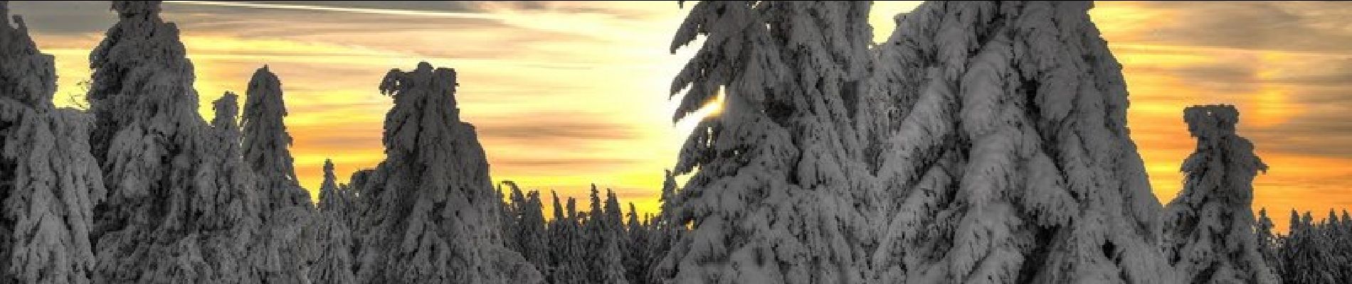
Randonnée Raquettes à neige de 18,3 km à découvrir à Grand Est, Bas-Rhin, Ottrott. Cette randonnée est proposée par tracegps.
Description
Départ du parking sur la D130 après le Col de la Rothlach, puis direction La Serva, ensuite col de la Charbonnière et retour à travers bois vers Rothlach.
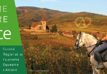
Localisation
Pays :
France
Région :
Grand Est
Département/Province :
Bas-Rhin
Commune :
Ottrott
Localité :
Unknown
Départ:(Dec)
Départ:(UTM)
374248 ; 5365555 (32U) N.
Commentaires
Randonnées à proximité
![Randonnée Randonnée équestre Ottrott - 2024-09-03 Journee Rothlach Sommerhof - Photo](https://media.geolcdn.com/t/375/260/83371a81-1c5b-4988-84fb-7fd3471a6a57.jpg&format=jpg&maxdim=2)
![Randonnée équestre Randonnée équestre](https://static1.geolcdn.com/sitytour/trail-icons/301.png)
2024-09-03 Journee Rothlach Sommerhof
Randonnée équestre
Moyen
Ottrott,
Grand Est,
Bas-Rhin,
France
![](/images/other/stat-length.png)
18,8 km | 26 km-effort
3h 23min
![](https://static1.geolcdn.com/siteimages/upload/files/16400158638029165_repeat_loop_refresh_sync_direction_icon.png)
Oui
![Randonnée Marche Le Hohwald - 2024-04-27 Marche Cascade du Hohwald Champ du Feu - Photo](https://media.geolcdn.com/t/375/260/d8b206f8-0969-498e-bcc6-fd799e0e40cd.jpg&format=jpg&maxdim=2)
![Marche Marche](https://static1.geolcdn.com/sitytour/trail-icons/101.png)
2024-04-27 Marche Cascade du Hohwald Champ du Feu
Marche
Moyen
Le Hohwald,
Grand Est,
Bas-Rhin,
France
![](/images/other/stat-length.png)
20 km | 31 km-effort
6h 58min
![](https://static1.geolcdn.com/siteimages/upload/files/16400158638029165_repeat_loop_refresh_sync_direction_icon.png)
Oui
![Randonnée Marche Le Hohwald - Tour du Hohwald - Photo](https://media.geolcdn.com/t/375/260/ext.jpg?maxdim=2&url=https%3A%2F%2Fstatic1.geolcdn.com%2Fsiteimages%2Fupload%2Ffiles%2F1553511878bg_sport_marche.png)
![Marche Marche](https://static1.geolcdn.com/sitytour/trail-icons/101.png)
Tour du Hohwald
Marche
Moyen
(1)
Le Hohwald,
Grand Est,
Bas-Rhin,
France
![](/images/other/stat-length.png)
8 km | 11,3 km-effort
2h 26min
![](https://static1.geolcdn.com/siteimages/upload/files/16400158638029165_repeat_loop_refresh_sync_direction_icon.png)
Oui
![Randonnée Randonnée équestre Belmont - Acpl 2ème jour Belmont Bellefosse - Photo](https://media.geolcdn.com/t/375/260/68f69c23-4011-4ca8-9039-fce627777a58.jpg&format=jpg&maxdim=2)
![Randonnée équestre Randonnée équestre](https://static1.geolcdn.com/sitytour/trail-icons/301.png)
Acpl 2ème jour Belmont Bellefosse
Randonnée équestre
Moyen
Belmont,
Grand Est,
Bas-Rhin,
France
![](/images/other/stat-length.png)
17,3 km | 25 km-effort
3h 20min
![](https://static1.geolcdn.com/siteimages/upload/files/16400158638029165_repeat_loop_refresh_sync_direction_icon.png)
Oui
![Randonnée Marche Le Hohwald - Hohwald - Rothlach - Neuntelstein - Photo](https://media.geolcdn.com/t/375/260/0ea7410a-d32d-4905-9369-a48f058188e6.jpg&format=jpg&maxdim=2)
![Marche Marche](https://static1.geolcdn.com/sitytour/trail-icons/101.png)
Hohwald - Rothlach - Neuntelstein
Marche
Moyen
(1)
Le Hohwald,
Grand Est,
Bas-Rhin,
France
![](/images/other/stat-length.png)
15,8 km | 22 km-effort
4h 28min
![](https://static1.geolcdn.com/siteimages/upload/files/16400158638029165_repeat_loop_refresh_sync_direction_icon.png)
Oui
![Randonnée Randonnée équestre Belmont - Circuit VC Belmont - Le Climont - Photo](https://media.geolcdn.com/t/375/260/a1198139-b874-4847-adb3-efd42fb36195.jpg&format=jpg&maxdim=2)
![Randonnée équestre Randonnée équestre](https://static1.geolcdn.com/sitytour/trail-icons/301.png)
Circuit VC Belmont - Le Climont
Randonnée équestre
Moyen
Belmont,
Grand Est,
Bas-Rhin,
France
![](/images/other/stat-length.png)
23 km | 33 km-effort
4h 20min
![](https://static1.geolcdn.com/siteimages/upload/files/16400158638029165_repeat_loop_refresh_sync_direction_icon.png)
Non
![Randonnée Randonnée équestre Belmont - Circuit VC Serva - Belmont - Photo](https://media.geolcdn.com/t/375/260/1588be67-92f1-44c9-a365-dcd95e3feb13.jpg&format=jpg&maxdim=2)
![Randonnée équestre Randonnée équestre](https://static1.geolcdn.com/sitytour/trail-icons/301.png)
Circuit VC Serva - Belmont
Randonnée équestre
Moyen
Belmont,
Grand Est,
Bas-Rhin,
France
![](/images/other/stat-length.png)
16,2 km | 22 km-effort
2h 50min
![](https://static1.geolcdn.com/siteimages/upload/files/16400158638029165_repeat_loop_refresh_sync_direction_icon.png)
Non
![Randonnée A pied Le Hohwald - Champ du feu début - Photo](https://media.geolcdn.com/t/375/260/f322735a-2e98-4355-b067-4845daa855de.jpg&format=jpg&maxdim=2)
![A pied A pied](https://static1.geolcdn.com/sitytour/trail-icons/100.png)
Champ du feu début
A pied
Facile
Le Hohwald,
Grand Est,
Bas-Rhin,
France
![](/images/other/stat-length.png)
6,8 km | 9,6 km-effort
2h 10min
![](https://static1.geolcdn.com/siteimages/upload/files/16400158638029165_repeat_loop_refresh_sync_direction_icon.png)
Non
![Randonnée Marche Natzwiller - visite - Photo](https://media.geolcdn.com/t/375/260/f3a361b7-b4c4-4d26-b468-ad6fc767e983.jpg&format=jpg&maxdim=2)
![Marche Marche](https://static1.geolcdn.com/sitytour/trail-icons/101.png)